The table below contains links to MSEAS information for various locations. Scripts to read/interpolate model output files and observational data are available from MSEAS Source Codes (registration required). Once registration has been completed and access has been granted to the source code web site, scripts are available from the downloads/plotting and the downloads/tools folders.
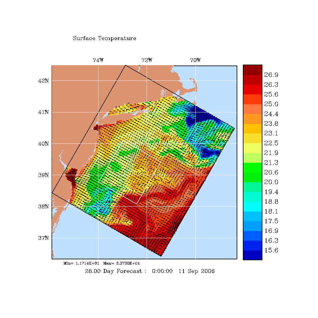
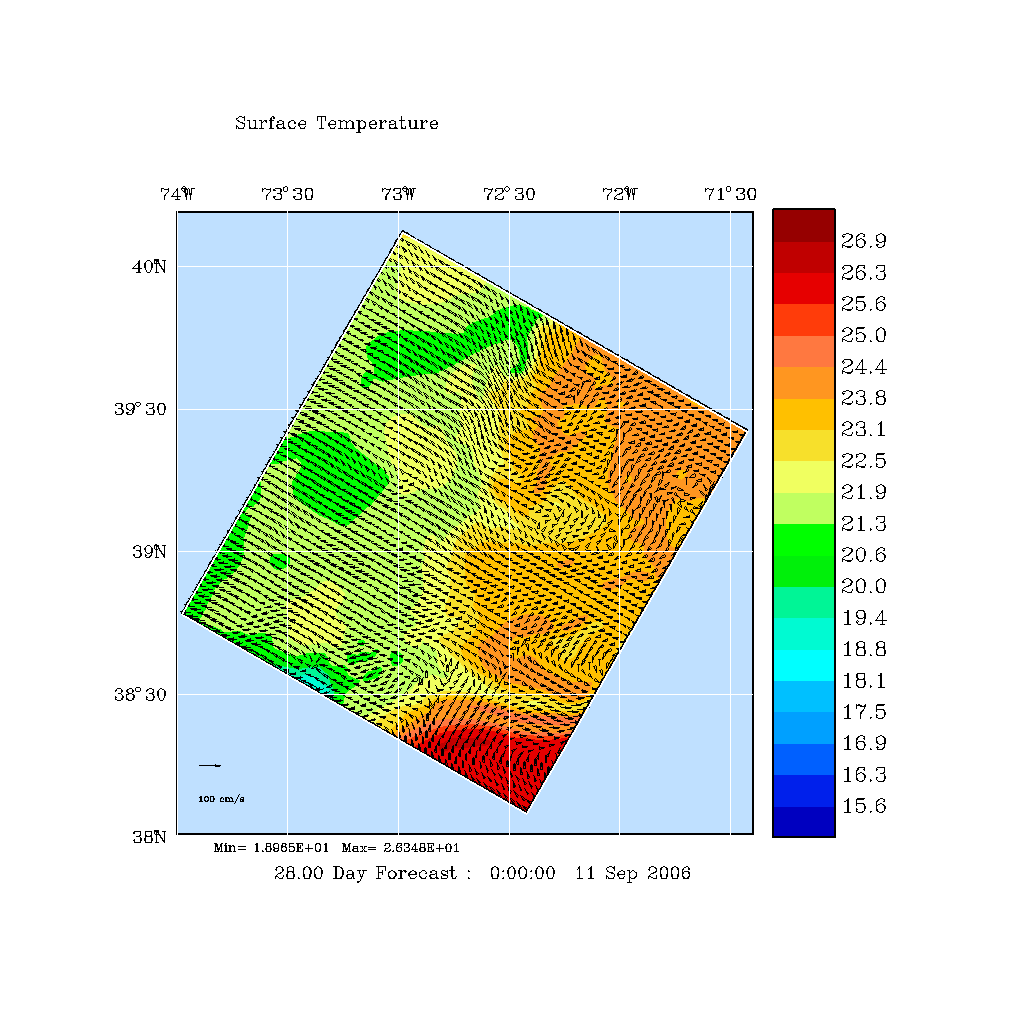
| Nested: Middle Atlantic Bight (MAB), Hudson Canyon (HC) | |||||
| MAB | HC | Observational Data | MSEAS Output NetCDF files | ||
|
|
|
CTD Observations | HC | grid | MIT_aw06_phys_2006081400_2006092612_03h.nc.gz |
| geo | MIT_aw06_phys_geo_2006081400_2006092612_03h.nc.gz | ||||
| MAB | grid | MIT_sw06_phys_2006081400_2006092612_03h.nc.gz | |||
| geo | MIT_sw06_phys_geo_2006081400_2006092612_03h.nc.gz | ||||
NetCDF file description
Note that velocity data is aligned in either one of two methods.
| grid: | velocity vectors aligned along grid (alongshore/offshore directions) | |
| geo: | velocity vectors aligned in geographic (east-west/north-south) directions. |
The file names can be interpreted as follows:
                       time of last
                      fields in file
                        yyyymmddHH
MIT_domain_phys_2009102400_2009110500_03h.nc.gz
                yyyymmddHH            HH
               time of first       frequency with which
               fields in file     fields are stored in file
|