The table below contains links to 11 day-long re-analysis ocean fields (computed in January 2008) estimated for the 2006 AWACS-SW06 exercise in the Middle Atlantic Bight Region. The re-analysis fields are the output of a stand-alone, data-assimilative dynamical model simulation carried out using our MSEAS system for the time period 24 August - 4 September, 2006. Model output files contain either temperature (°C) and salinity (PSU) or velocity (cm/s) data at a 3km horizontal resolution, 1hr temporal resolution, on 30 terrain-following (double-sigma) vertical levels.
This is a re-analysis run using the parameters of the central simulation with full data assimilation found in http://mseas.mit.edu/Research/AWACS/RunCompOsse/Control/. It is a free surface simulation with Tidal and Atmospheric forcing. In situ observations from Rutgers SeaGliders, NMFS cruises, CTD casts collected aboard the research vessels Knorr, Quest and Tioga, as well as Scanfish data are used to create the initial conditions and twice-daily assimilation fields. SST is also assimilated on Aug 14, 17, 19, 21, 23, 25.
Note: There are two type of output files for the velocities, with different orientations for the velocity components:
| NetCDF files | ||
| Temperature and Salinity | pe_out_ts.nc | |
| Velocity | Along Grid | pe_out_v.nc |
| Geographic | pe_out_vrot.nc | |
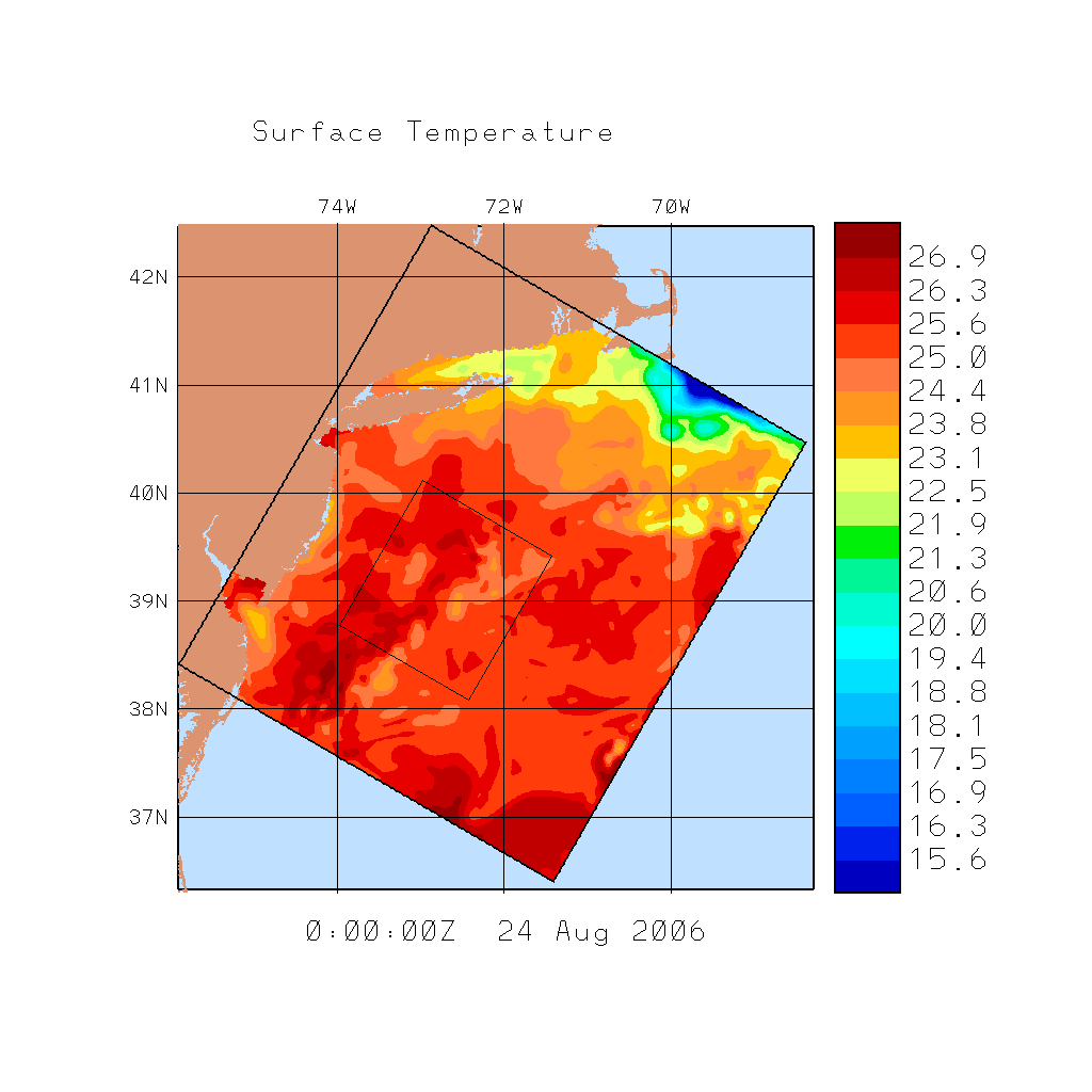
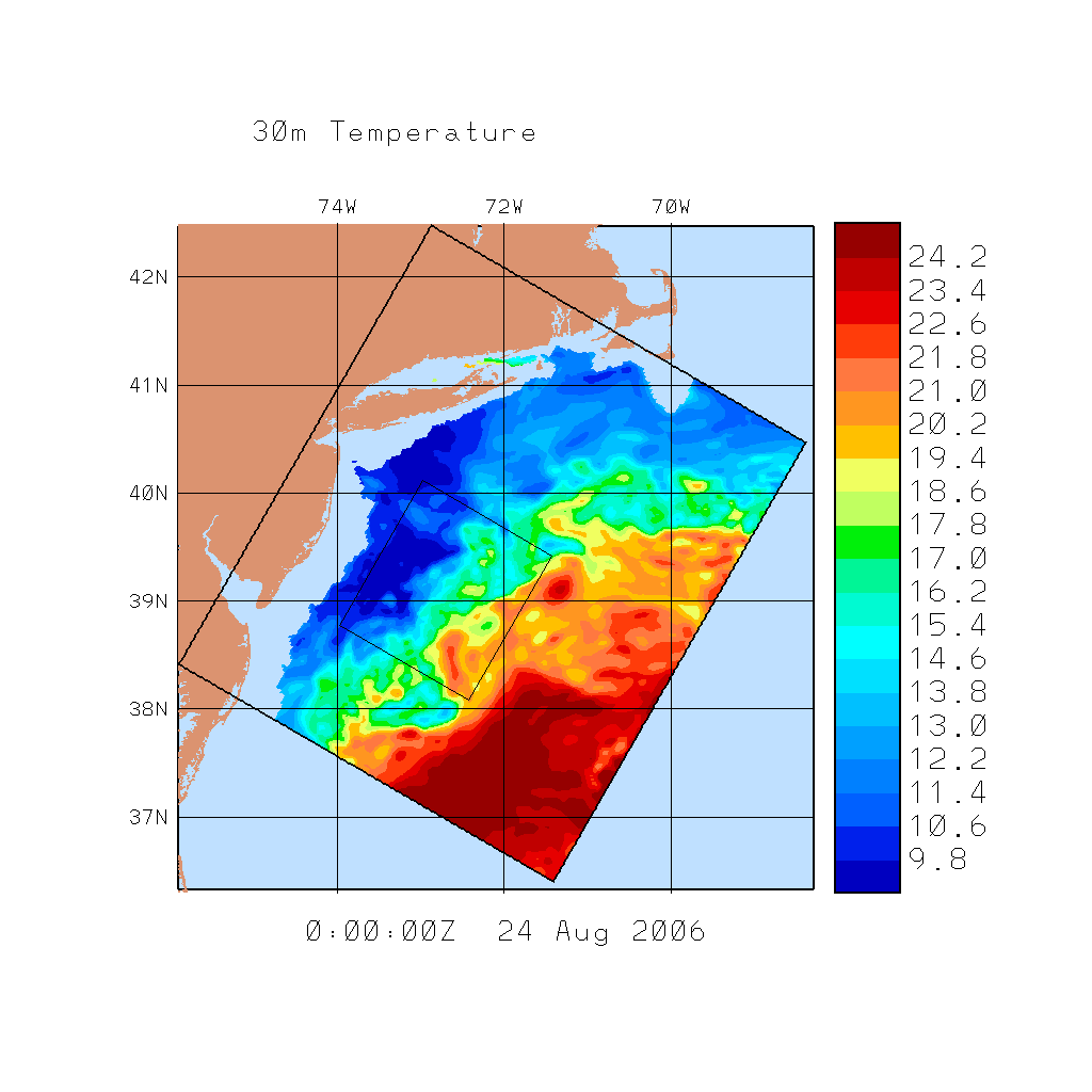
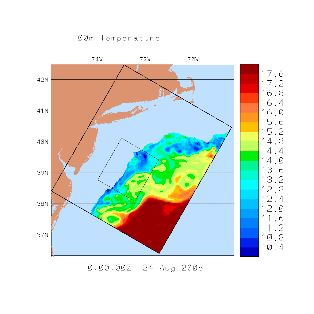
| Example Temperature Plots | ||
| Surface | 30m | 100m |
|
|
|
|
To help extract data from these files in Matlab, we include the function readhopspe.m. To use this function, you'll also need to download
        /matlab/toolbox/local/mexnc
        /matlab/toolbox/local/netcdf_toolbox/netcdf
        /matlab/toolbox/local/netcdf_toolbox/netcdf/ncutility
        /matlab/toolbox/local/netcdf_toolbox/netcdf/nctype