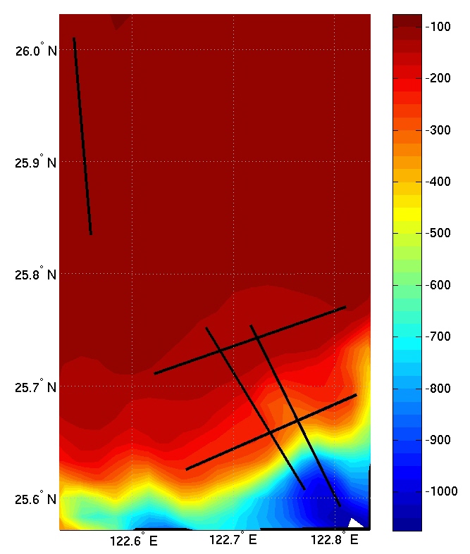
| Latitude (deg) |
Longitude (deg) |
| Alongshelf 1- along 130 m isobath | |
| 25.7109 N | 122.622 E |
| 25.770 N | 122.811 E |
| Alongshelf 2- along 280 m isobath- possible mud volcanoes | |
| 25.6254 N | 122.6535 E |
| 25.6921 N | 122.8215 E |
| Cross-shelf 1- Over shelf 115 m isobath | |
| 26.0106 N | 122.542 E |
| 25.8348 N | 122.5589 E |
| Cross-shelf 2- Midway between canyon branches | |
| 25.7519 N | 122.6729 E |
| 25.6077 N | 122.7702 E |
| Canyon 1- Down axis of canyon (second from west in North Mien-Hua Canyon) | |
| 25.7540 N | 122.7174 E |
| 25.5925 N | 122.8052 E |