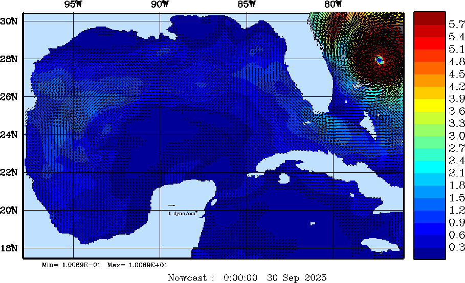
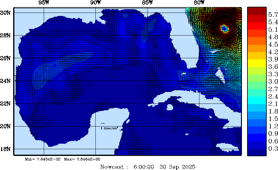
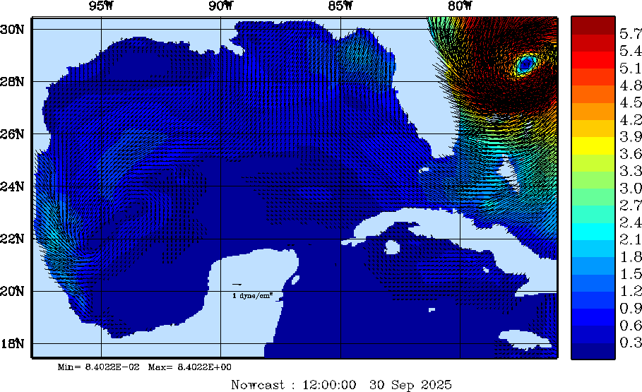
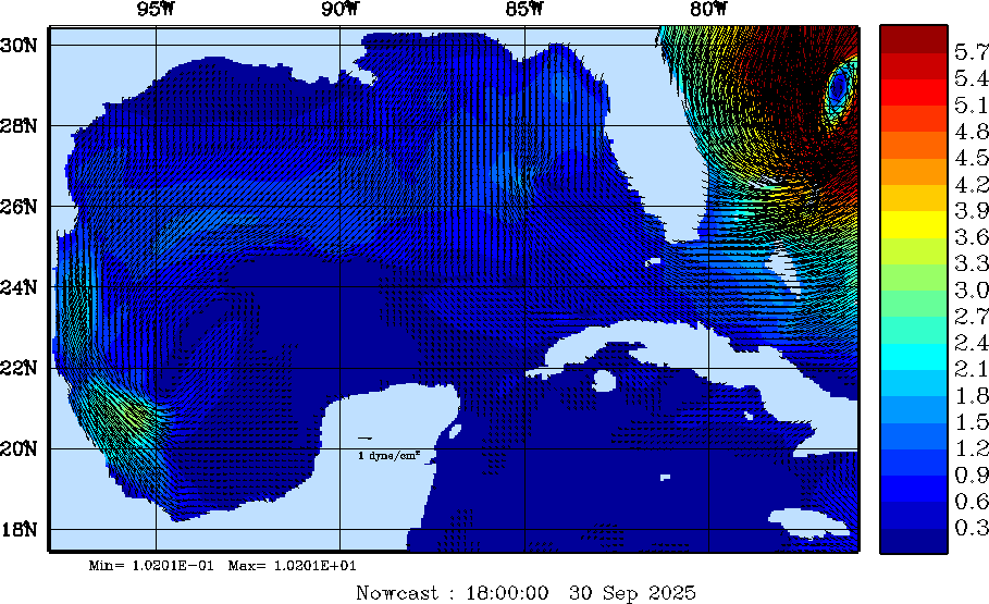
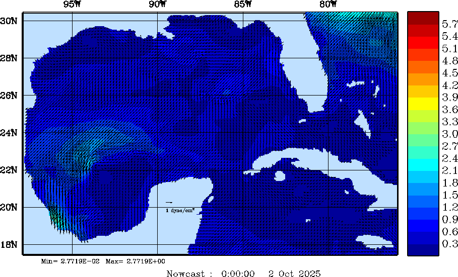
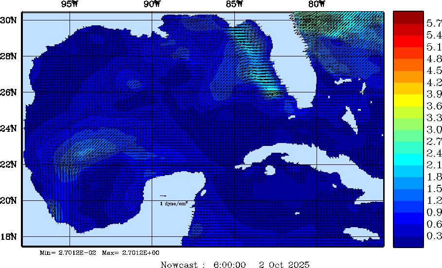
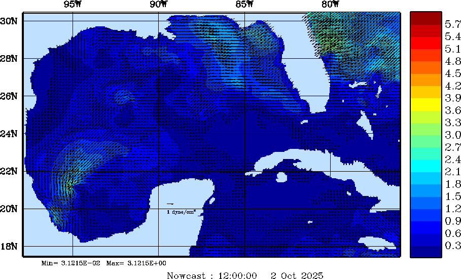
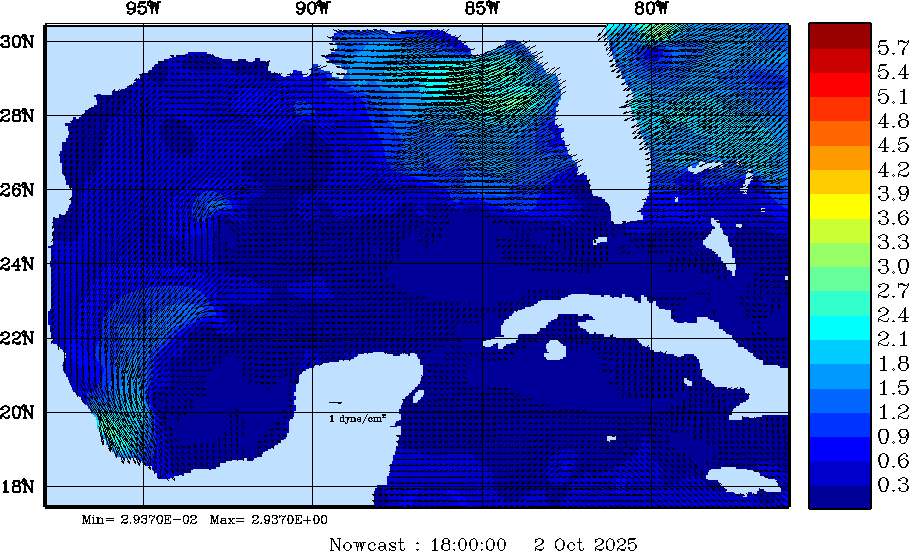
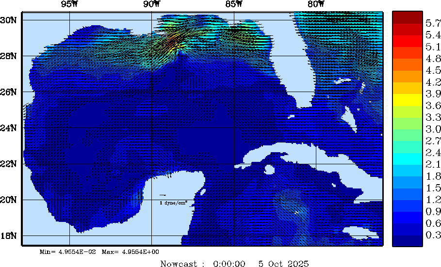
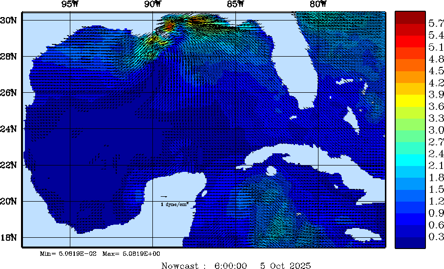
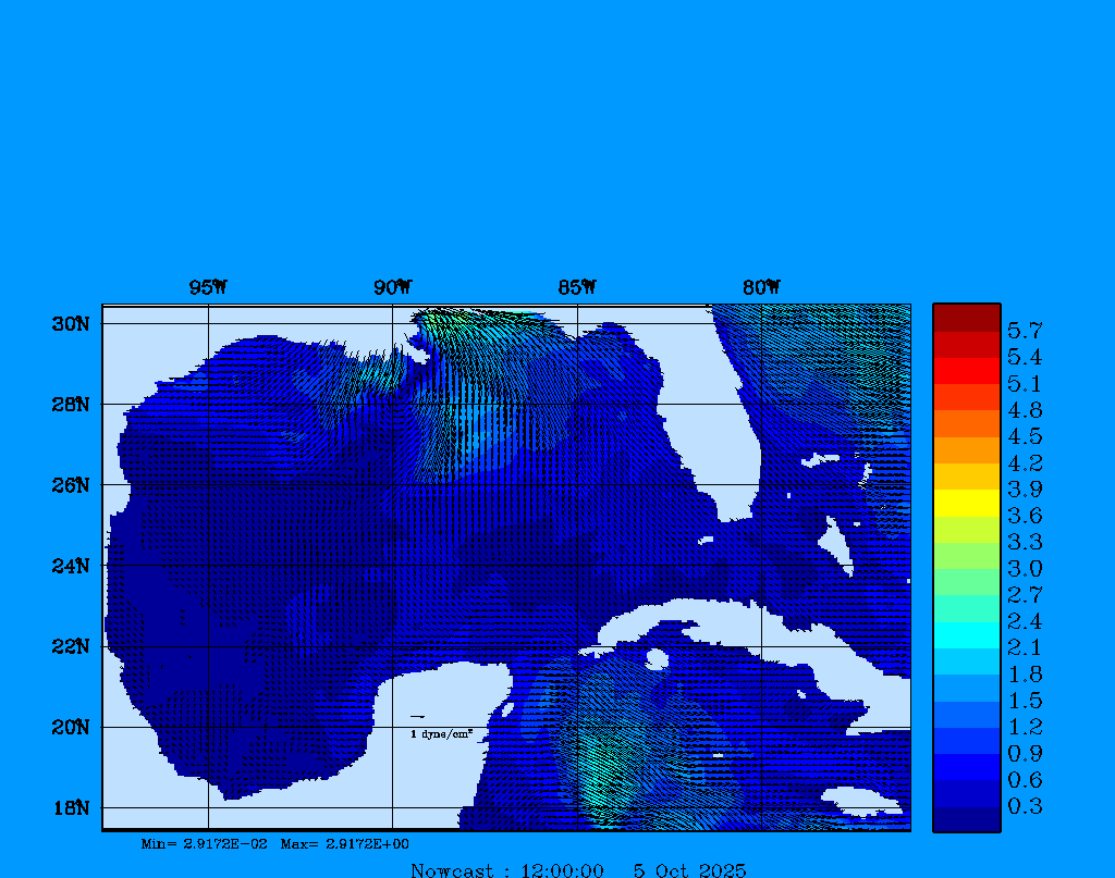
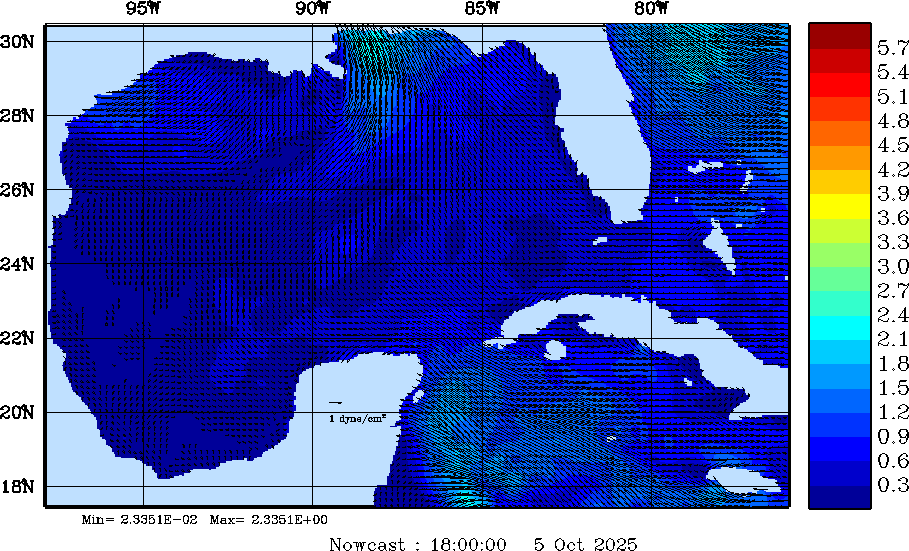

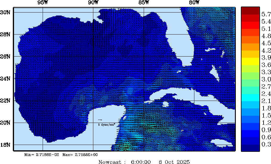
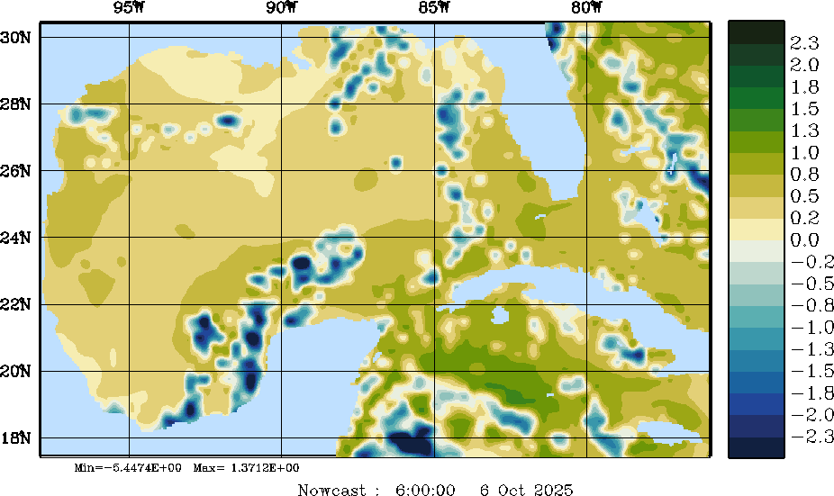


Note: 1 N/m2 = 10 dyne/cm2
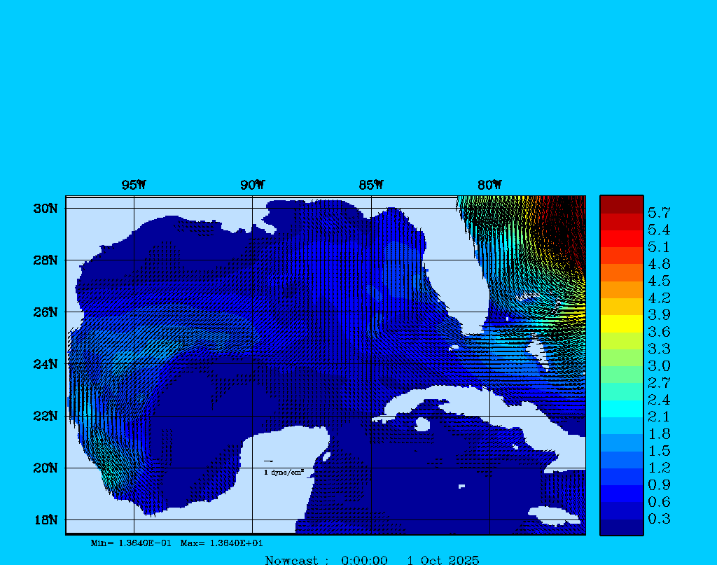
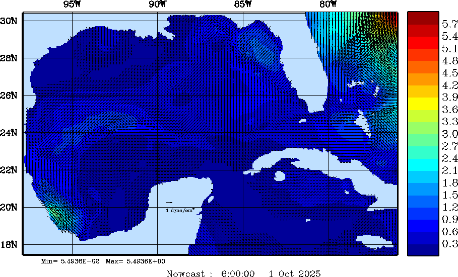
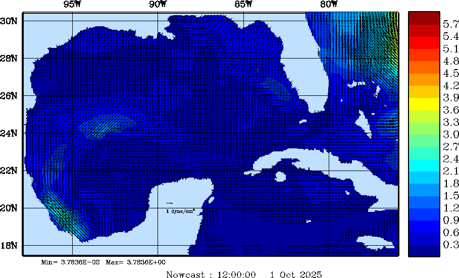
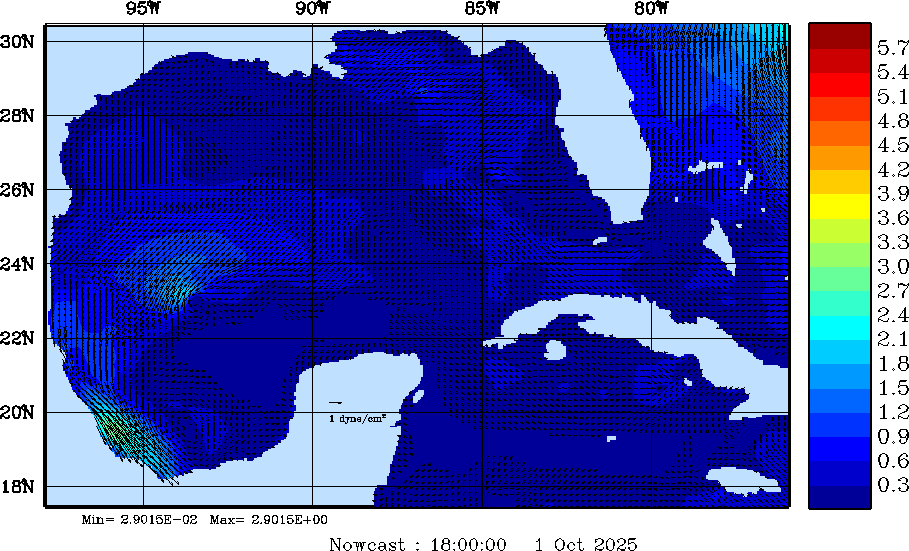
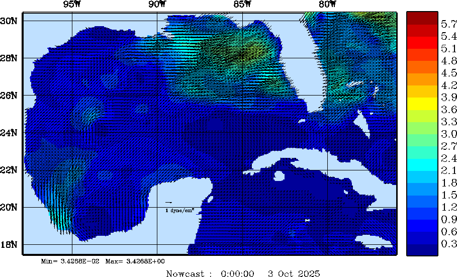
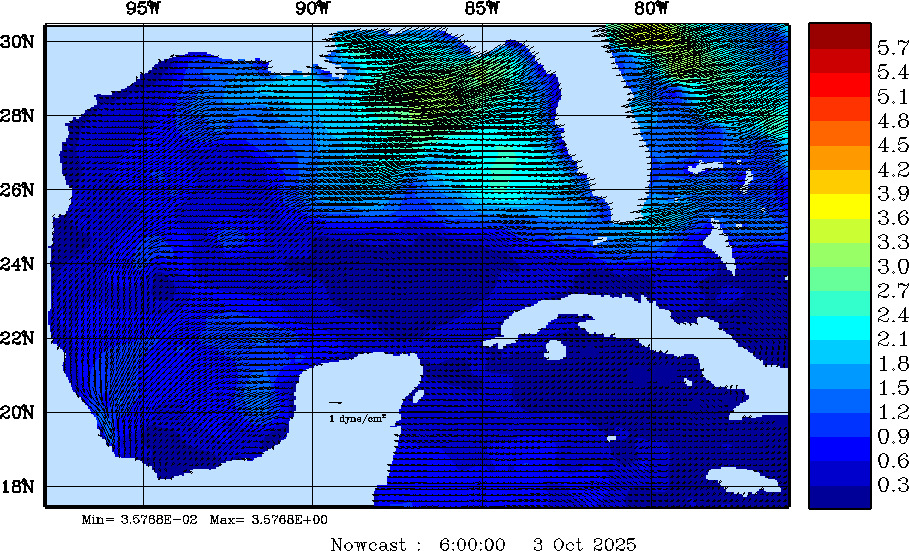
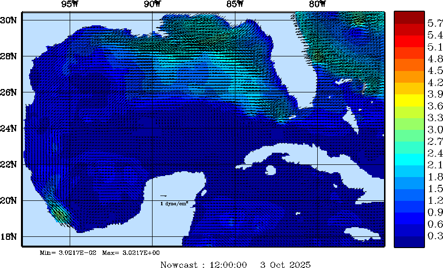
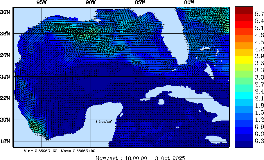
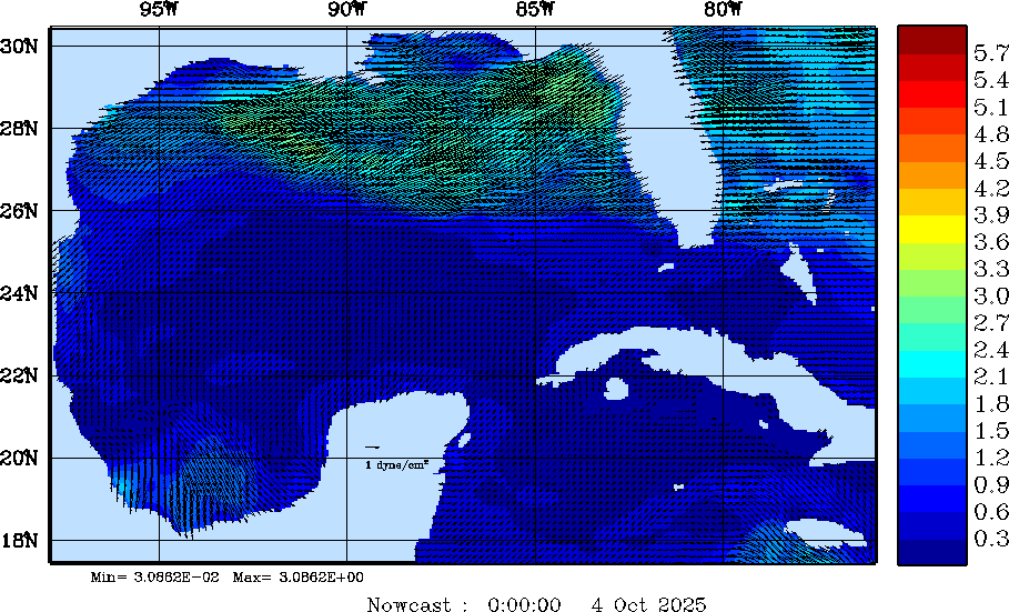
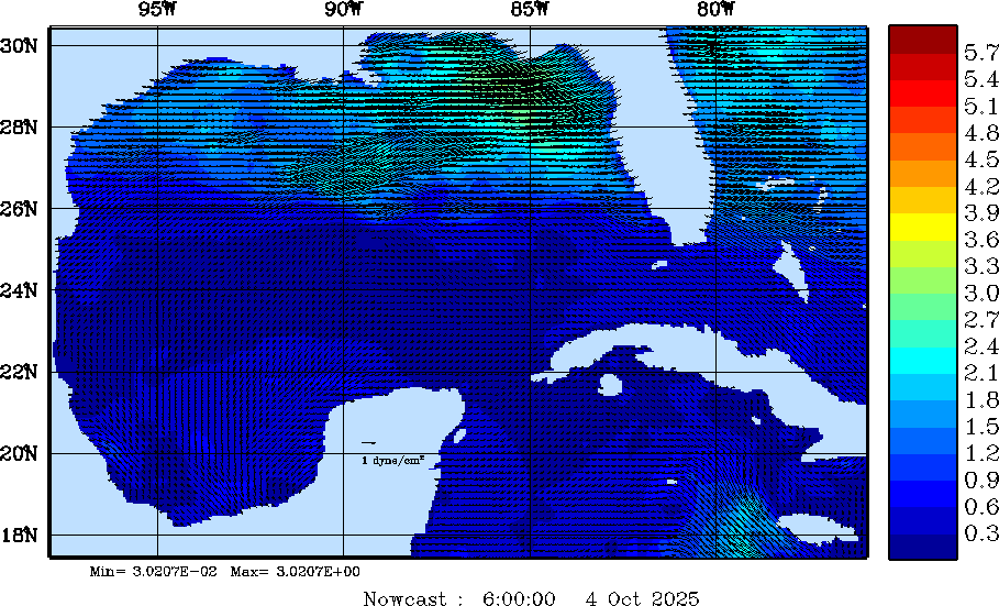
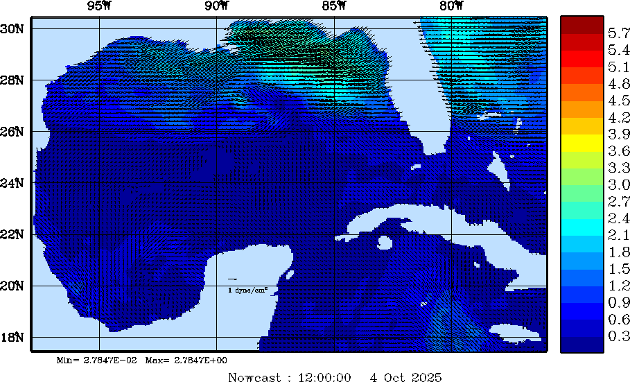
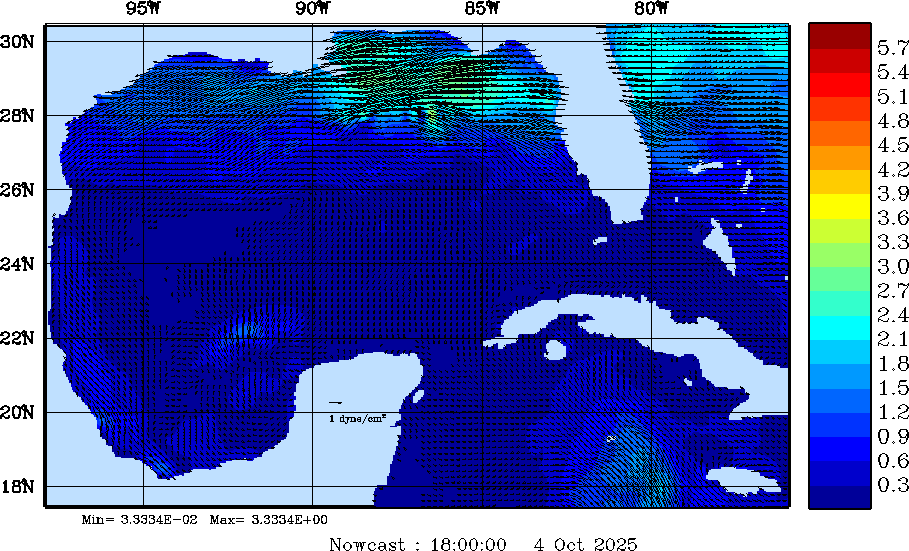
| Wind Stress Snapshots (dynes/cm2); processed by MSEAS from merged NCEP fields | |||||||||||||||||||||||||
| 2025 Sep 30 | 2025 Oct 01 | 2025 Oct 02 | 2025 Oct 03 | 2025 Oct 04 | 2025 Oct 05 | 2025 Oct 06 | |||||||||||||||||||
| 00Z | 06Z | 12Z | 18Z | 00Z | 06Z | 12Z | 18Z | 00Z | 06Z | 12Z | 18Z | 00Z | 06Z | 12Z | 18Z | 00Z | 06Z | 12Z | 18Z | 00Z | 06Z | 12Z | 18Z | 00Z | 06Z |
|
|
|
|
|
|
|
|
|
|
|
|
|
|
|
|
|
|
|
|
|
|
|
|
|
|
|
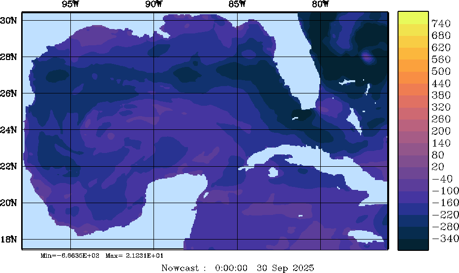
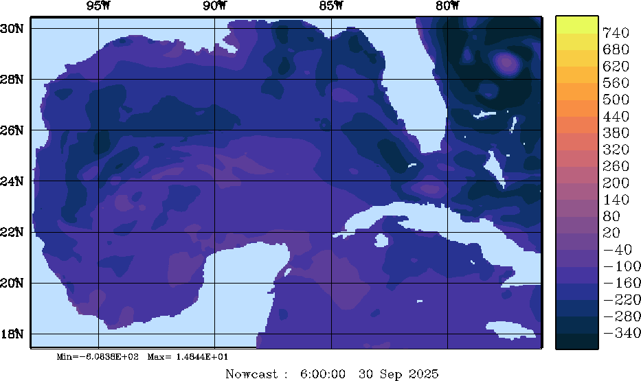
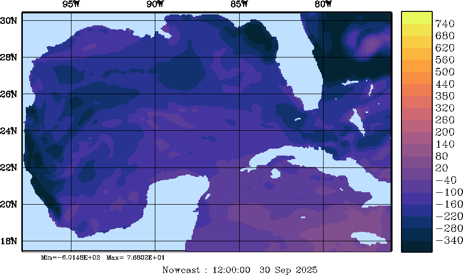
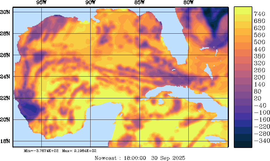
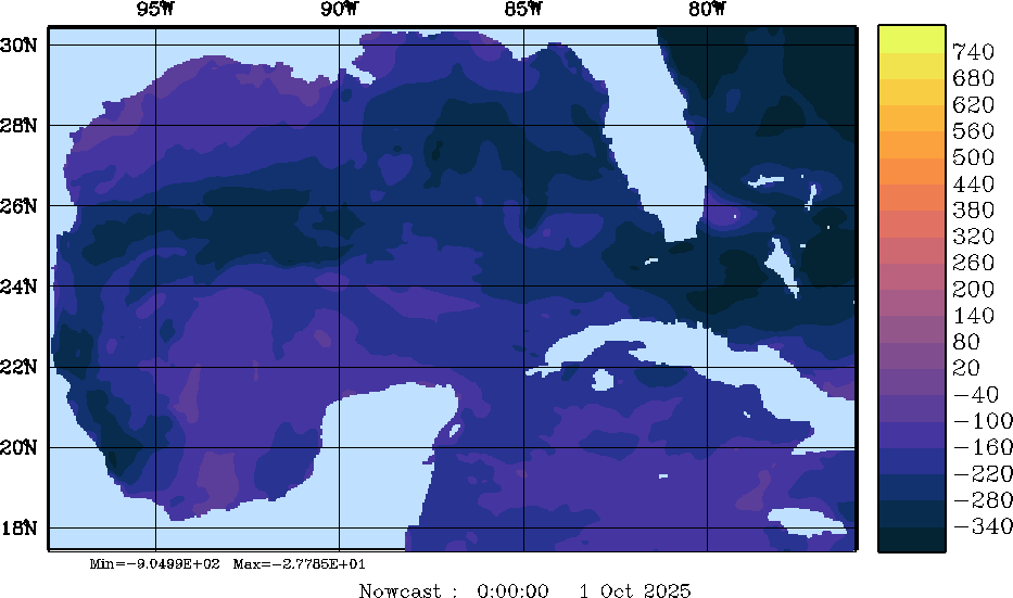
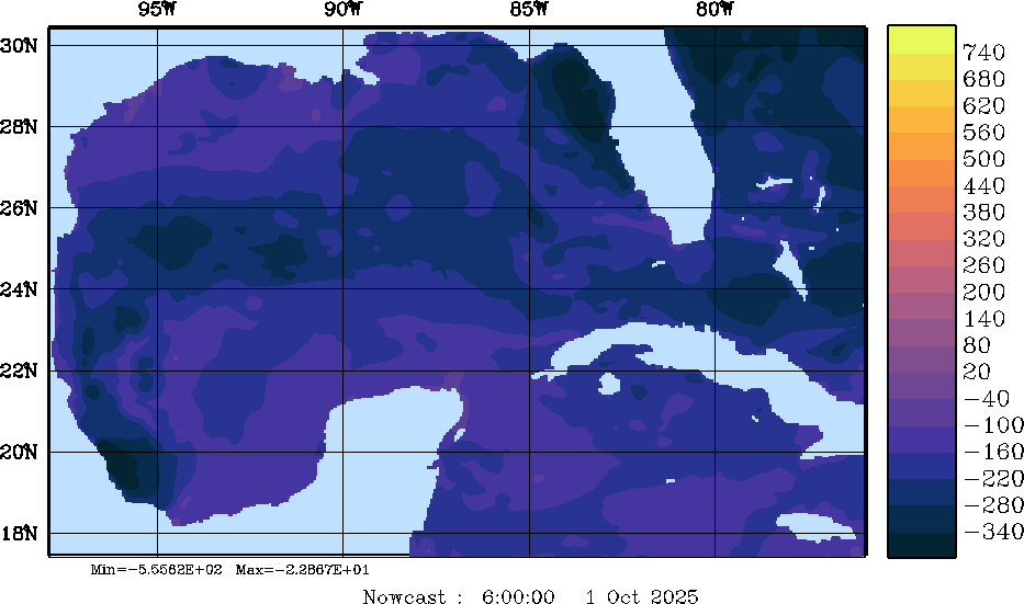
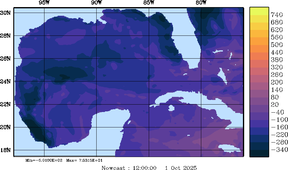
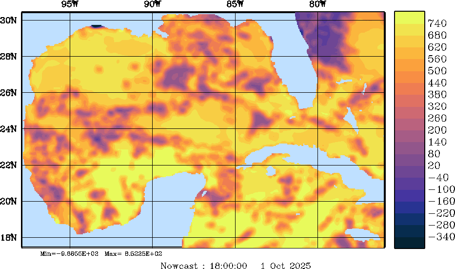
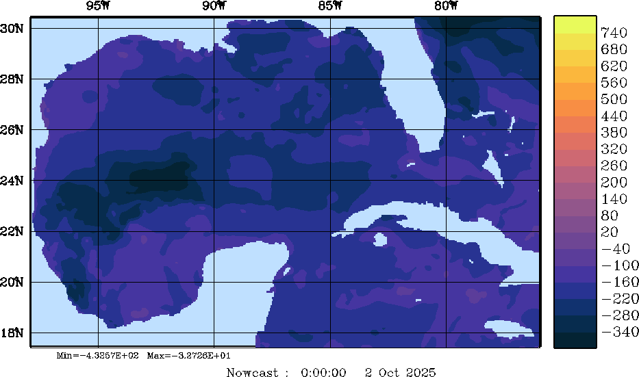
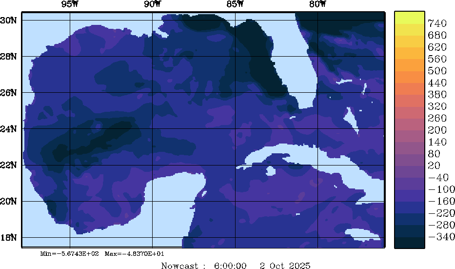
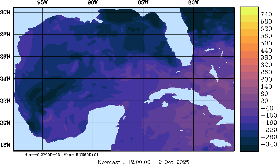
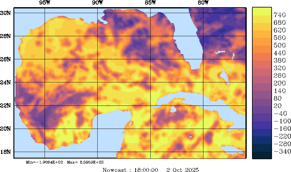
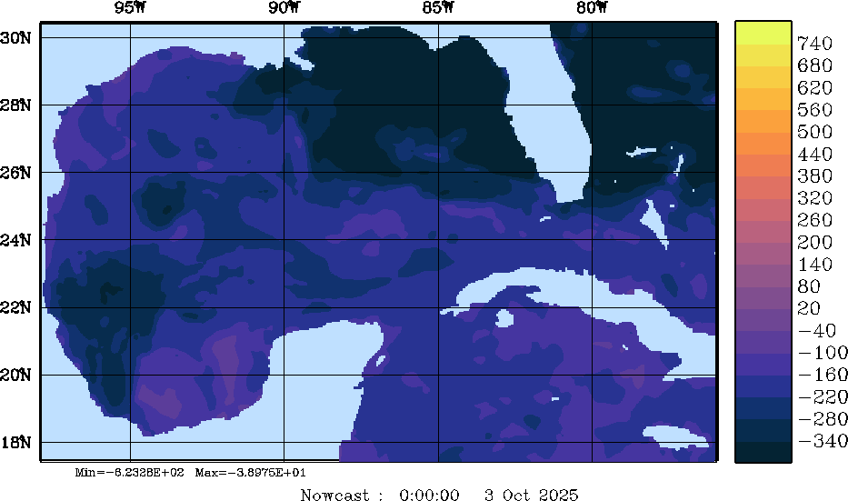
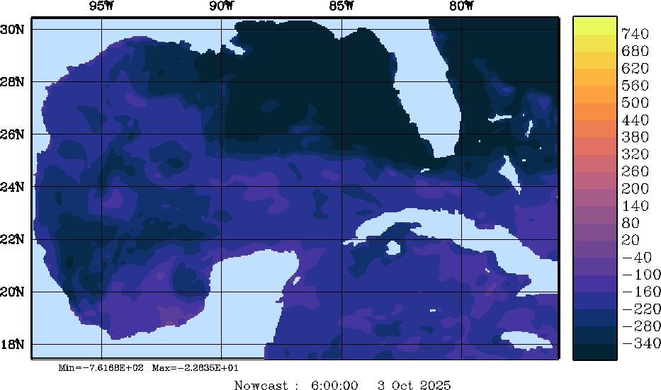
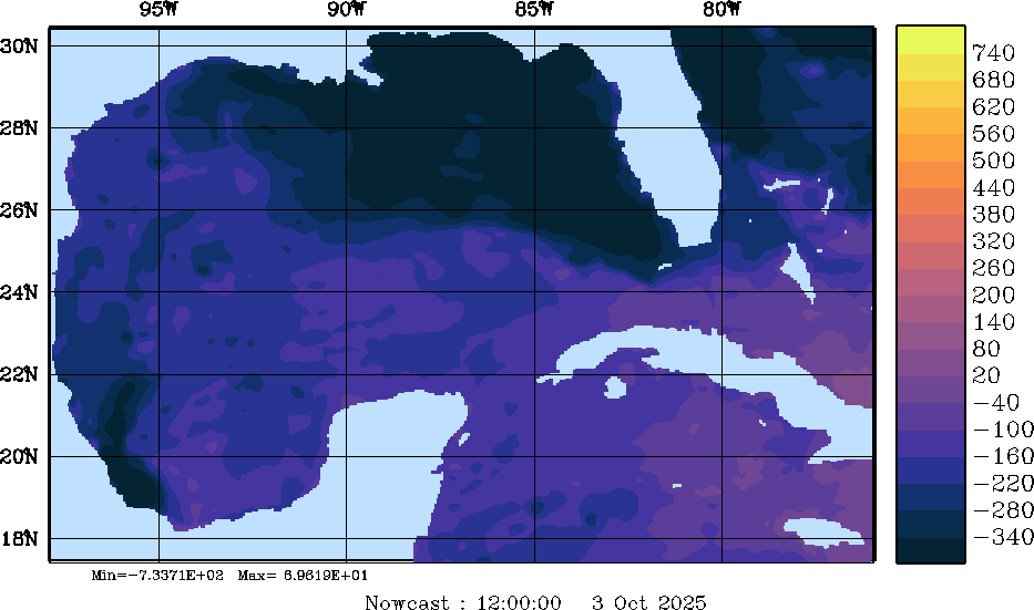
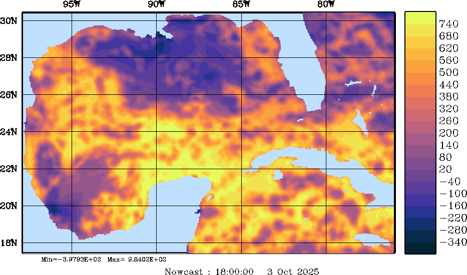
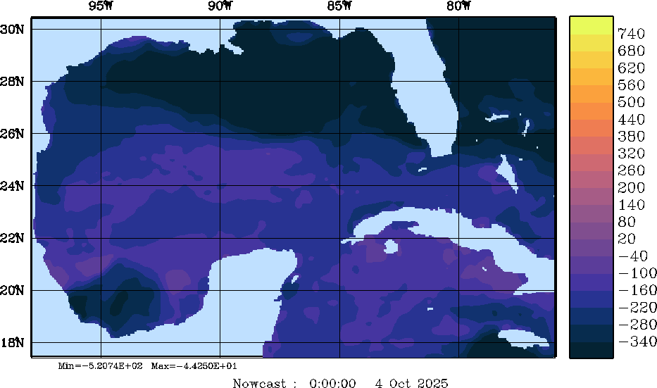
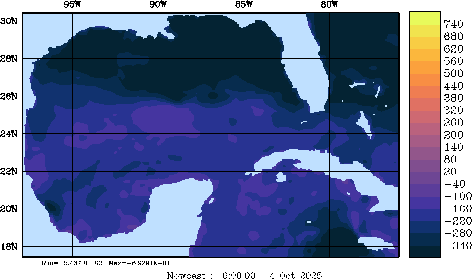
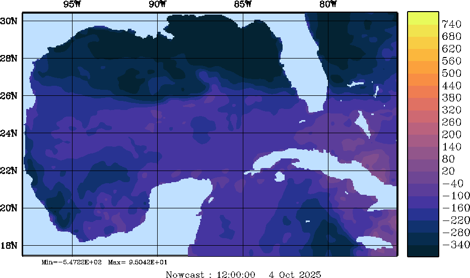
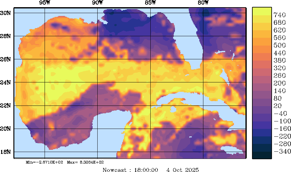
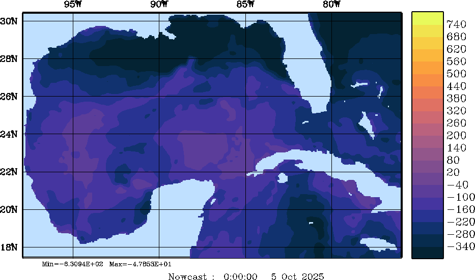
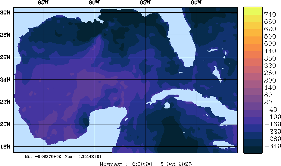
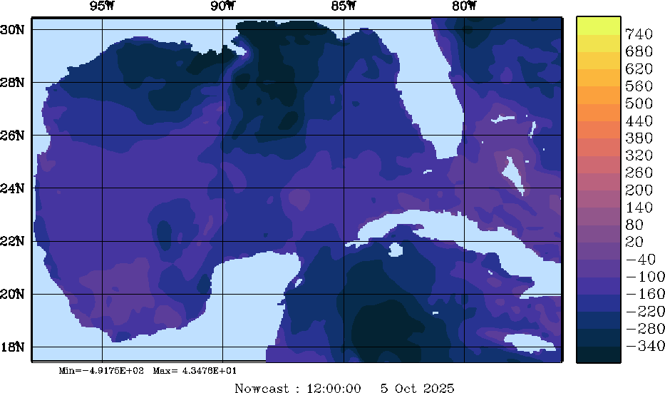
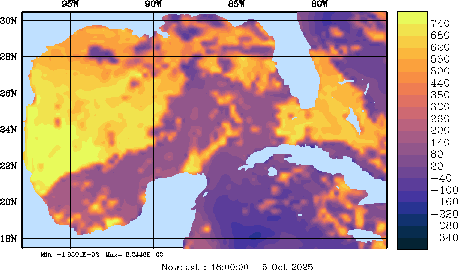
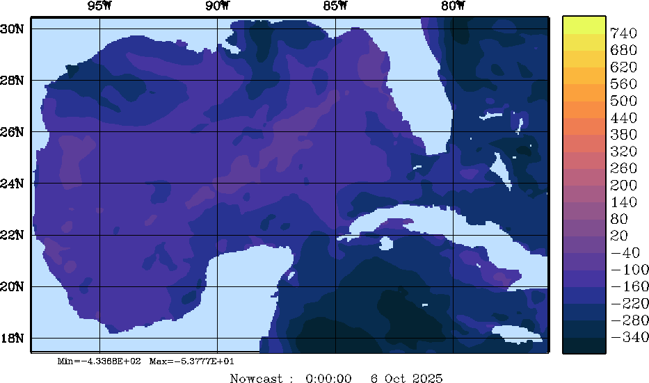
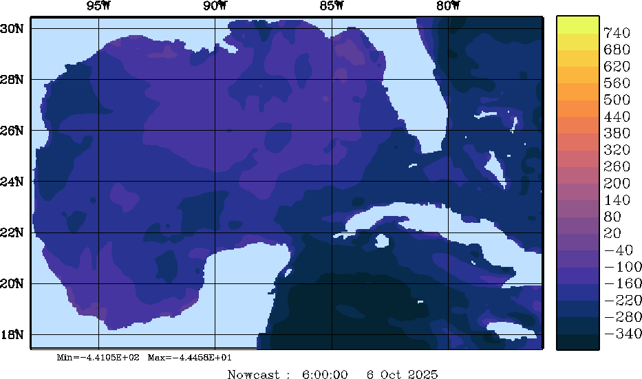
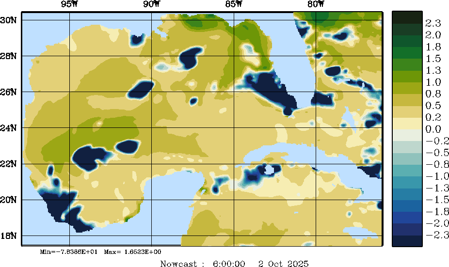
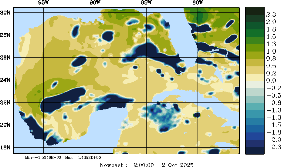
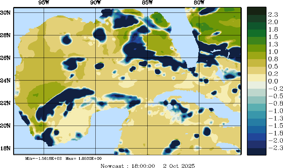
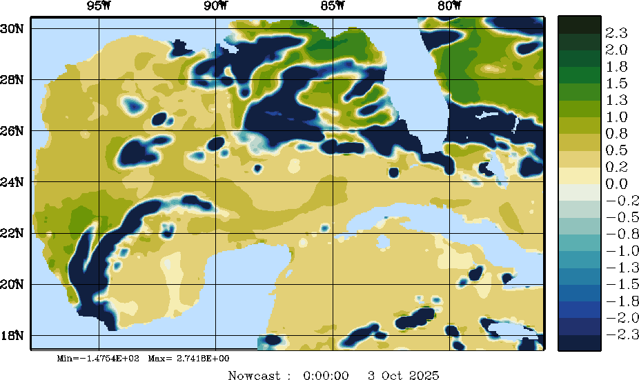
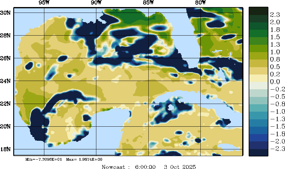
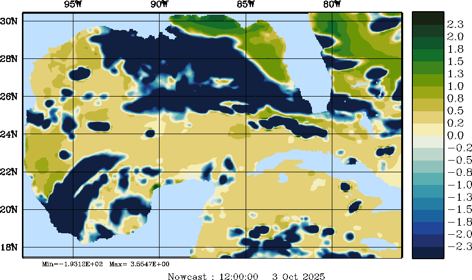
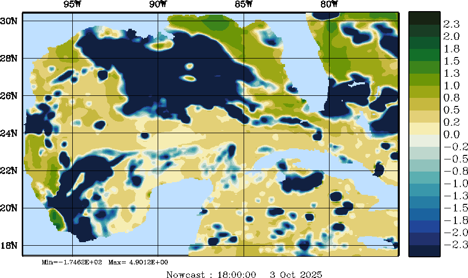
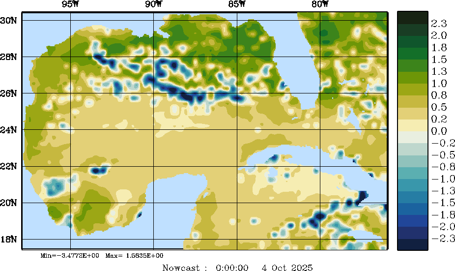
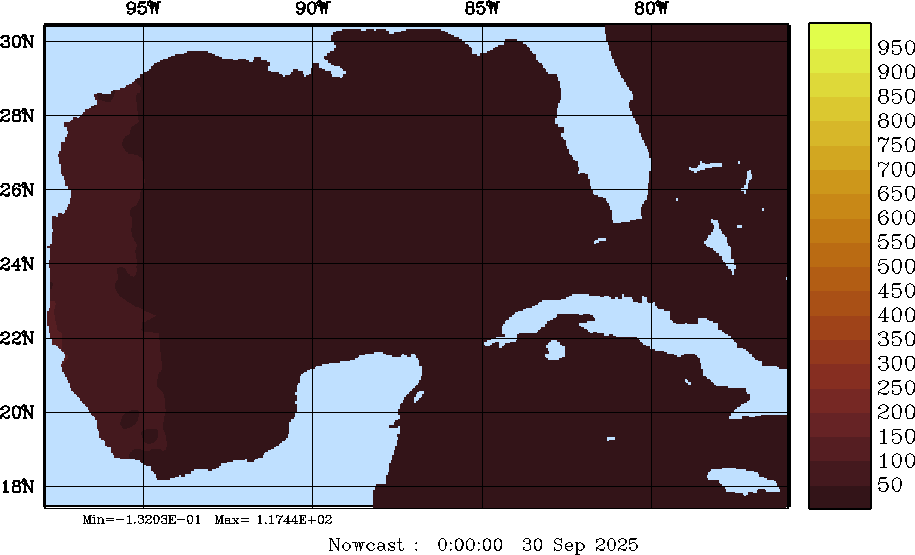
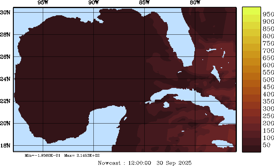
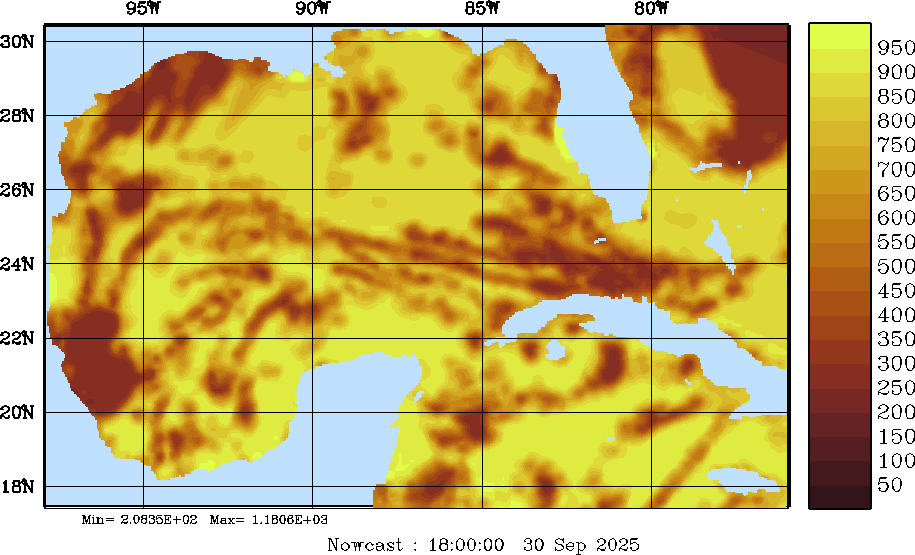
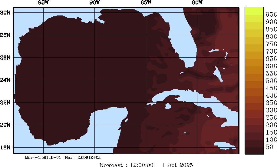
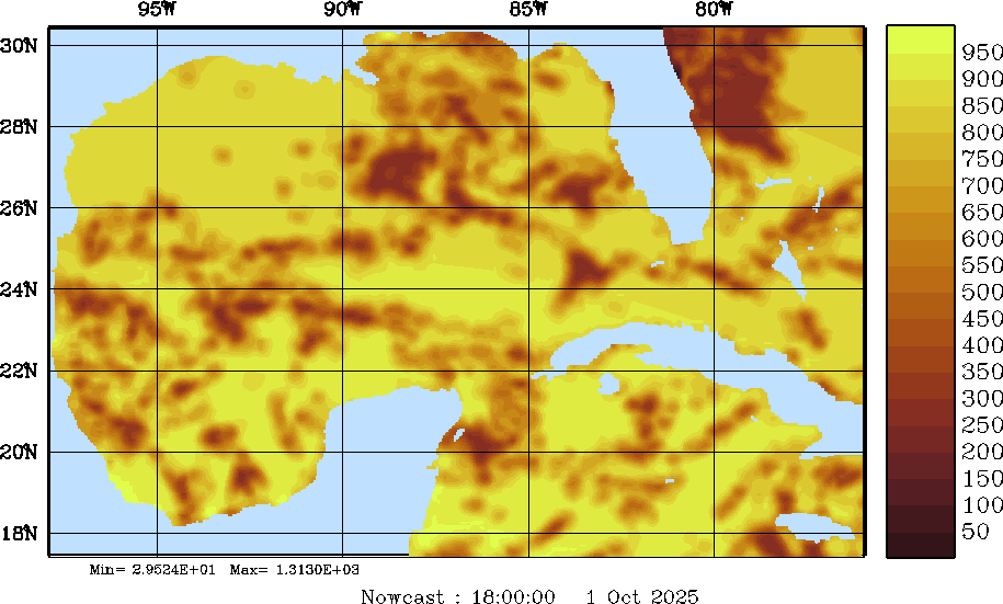
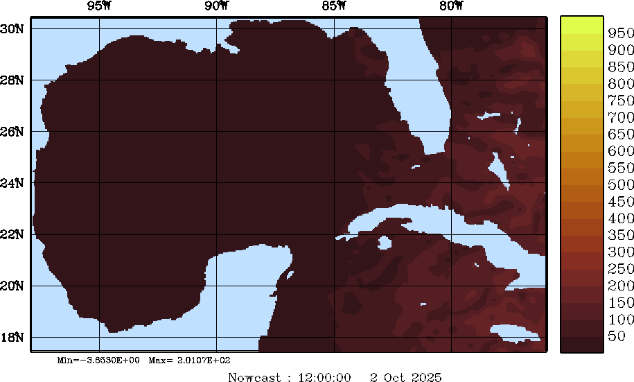
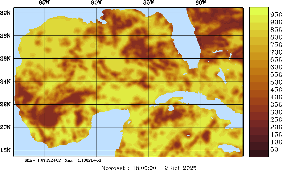
| Net Heat Flux Snapshots (W/m2); processed by MSEAS from merged NCEP fields | |||||||||||||||||||||||||
| 2025 Sep 30 | 2025 Oct 01 | 2025 Oct 02 | 2025 Oct 03 | 2025 Oct 04 | 2025 Oct 05 | 2025 Oct 06 | |||||||||||||||||||
| 00Z | 06Z | 12Z | 18Z | 00Z | 06Z | 12Z | 18Z | 00Z | 06Z | 12Z | 18Z | 00Z | 06Z | 12Z | 18Z | 00Z | 06Z | 12Z | 18Z | 00Z | 06Z | 12Z | 18Z | 00Z | 06Z |
|
|
|
|
|
|
|
|
|
|
|
|
|
|
|
|
|
|
|
|
|
|
|
|
|
|
|
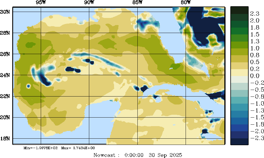
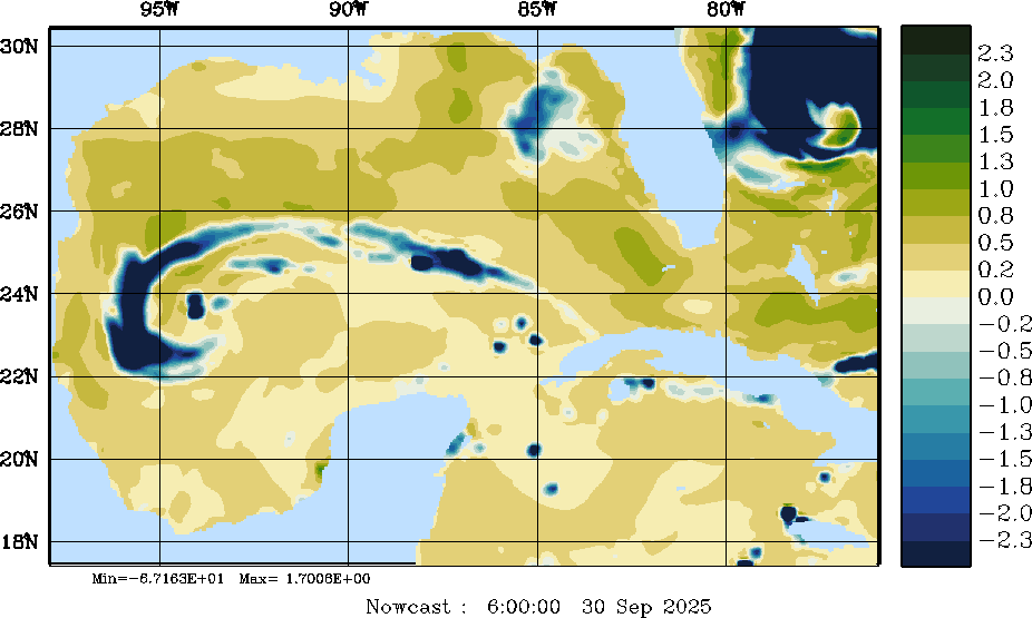
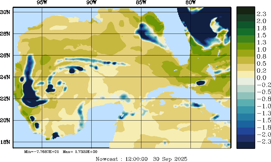
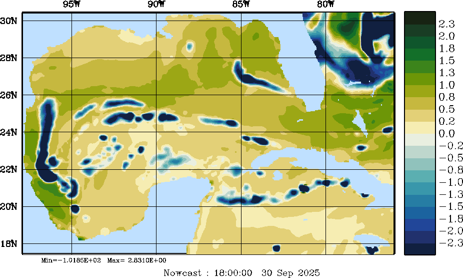
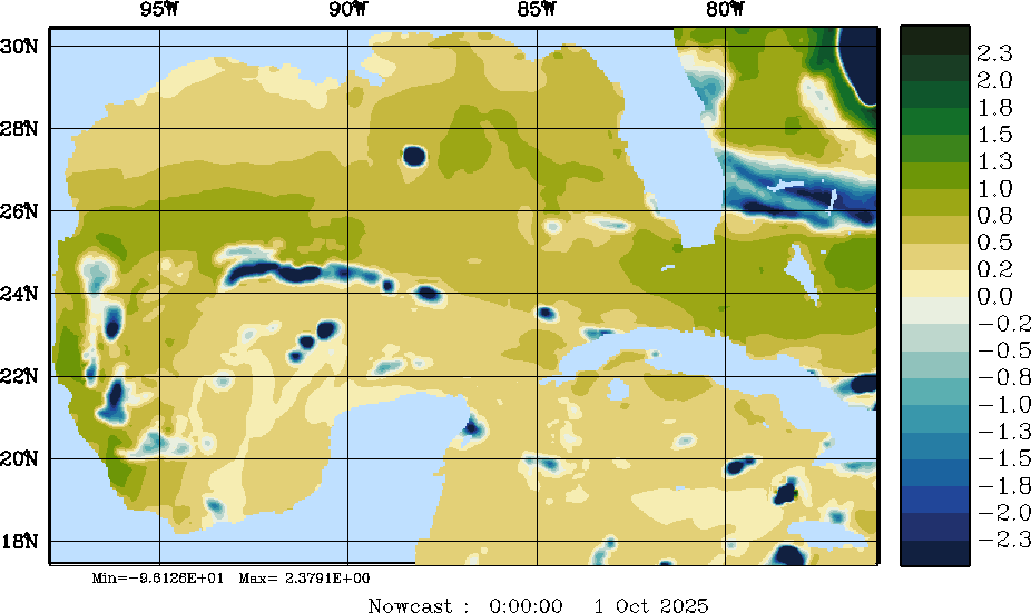
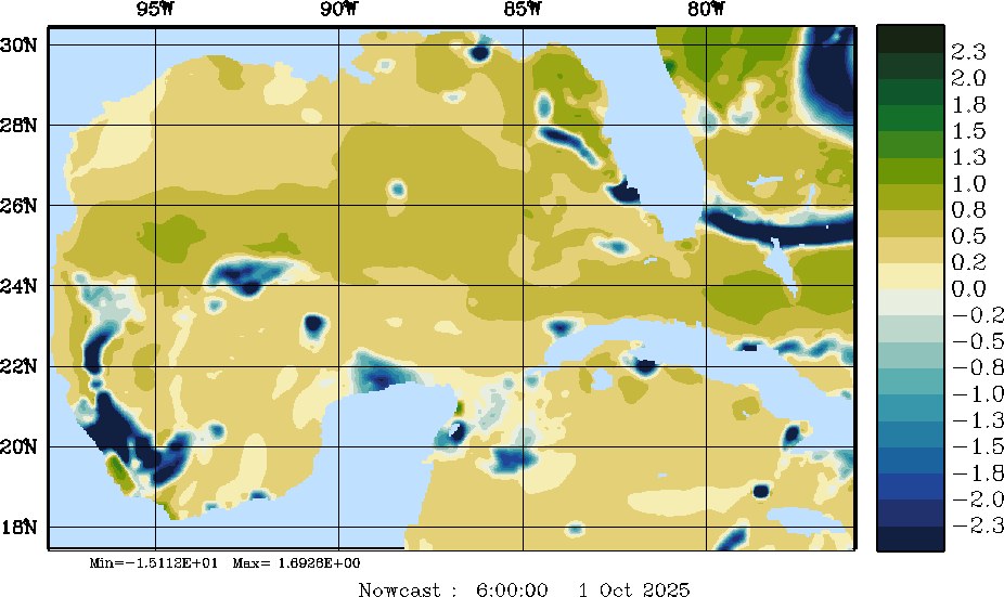
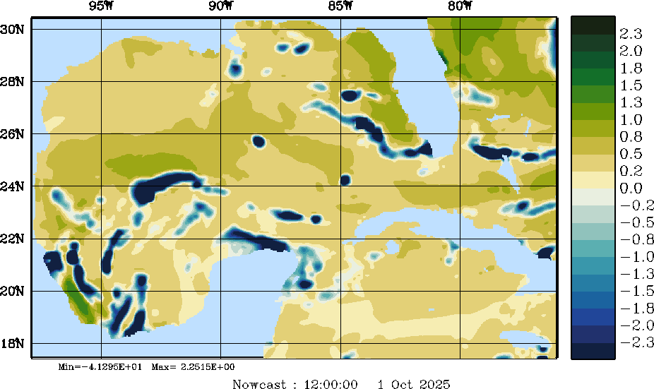
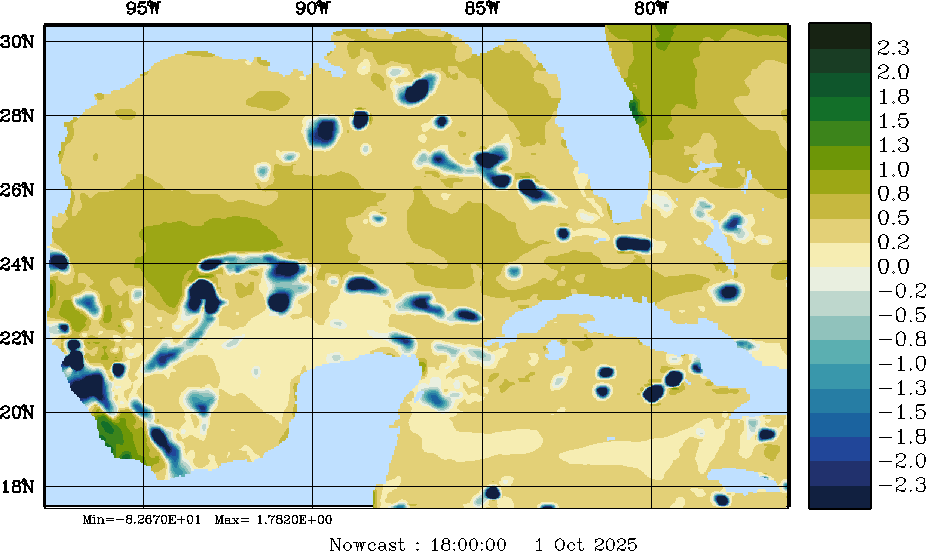
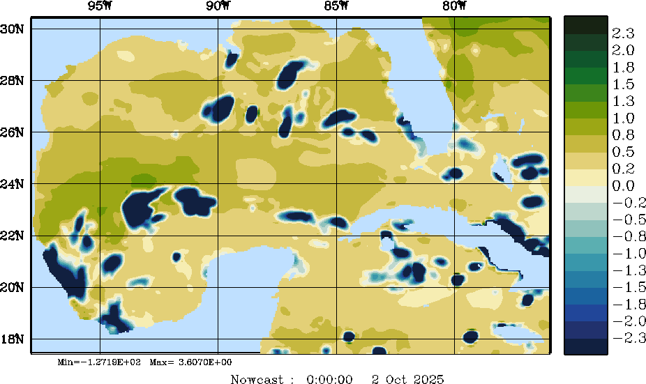
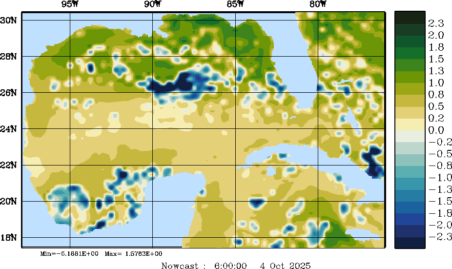
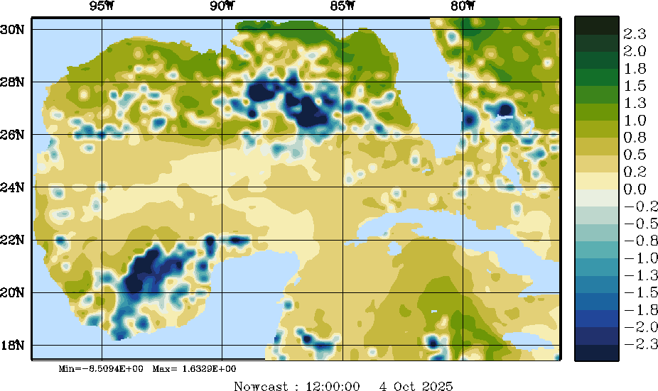
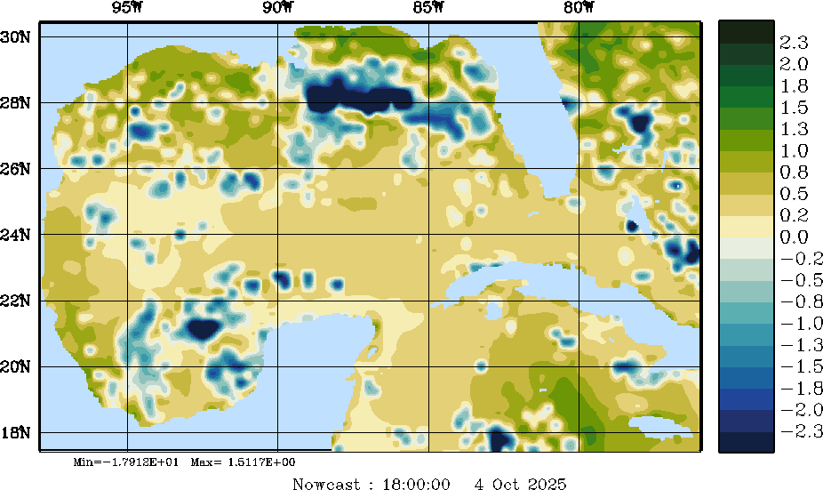
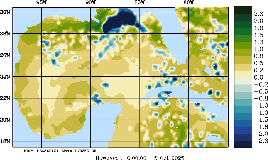
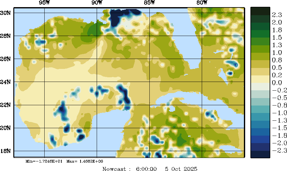
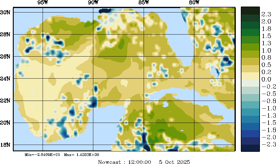
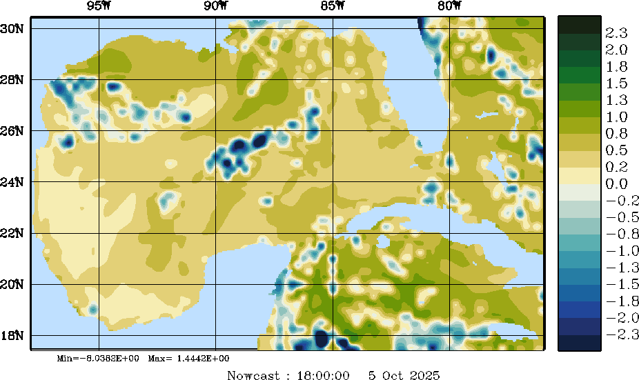
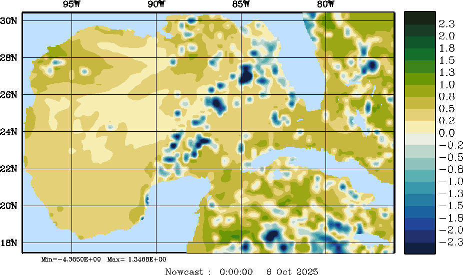
| E - P Snapshots (cm/day); processed by MSEAS from merged NCEP fields | |||||||||||||||||||||||||
| 2025 Sep 30 | 2025 Oct 01 | 2025 Oct 02 | 2025 Oct 03 | 2025 Oct 04 | 2025 Oct 05 | 2025 Oct 06 | |||||||||||||||||||
| 00Z | 06Z | 12Z | 18Z | 00Z | 06Z | 12Z | 18Z | 00Z | 06Z | 12Z | 18Z | 00Z | 06Z | 12Z | 18Z | 00Z | 06Z | 12Z | 18Z | 00Z | 06Z | 12Z | 18Z | 00Z | 06Z |
|
|
|
|
|
|
|
|
|
|
|
|
|
|
|
|
|
|
|
|
|
|
|
|
|
|
|
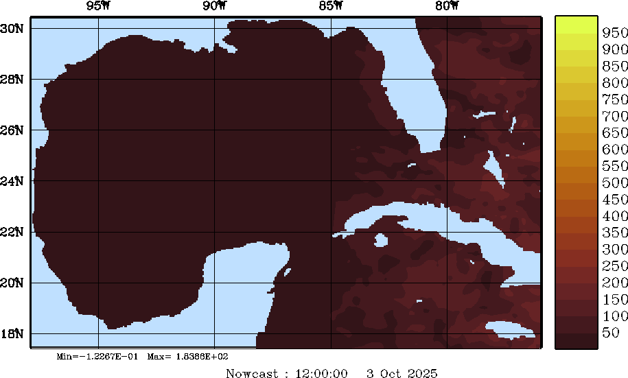
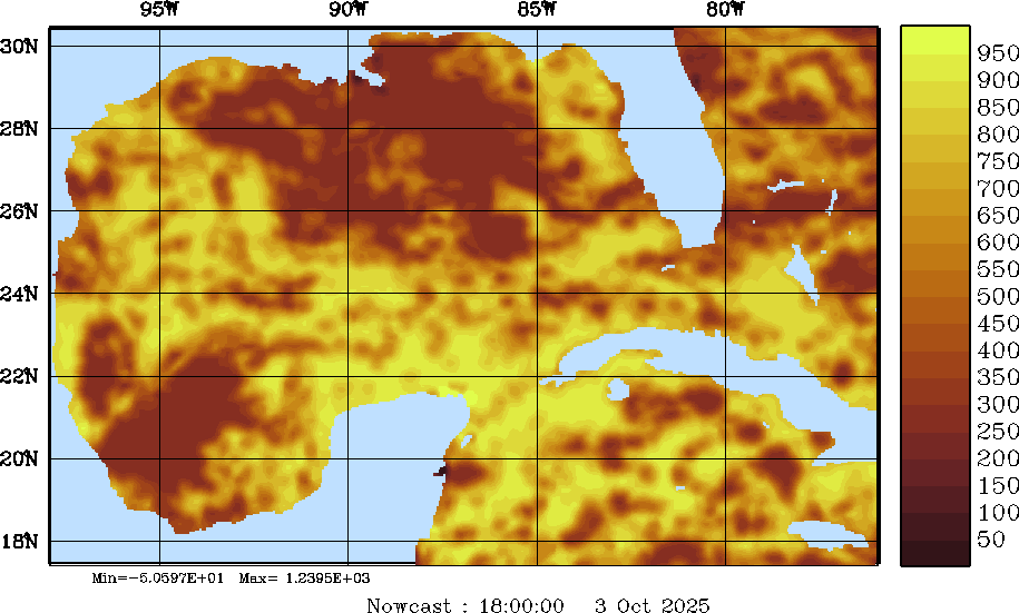
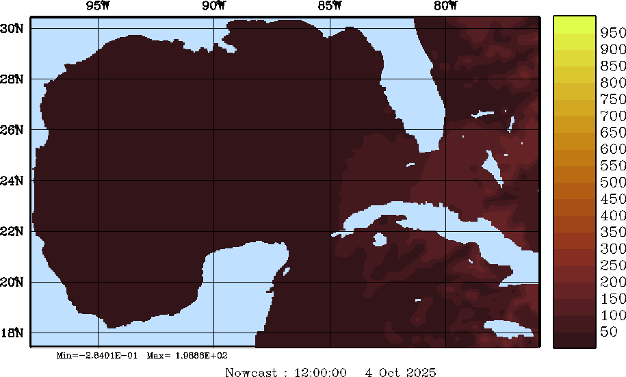
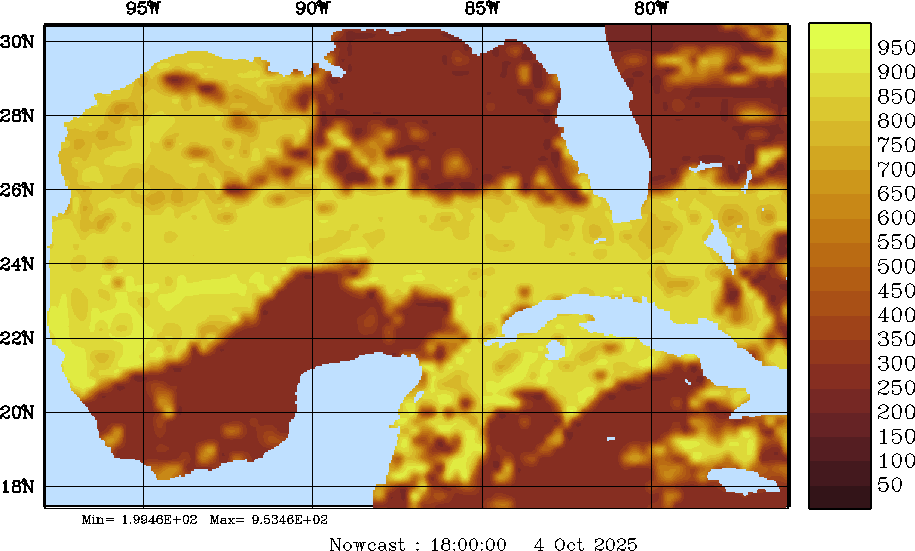
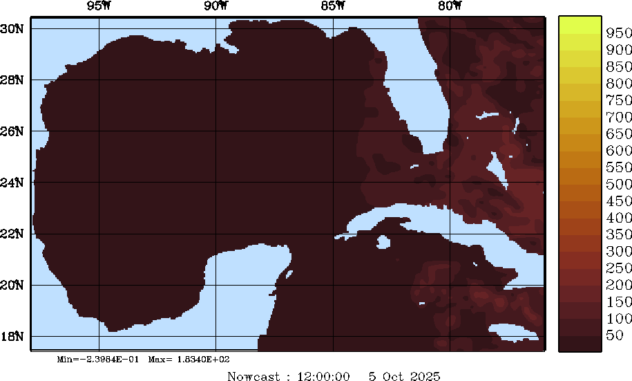
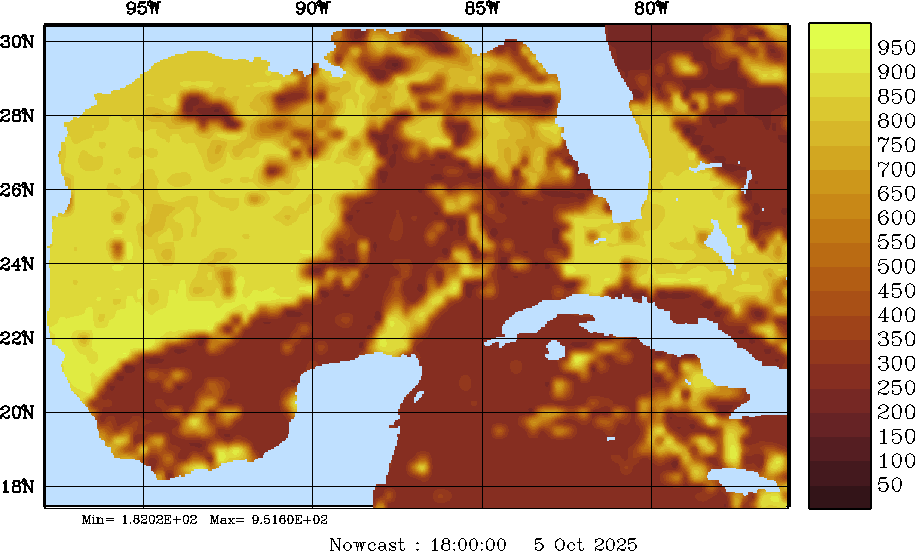
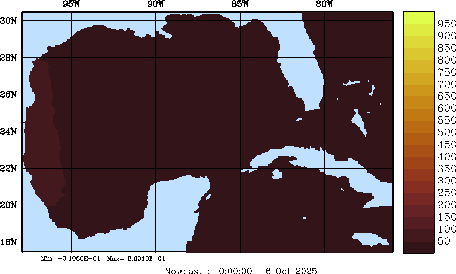
| SW Radiation Snapshots (W/m2); processed by MSEAS from merged NCEP fields | |||||||||||||||||||||||||
| 2025 Sep 30 | 2025 Oct 01 | 2025 Oct 02 | 2025 Oct 03 | 2025 Oct 04 | 2025 Oct 05 | 2025 Oct 06 | |||||||||||||||||||
| 00Z | 06Z | 12Z | 18Z | 00Z | 06Z | 12Z | 18Z | 00Z | 06Z | 12Z | 18Z | 00Z | 06Z | 12Z | 18Z | 00Z | 06Z | 12Z | 18Z | 00Z | 06Z | 12Z | 18Z | 00Z | 06Z |
|
|
|
|
|
|
|
|
|
|
|
|
|
|
|
|
|
|
|
|
|
|
|
|
|
|
|