


Shown are our MIT-MSEAS forecasts of forward float flow maps for three EM-APEX floats in the Gulf region during the period June 20 - July 3, 2025.
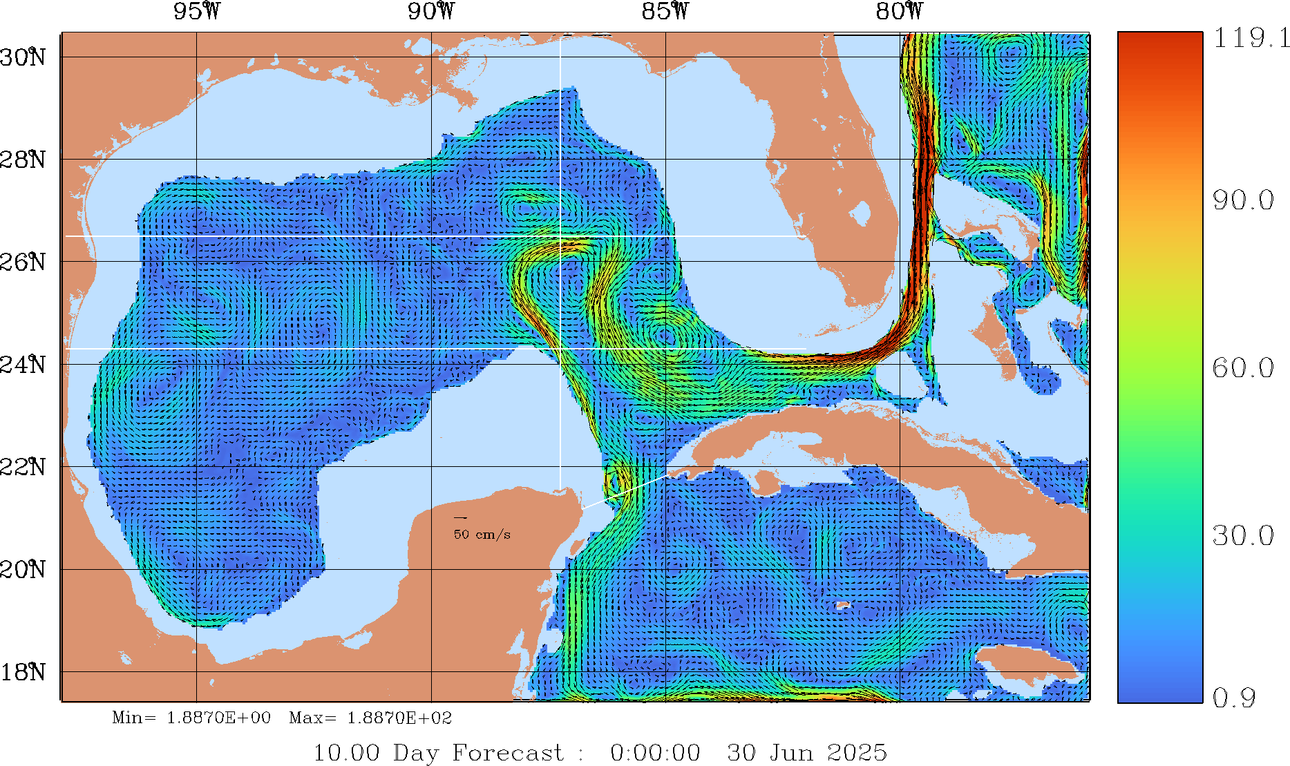
We first compute the 3D forward float flow maps for different time windows (spanning June 20 - July 3) for the whole Gulf domain. Float forward flow maps link the initial location of a float to its final position as it is advected over a specified time window by the currents and its vertical profiling motions. To mimic these motions of EM-APEX floats, the vertical velocity from the MIT MSEAS PE is replaced with an analytic float behavior model that either has the float parked at 1500 m or makes a profile from 1500 m to 0 m and back down to 1500 m over an 8.5 hour period.
In the table of panels below, we show float flow map forecasts for two types of EM-APEX behaviors, first for floats doing one profile per day and then for floats doing two profiles per day. For each type, two floats aim to start in LC frontal eddies (LCFEs) and remain in these LCFEs, while a third float aims to start and remain in the main LC. In all cases, forecasts start on June 20, 2025.
We selected the initial float regions (two floats in LCFEs and one float in the main LC lobe) based on watermass analyses (T, S, σT) at several depths, velocity and vorticity fields at several depths, and Lagrangian feature analysis (coherent structures, FTLE, etc.). Once these initial regions are defined, we then highlight the forward float flow maps at the initial time and color their forecast positions at the different intermediate times of the forward float flow map in two different ways. The first coloring scheme is a solid color for each region surrounding each float - 1 (dark blue), 2 (green), and 3 (maroon). This scheme simply highlights where the material in the region is going over time. The second scheme colors floats in each region by their initial distance from the centroid of the region. This scheme highlights how each region is being distorted, especially how its edges can be affected by shear and turbulence.
Floats starting in the northern Loop Current (LC) Frontal Eddy (FE) region (green) on June 20 are forecast to advect southward along the LC. These floats begin to interact the Tortugas LCFE by June 26. By July 3 the eddy shears a filament of float around its western and southern edges.
Floats from the eastern Tortugas LCFE region (maroon) mostly remain coherent and within the region they started until June 25. Later, float locations mostly on the edges are strained into filaments forming from the edges of the LCFE by July 3, see solid and distance color maps.
Floats starting in the LC core region (dark blue) are forecast to mostly remain inside the LC but are advected to the east and southeast with some distortion. By June 27, some floats on the northwest edge of the region get entrained by the LC and are advected north and east. Some of these are entrained by an LCFE north of the LC into a nortward filament, see solid and distance color maps.
The results for the twice-a-day sampling are over all similar to the once-a-day sampling but the filamentation is happening faster and producing longer filaments (e.g. compare for example once-a-day to twice-a-day on July 3) indicating that on average the extra sampling should not increase the risk of the float leaving the initial watermass in which it was placed by July 3, except in the edge regions subject to strong shear and filamentation.
| Initial position | June 20 to June 21 | June 20 to June 22 | June 20 to June 23 | June 20 to June 24 | June 20 to June 25 | June 20 to June 26 | June 20 to June 27 | June 20 to June 28 | June 20 to June 29 | June 20 to June 30 | June 20 to July 1 | June 20 to July 2 | June 20 to July 3 |
| Sampling once per day | |||||||||||||
|
|
|
|
|
|
|
|
|
|
|
|
|
|
|
|
|
|
|
|
|
|
|
|
|
|
|
|
|
|
| Sampling twice per day | |||||||||||||
|
|
|
|
|
|
|
|
|
|
|
|
|
|
|
|
|
|
|
|
|
|
|
|
|
|
|
|
|
|