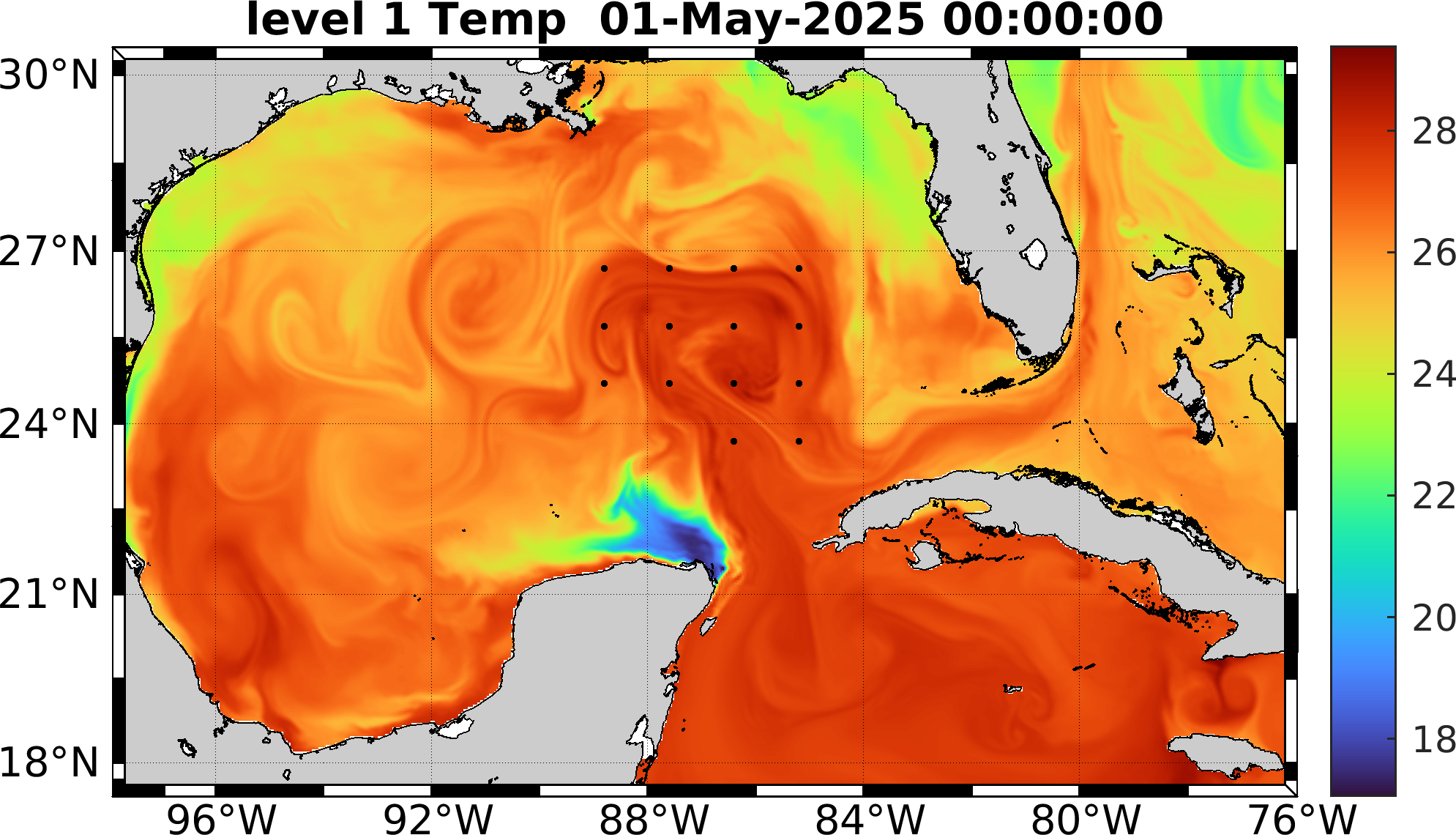
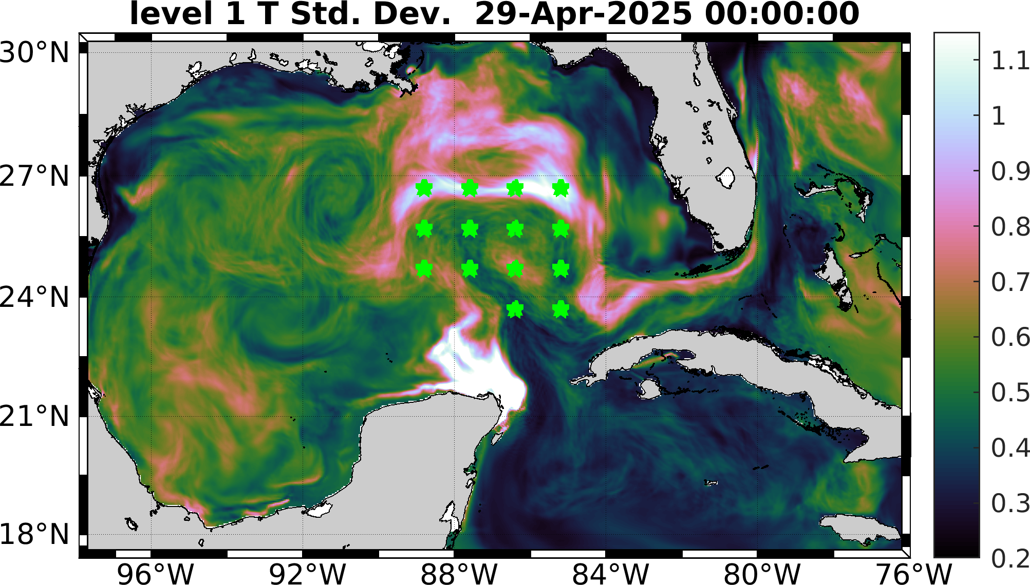
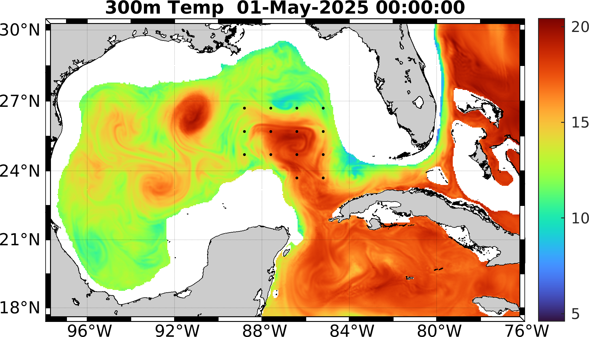
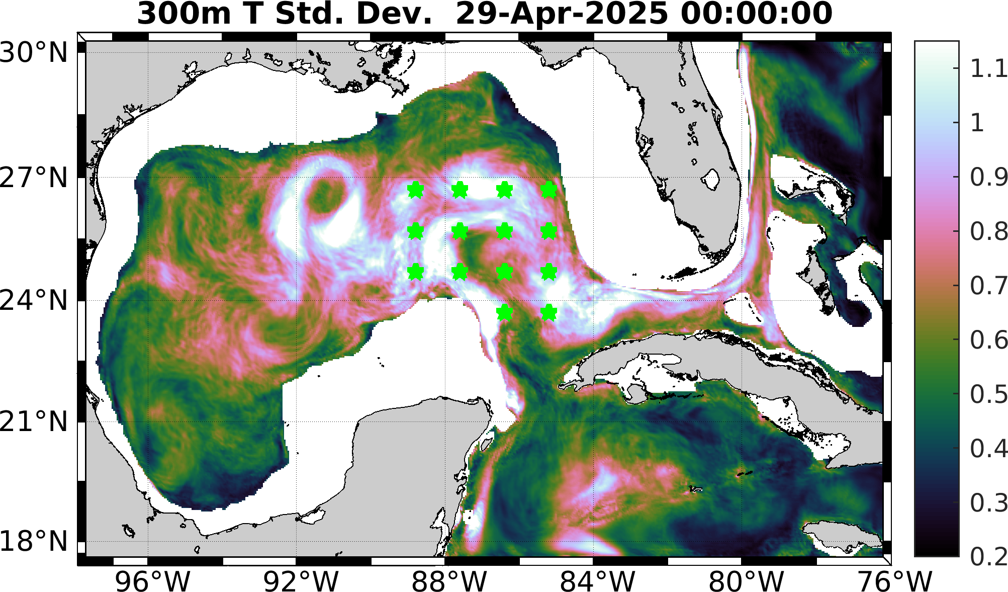
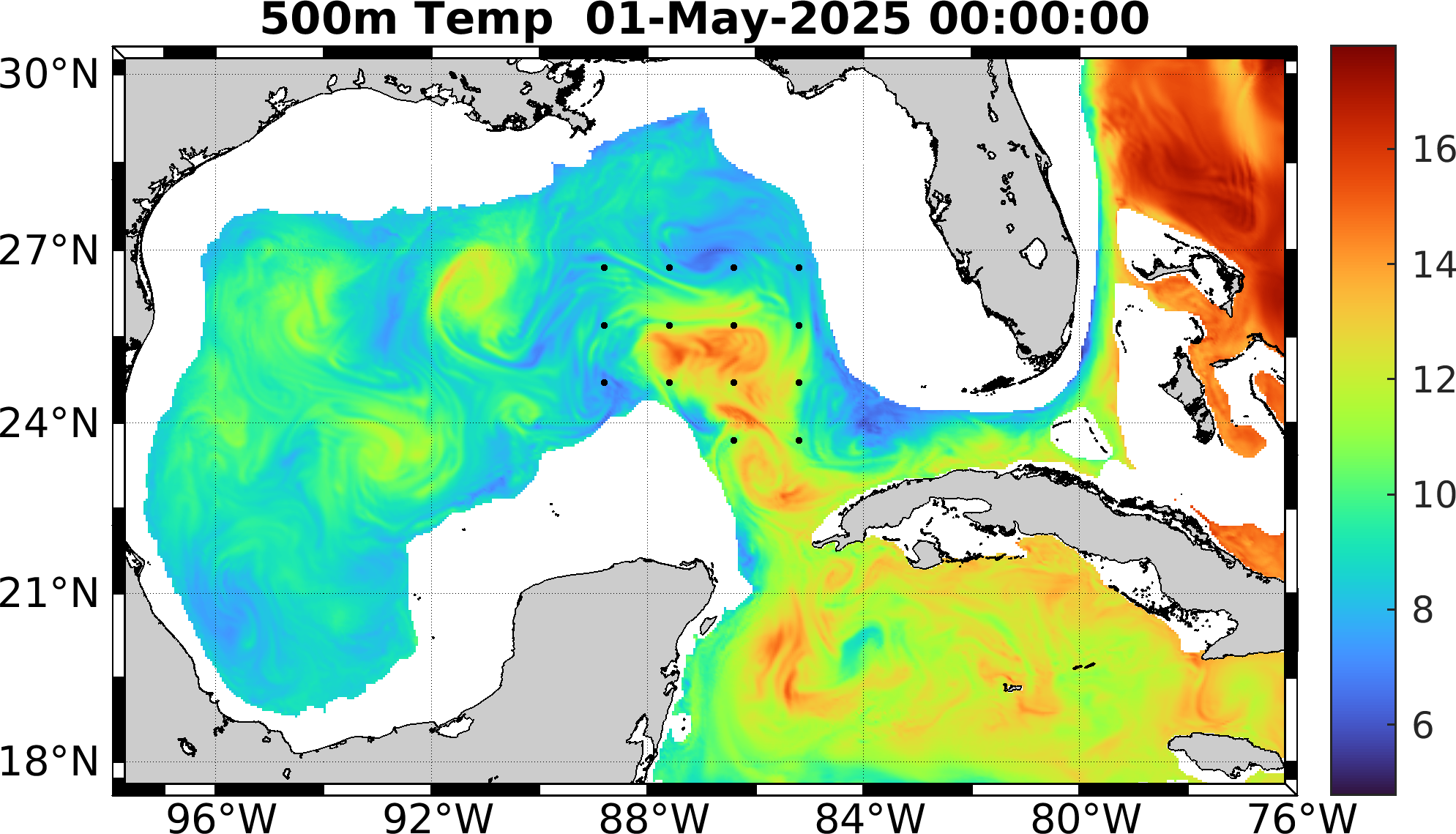
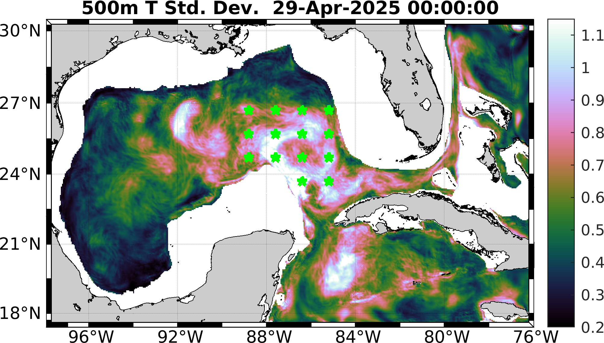
The target (verification) points are shown as either black dots or green stars in the maps below. They encompass the forecast LC region and its uncertainty. The target fields are defined by profiles at all the target points taken together, at the verification time, at 150m, 300m, and 500m depths.
These verification points consider temperature and its standard deviation at the surface, 300m and 500m. Locations where the topography is shallower than 500m are eliminated.
| Depth (m) | Background field | |
|---|---|---|
| Temperature | Temperature uncertainty | |
| 0 |
|
|
| 300 |
|
|
| 500 |
|
|