AOSN-II August 2003
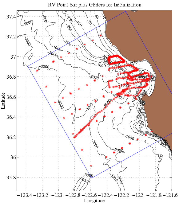
Data collected by the research vessel Point Sur and WHOI and Scripps gliders from 2-6 August 2003 were analyzed to provide an estimate for the synoptic conditions at that time. This estimate of synoptic conditions provided the initialization conditions for the Harvard Ocean Prediction System (HOPS) model simulations. Subsequently, each simulation has been restarted from the simulation which preceeded it.
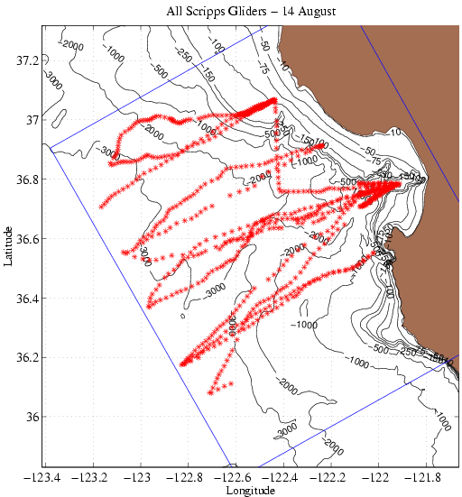
Additional data from 7-23 August from Woods Hole Oceanographic Institution and Scripps Institute of Oceanography autonomous underwater vehicles (gliders) have been assimilated into the ongoing simulation. In addition, SST from a Naval Postgraduate School aircraft flight has been assimilated on 15 August. The complete data coverage during the exercise through 14 August is shown for the Scripps and the WHOI gliders.
| Temperature | Salinity |
The product package includes nowcast and forecast maps of temperature (oC) and salinity (PSU) with superimposed vectors of sub-tidal velocity at four depth levels: 0m, 10, 30m and 200m. These levels are: the surface (0m), within the mixed layer (10m), the middle of the thermocline (30m) and within the California Undercurrent (200m). In addition, there are vertical sections of temperature off-shore from Point Ano Nuevo, Monterey bay and Point Sur. All products are for 0000Z of the respective day. Clicking on "Temperature" or "Salinity" in the table above accesses the products for that variable.
Atmospheric forcing for the PE model is derived from the US Navy operational COAMPS (Jim Doyle) at 3km resolution. Early August winds were generally not upwelling favorable. Winds were light and variable, leading to relaxation conditions. During the relaxation conditions, upwelling along the coast diminished and warm off-shore water moved on-shore. From 7 August through 19 August winds were upwelling favorable. The anomalous warming of Monterey Bay was replaced by cooler waters and significantly upwelling off Points Ano Nuevo and Sur occurred. The upwelled water was transported southwards across the mouth of Monterey Bay.
For the period 20-23 August the wind forcing was light and from the south and southwest. In response, general warming took place and upwelling at both Points Ano Nuevo and Sur were significantly reduced. Warm off-shore water moved towards the coast and was carried up the coast. As a response to the wind, there was the formation of a cyclonic eddy to the south of the persistent Monterey Bay anti-cyclone. For the period 22-24 August the wind forcing was more upwelling favorable. A resumption of upwelling at both Points Ano Nuevo and Sur took place, especially visible below the surface layer.
For the period 24-26 August the wind forcing is predicted to continue to be upwelling favorable, especially in direction (winds are less strong). In the simulation, noticeably at 10m, we see a continuation of upwelling at both Points Ano Nuevo and Sur. There is a very coherent along-shore current from north to south, which generates a large meander by 26 August. This meander moves on-shore towards Monterey Peninsula.
A preliminary MS-EVA analysis was performed on the complete simulation from which this nowcast and forecast were generated. Starting August 21, (the wind began to relax on Aug 19) there seems to be a steady transfer of potential energy at 500m from the large-scale time window (longer than 10 days) to the meso-scale window (2 to 10 days) in the Monterey Bay, and a steady transfer of kinetic energy just outside the bay. But no significant local increase of meso-scale potential energy and kinetic energy have been identified at the corresponding locations. It is not clear what events these transferred energies are supplied for.