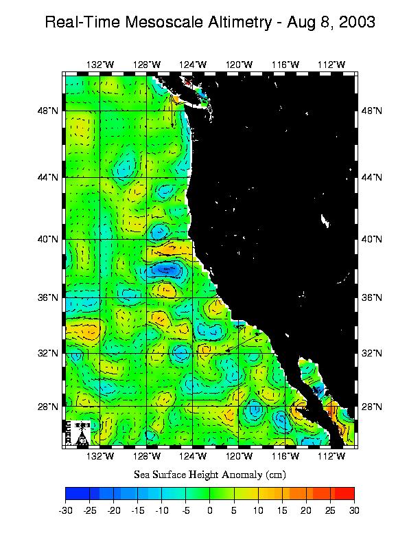
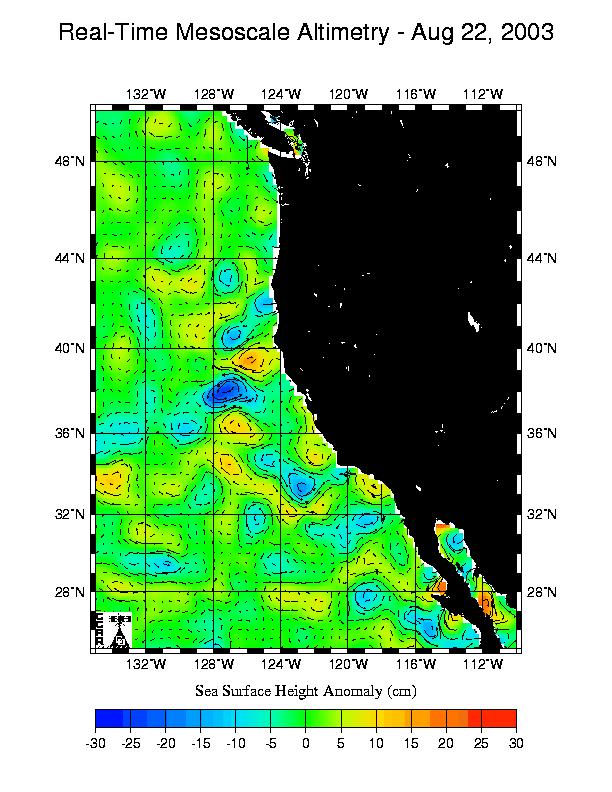
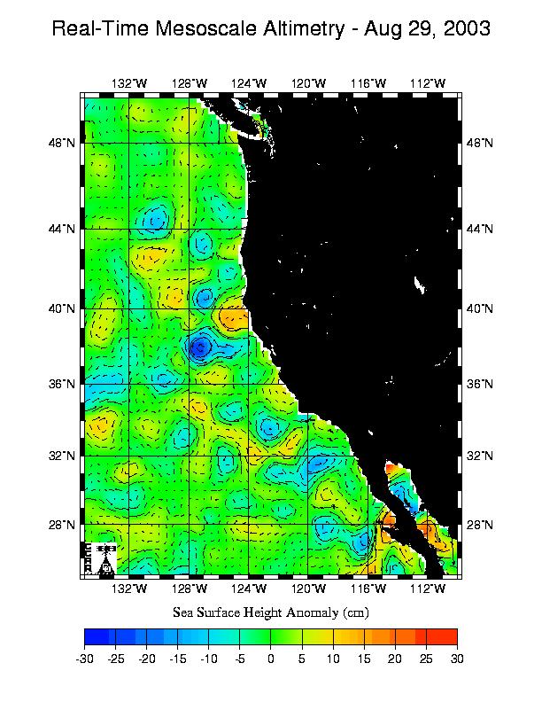
The plots of geostrophic velocity are fixed by CCAR to cover a 25x25 degree region.

|
|

|
|
|

|
The following plots were acquired from the Colorado Center for Astrodynamics Research altimetry geostrophic velocity viewer web page (http://www-ccar.colorado.edu/~realtime/global_realtime/geovel.html).
From their page: "Welcome to the CCAR Global Near Real-Time Altimeter Geostrophic Velocity Viewer. This page allows you to view maps of the sea surface height (as an anomaly or including an estimate of the mean height) with superimposed velocity vectors. The maps are produced from Jason, TOPEX/POSEIDON(T/P), Geosat Follow-On(GFO) and ERS-2 altimeter data processed in near real-time. This quick-look processing is designed to retain the mesoscale sea surface height anomalies associated with fronts and eddies. An analysis product is produced every weekday, based on the latest 10 days of Jason and T/P, 17 days of GFO and 35 days of ERS-2 sampling, if available."
The plots of geostrophic velocity are fixed by CCAR to cover a 25x25 degree region.
|
|
|
|
|
|
|
|