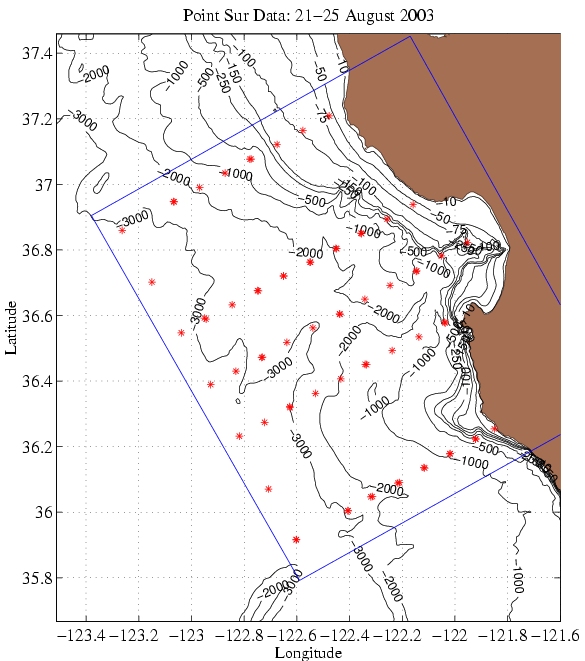
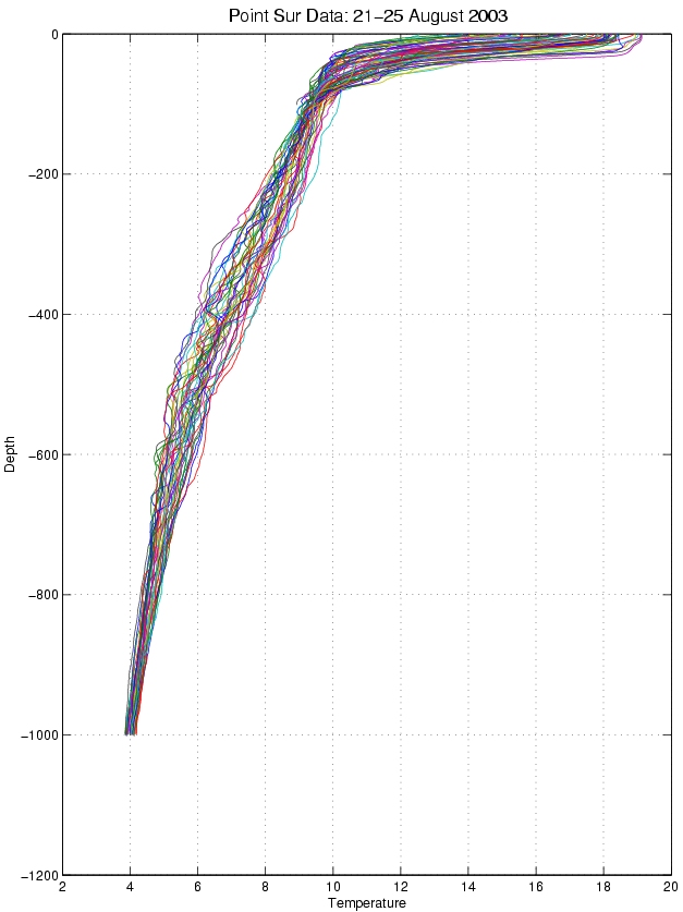
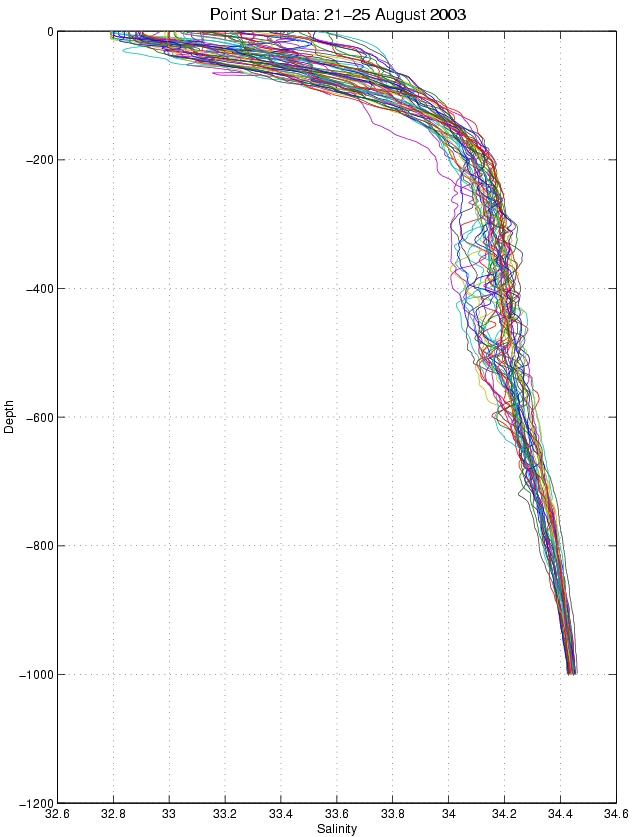
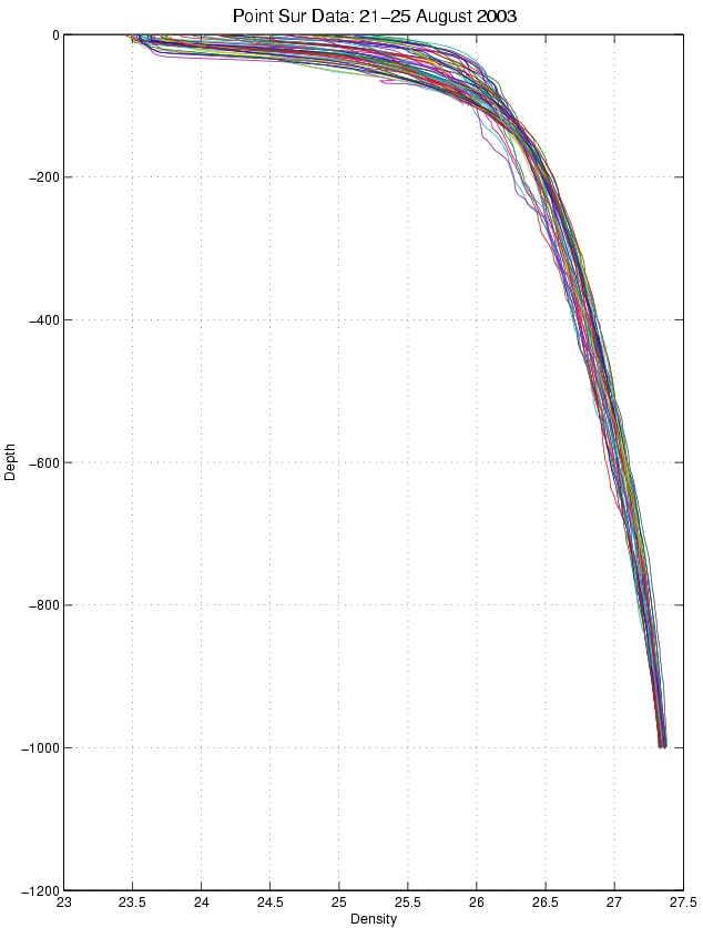
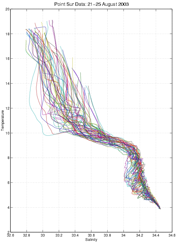
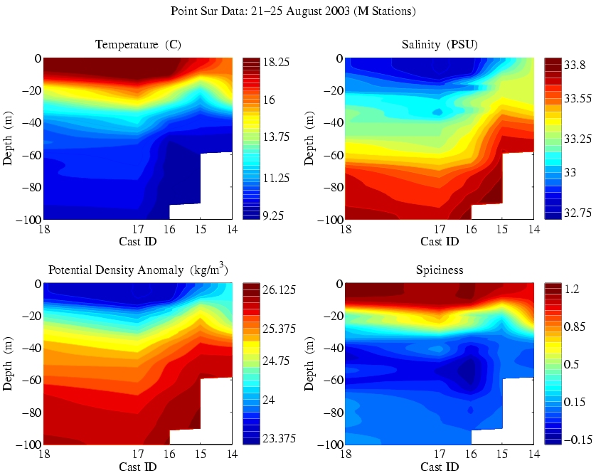
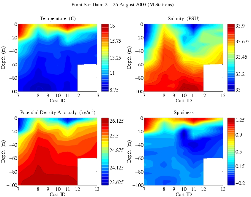
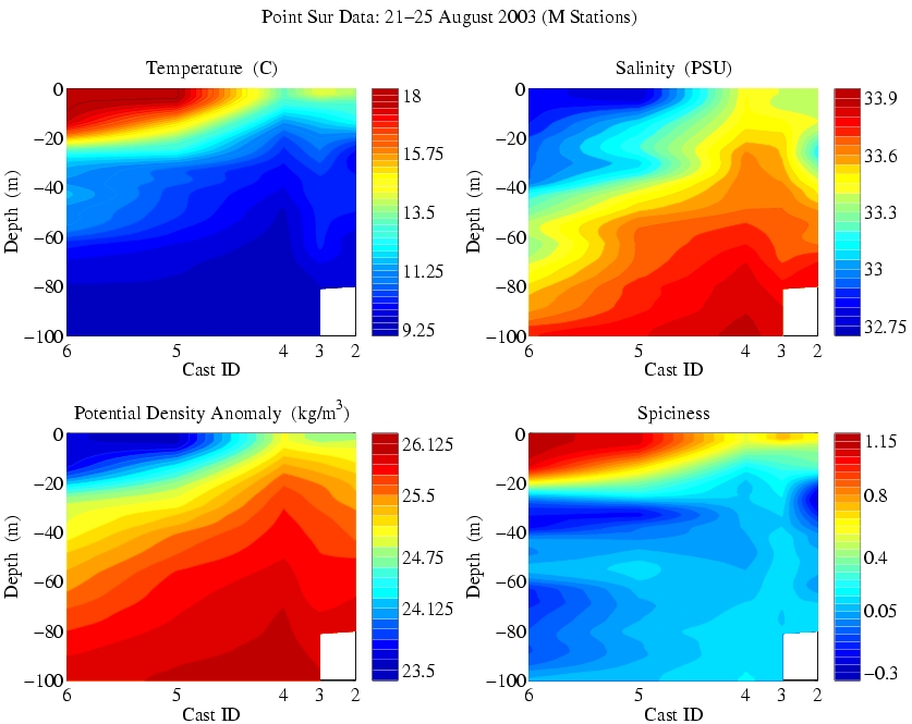
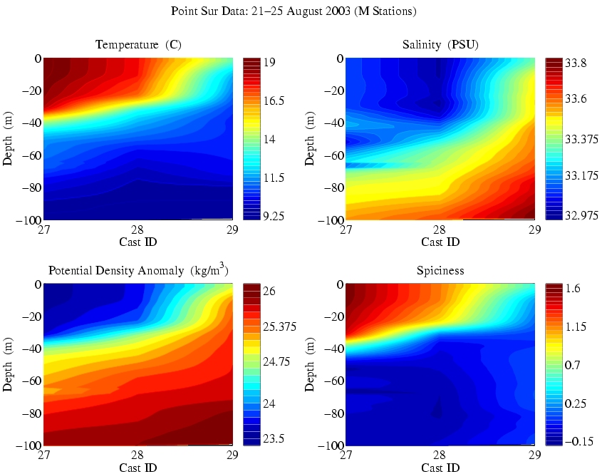
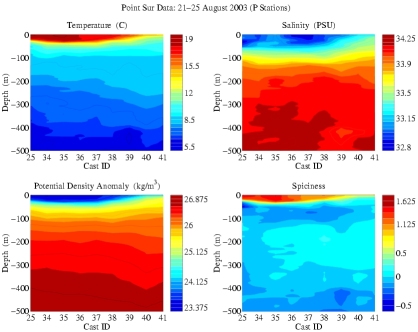
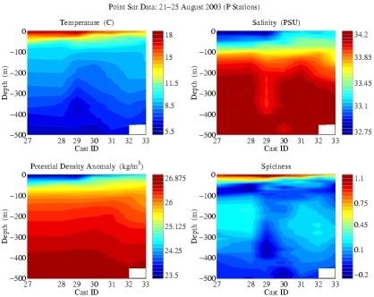
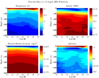
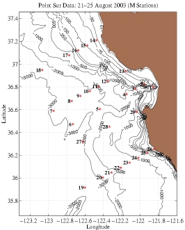
AOSN-II: R/V Point Sur Data - 21-25 August 2003
|
| Click on any image to enlarge |
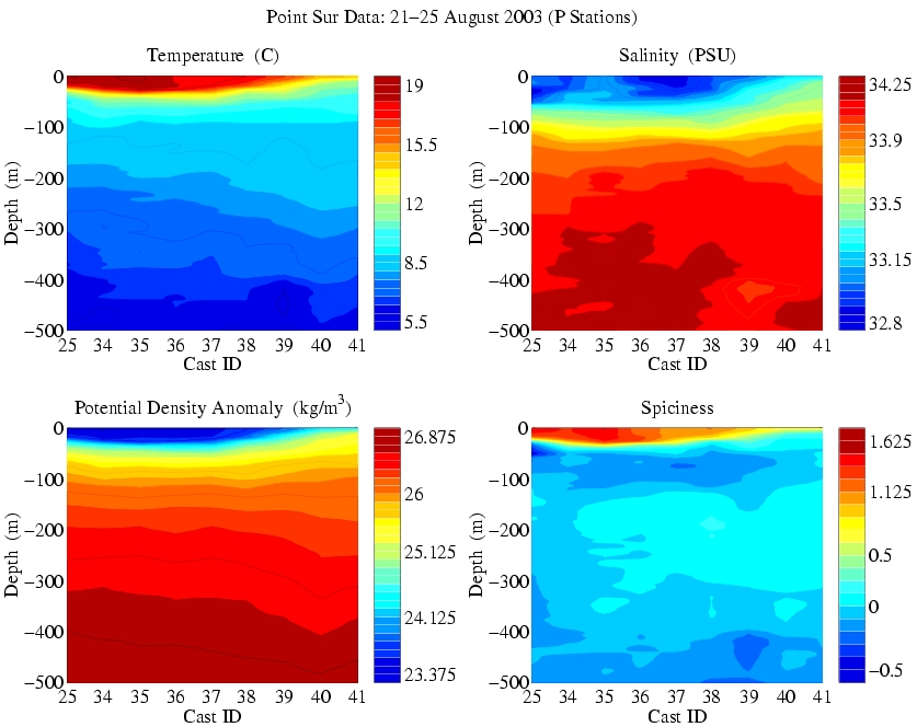
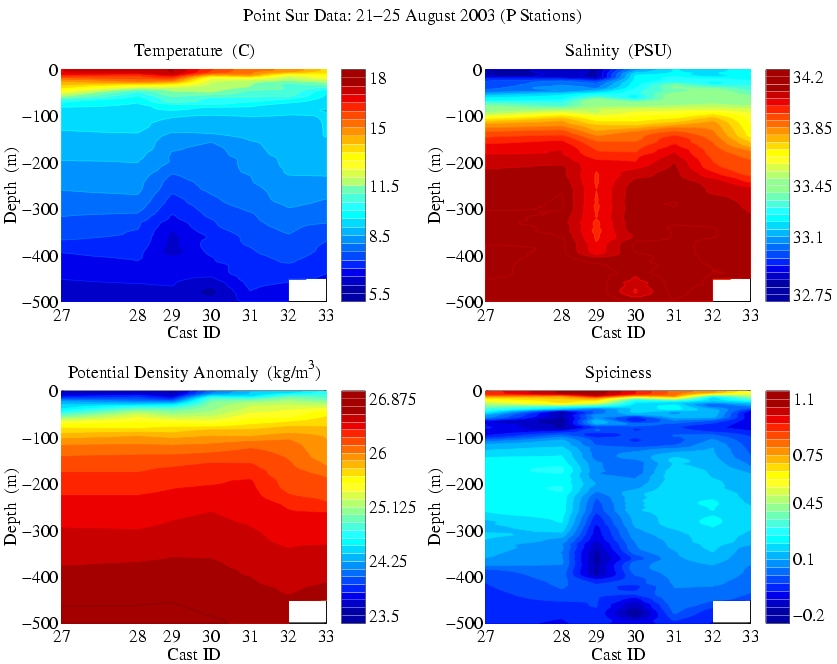
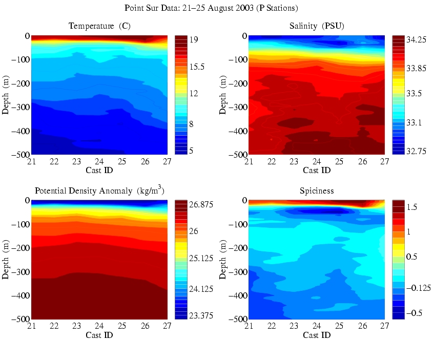
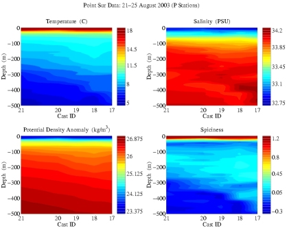
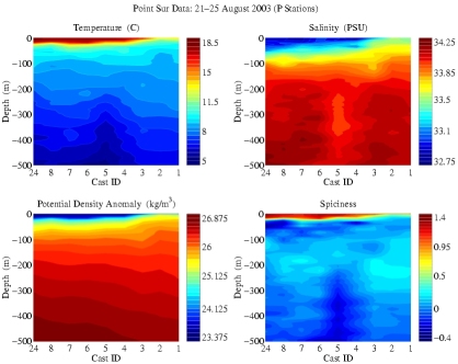
Note that the Point Sur carried two instrument packages for carrying out CTD obsverations
and performed many repeat casts. Below are vertical sections plotted using only data from
one instrument package or the other. The packages are identified as "Point Sur" or "P"
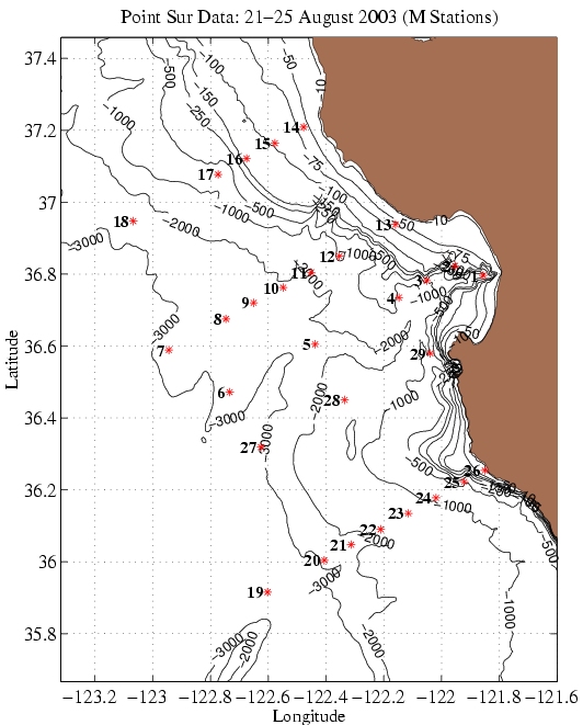
and "MBARI" or "M". The station identifiers below do NOT match the official stations
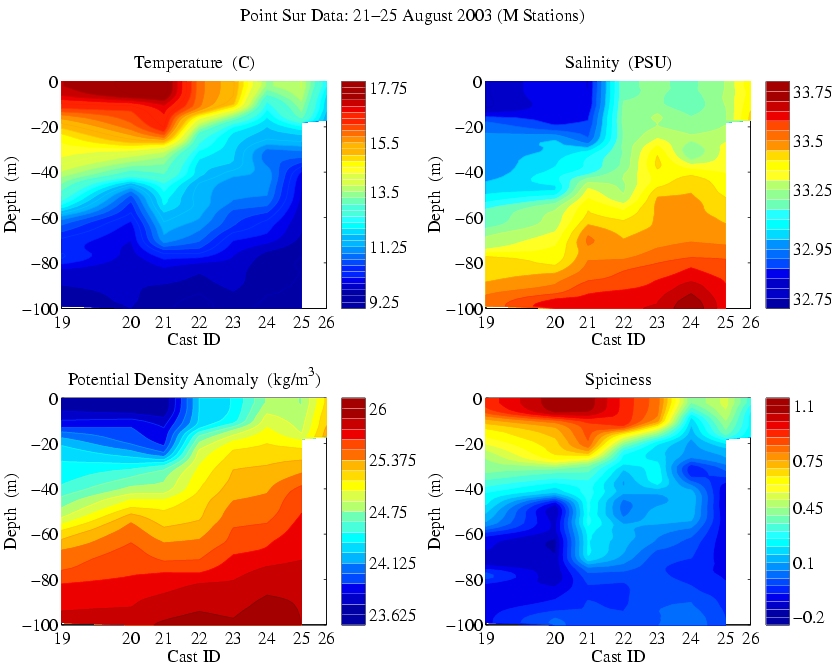
identifiers. They are simplified for this representation. "M" stations for this cruise
are generally only to 100m.
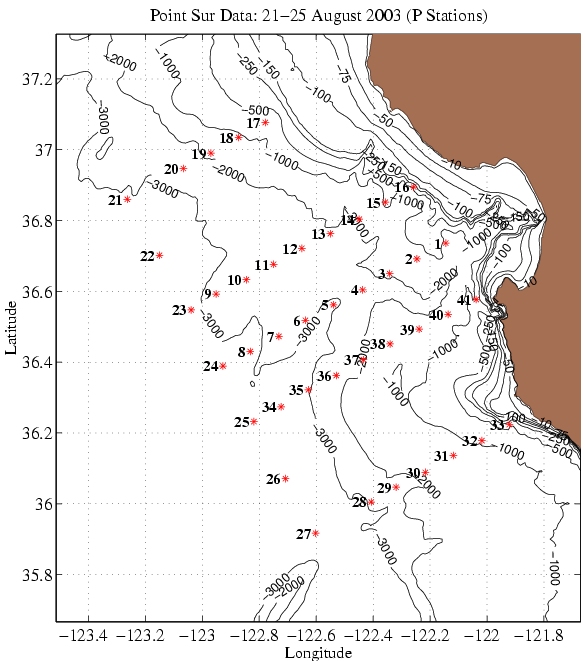
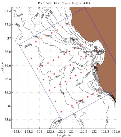
The cruise track creates five west-east sections and one north-south. These are labeled
Section 1 at the north to Section 5 at the south. Section 6 is the north-south section
along the western edge of the cruise track.
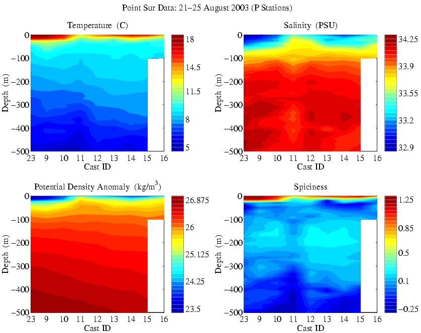
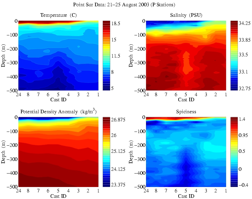
| "Point Sur" or "P" Stations |

|
| Section 1 | Section 2 | Section 3 |
|

|
|
| Section 4 | Section 5 | Section 6 |
|
|
|
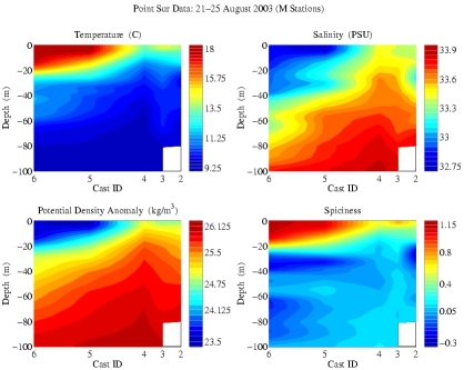
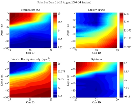
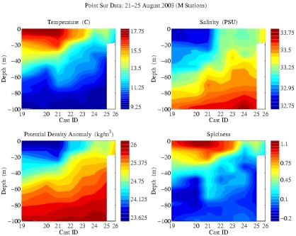
| "MBARI" or "M" Stations |
|
| Section 1 | Section 2 | Section 3 |

|

|
|
| Section 4 | Section 5 | |
|
|
|