Assessment of Skill for Coastal Ocean Transients (ASCOT-01)
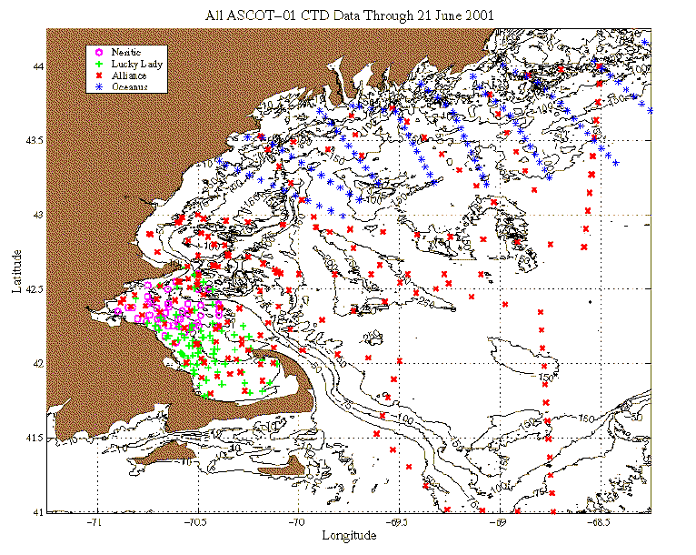
Physical and biological data collected from the NATO Research Vessel Alliance, the R/V Lucky Lady (UMass.- Dartmouth), the R/V Neritic (UMass.-Boston) and the R/V Aquamonitor (Battelle Labs for the Mass. Water Resources Authority; our special thanks to Battelle and the MWRA for the distribution and use of their data) during the period 6-21 June 2001 has been combined with historical Massachusetts Bay data to provide an estimate for the current synoptic conditions. This estimate of synoptic conditions provide the initialization conditions for the Harvard Ocean Prediction System (HOPS) model simulations.
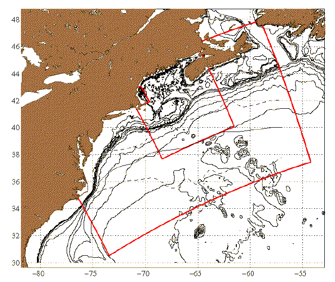
The ASCOT-01 simulation and operational system consists of a set of three two-way nested domains: the Northwest Atlantic (NWA), the Gulf of Maine (GOM) and Massachusetts Bay (MB). The specifics of the individual domains are given in other documents. The coupled biological/physical simulations are being only run in the MB domain in a stand-alone mode.
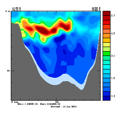
The quantities included in the products below include: chlorophyll, zooplankton, NO3, and NH4 for various depths. Products include maps of the respective quantities at different levels as well as a vertical section of chlorophyll across Massachusetts Bay. Values of the quantities are millimoles nitrogen per meter3, with the exception of chlorophyll, which is milligrams per meter3.
| 24 June 2001 | 25 June 2001 |
| 26 June 2001 | 27 June 2001 |
An animated vertical section from Brewster, MA (Cape Cod Bay) to Salem, MA (i.e. looking toward the coast from off-shore) depicts the unusual mixing and advection of chlorophyll offshore at the surface from the coast due to the winds and advection patterns in the forecast. This unusual pattern is visible beginning day 7 of the simulation. The location of this section is indicated in the 5m chlorophyll maps for each day. This animation is for a fourteen-day long simulation from June 14 through June 27.
Compared to the estimates of June 23, the new atmospheric forecasts and the assimilation of the MWRA data have again reduced the amplitude of this effect, but the surface advection from the shore remains visible.
Return to the Harvard ASCOT-01 home page
Your comments on these and other products are welcome. Please send them to:
robinson@pacific.harvard.edu