

AFMIS
|
|
|
|
Observational System Simulation Experiment (OSSE)
A two-way nested model consists of a dynamical model defined in two domains, one with coarser resolution containing the other with finer resolution. Information from the finer resolution domain, properly averaged, is used to replace information in the coarser resolution domain areas intersecting with the finer resolution domain (up-scale). Information from the coarser resolution domain around the boundaries of the finer resolution domain is used, properly interpolated, to improve boundary information in the finer resolution domain (down-scale).
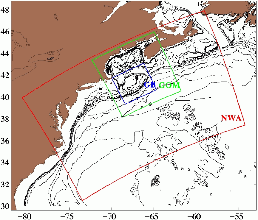
The AFMIS RTDOC operational system consists of three nested domains: the Northwest Atlantic (NWA), the Gulf of Maine (GOM) and Georges Bank (GB). The domains are shown in the figure below. In the operational context, there is two-way nesting between the NWA and GOM (NWA/GOM) domains and the GOM and GB (GOM/GB) domains. The NWA/GOM nested run provides boundary conditions for the GOM during the GOM/GB nested run.
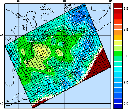
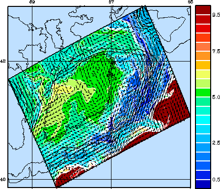
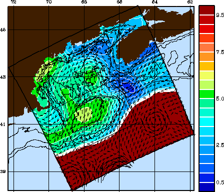
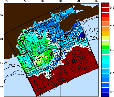
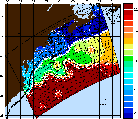
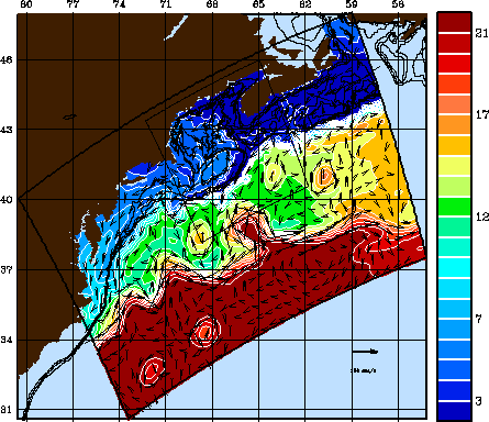
Prior to carrying out the operational forecasts, a forecast Observational System Simulation Experiment (OSSE) was carried out using the relatively data rich year of 1998. A six day (March 31 - April 5) simulation in the two-way nested Georges Bank/Gulf of Maine and Gulf of Maine/Northwest Atlantic domains is pictured in the next figure. Shown are color contours of surface temperature with superimposed velocity vectors for the beginning and end of the simulation for the Georges Bank domain (top row), the Gulf of Maine domain (middle row) and the Northwest Atlantic domain (bottom row).
|
|
|
|
|
|
|
|
|