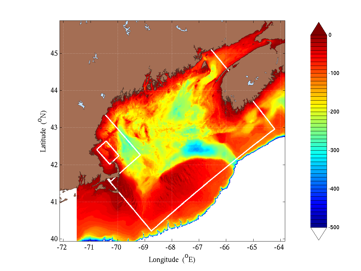
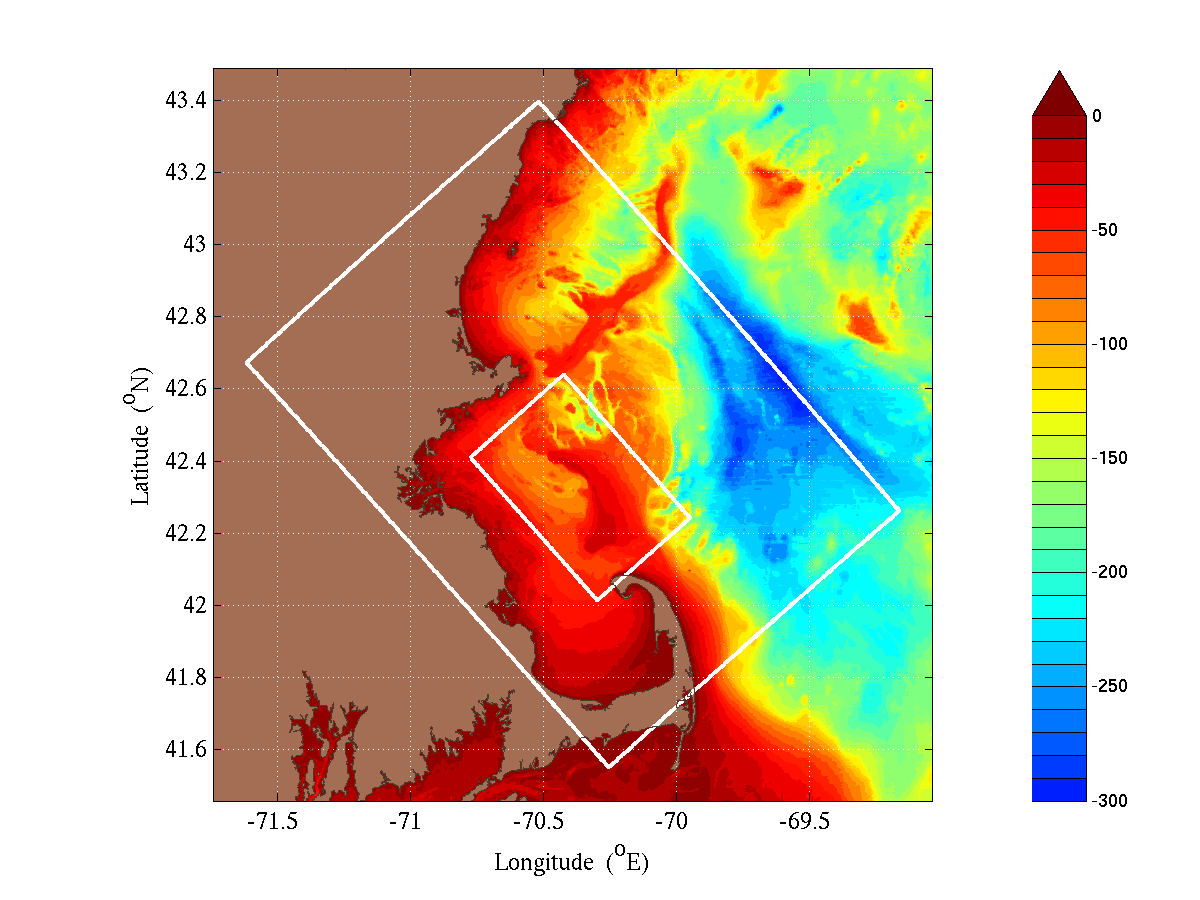
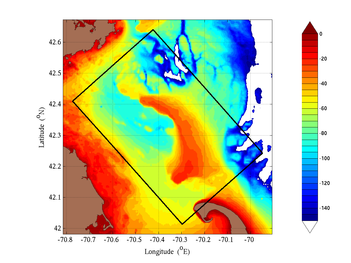
A set of three domains, configured for telescoping two-way nesting are proposed for the Stellwagen Bank simulation. These domains represent a compromise of the highest resolution possible with a reasonable run-time (~ 1hr for 1 simulation day). The largest is a 489×378km domain which covers the Gulf of Maine at a 2.34km resolution. This domain is designed to maintain a synoptic Maine Coastal Current inflow and resolve any tidal influences from the Gulf and Georges Bank. The next is a 121×168km domain to simulate Massachusetts Bay and its surroundings at 781m resolution. This domain was selected to be covered by the general area surveys and to resolve the local and Gulf of main influences on Stellwagen Bank. The final domain is a 39×59km domain for direct simulations of Stellwagen Bank at a 260m resolution. All three domains employ rotated spherical coordinates and 70 vertical levels in a double-sigma configuration, optimized for local steep bathymetry and the depths of the thermoclines/haloclines. The original topography is a 15 arcsecond product from the USGS created by Rich Signell.
| Gulf of Maine, 0.02106° res, 209×162 | MassBay, 0.00702° res, 155×216 |
|
|
|
| Stellwagen Bank, 0.00234° res, 149×228 | |
|
|