MSEAS PHILEX IOP09 Tides Home Page
| Generalized Inverse High-Resolution Barotropic Tides |
|
|
|
|
Our barotropic tidal estimates are obtained from forward and
generalized-inverse solutions of the shallow water equations, in 2
nested multi-scale domains over high resolution bathymetry. Currently,
we utilize 1-minute resolution Smith and Sandwell (2007) bathymetry.
Two nested domains are utilized:
- Archipelago domain: a domain which encompasses the Philippine
Archipelago and the surrounding basin. The OBCs for the Archipelago
domain are obtained from the Regional (Indonesia) TPXO fields of Egbert et al.
- Hgh-resolution domain: a domain covering the Sulu sea, the Mindoro
Strait, the San Bernardino Strait, the Mindanao and the Surigao
Straits, and the surrounding basin. This domain is nested in the Archipelago domain.
The tidal forcing for MSEAS in the Philex domains is estimated using the
described inverse barotropic shallow water spectral model (see the link
below for a more complete description). For regional-scale basins the
tidal forcing occurs pre-dominantly through the open boundary
conditions and the contribution of the astronomical tidal forcing
inside the domain is negligible. In such basins, the barotropic
response of the ocean to the tidal signal in the open boundary
conditions (OBCs) has to be accurately modeled.
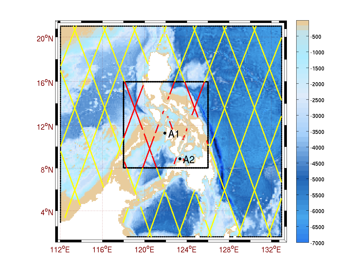
Topex-Poseidon (TP) satellite altimeter data, with
tracks shown in Figure 1, and the velocity
and the SSH data from two moorings in the Panay (A1) and
the Dipolog (A2) straits were assimilated in
the inverse solution.
The A1 and A2 moorings were deployed and operated
by the team led by Janet Sprintall of the
Scripps Institution of Oceanography
as part of the Philex observational program.
In addition to the Acoustic Doppler Current
Profilers (ADCPs), the moorings were
carrying pressure gauges, suitable
for inferring the SSH.
The Topex-Poseidon data, collected from
the launch of the satellite in
1992, were provided to us in the form of
tidal constituents (SSH amplitudes and phases)
by Dr. Richard Ray, of the
Planetary Geodynamics Laboratory at the NASA
Goddard Space Flight Center.
The observational data were utilized to correct for errors in open
boundary conditions of the nested domains. Strong dynamical
constraints were utilized: the inverse tidal fields satisfy the
shallow water equations exactly. Tidal constituent estimates (h,u,v)
are then utilized as the boundary tidal forcing for MSEAS.
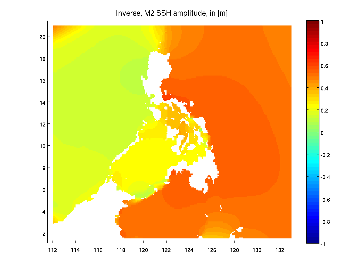
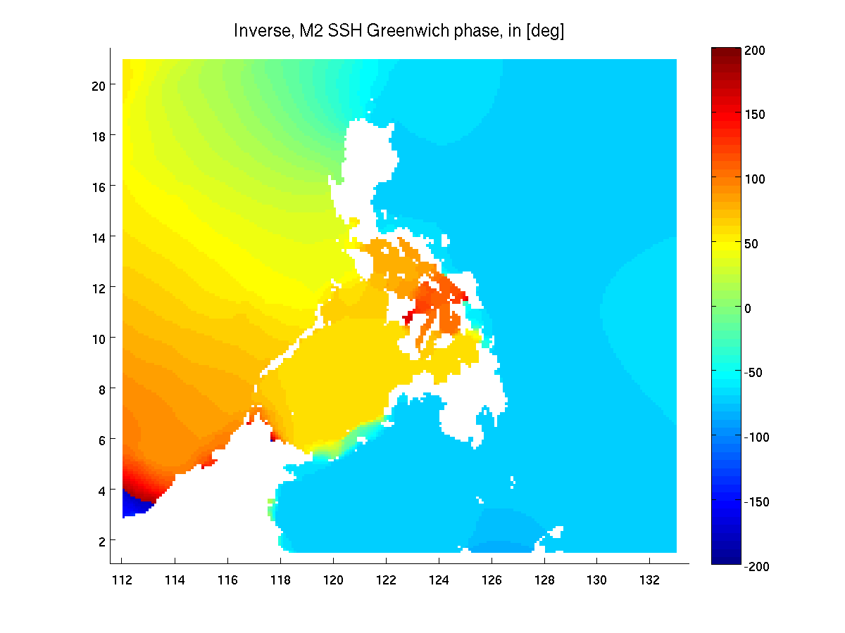
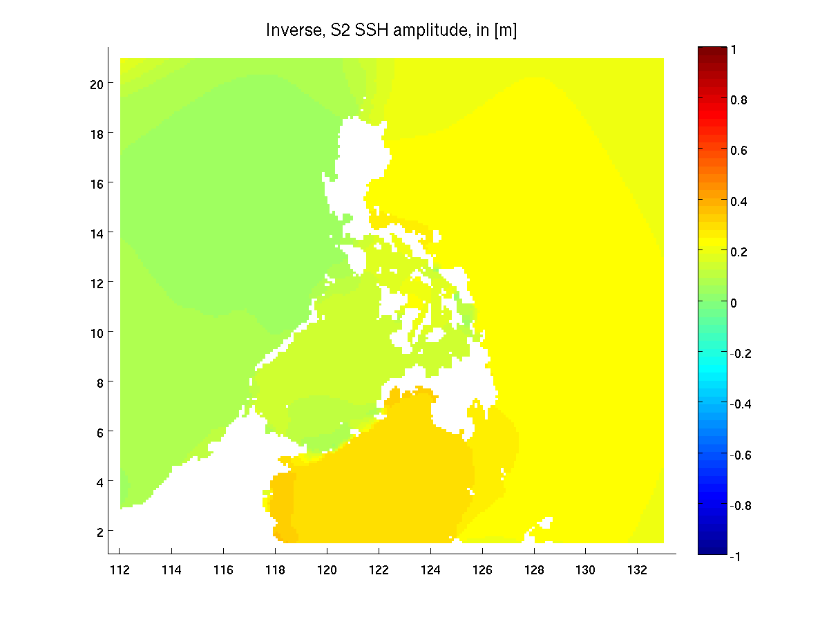
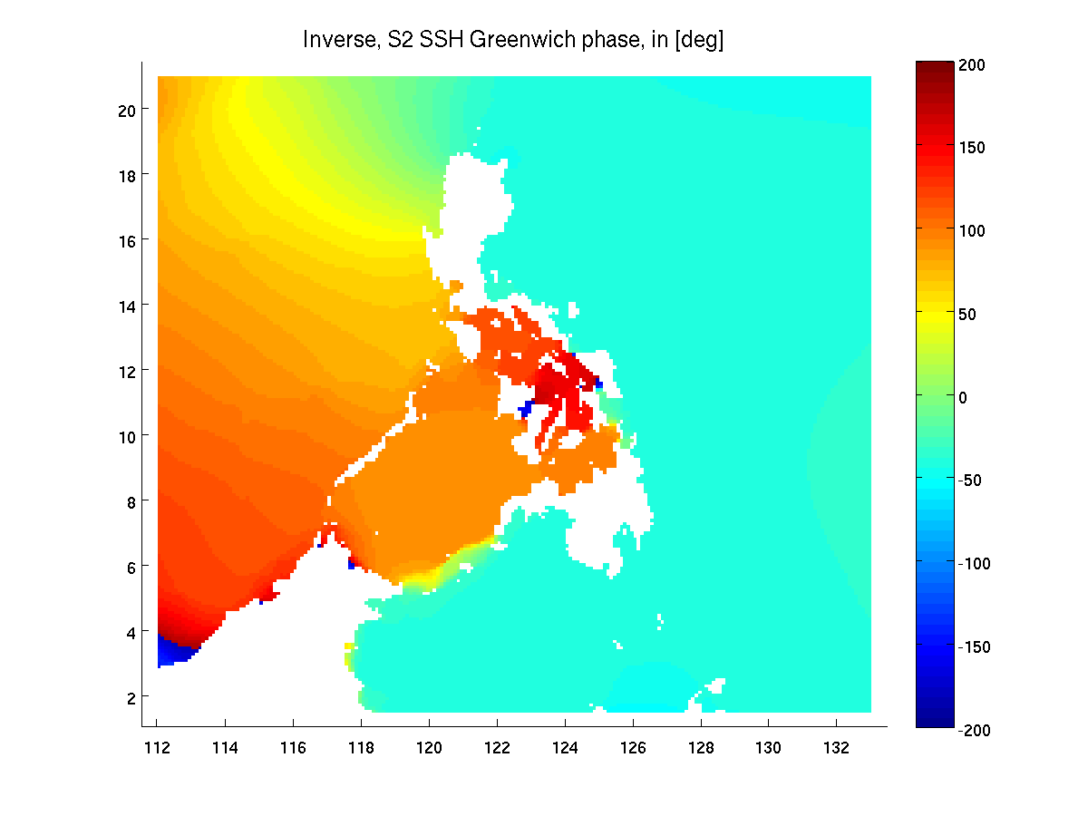
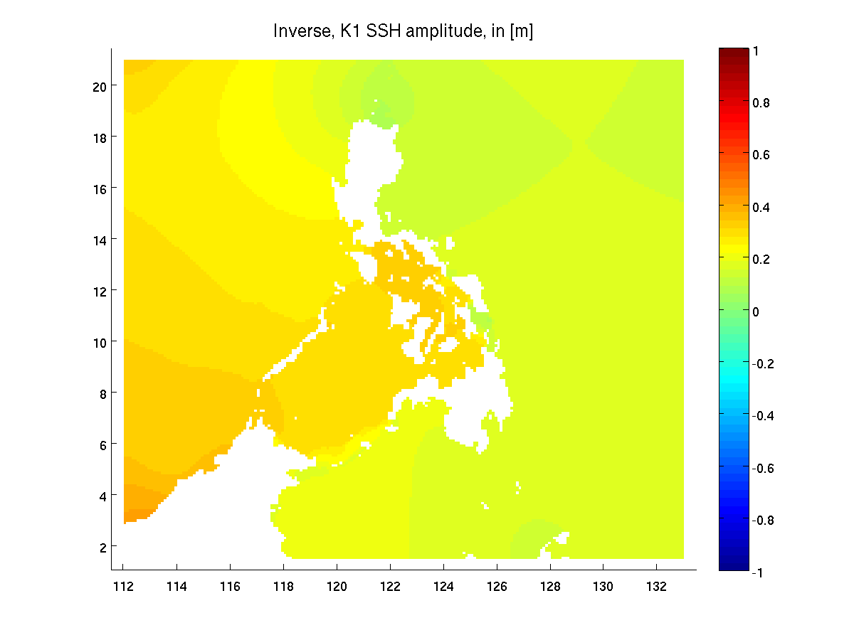
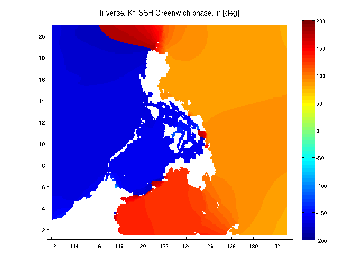
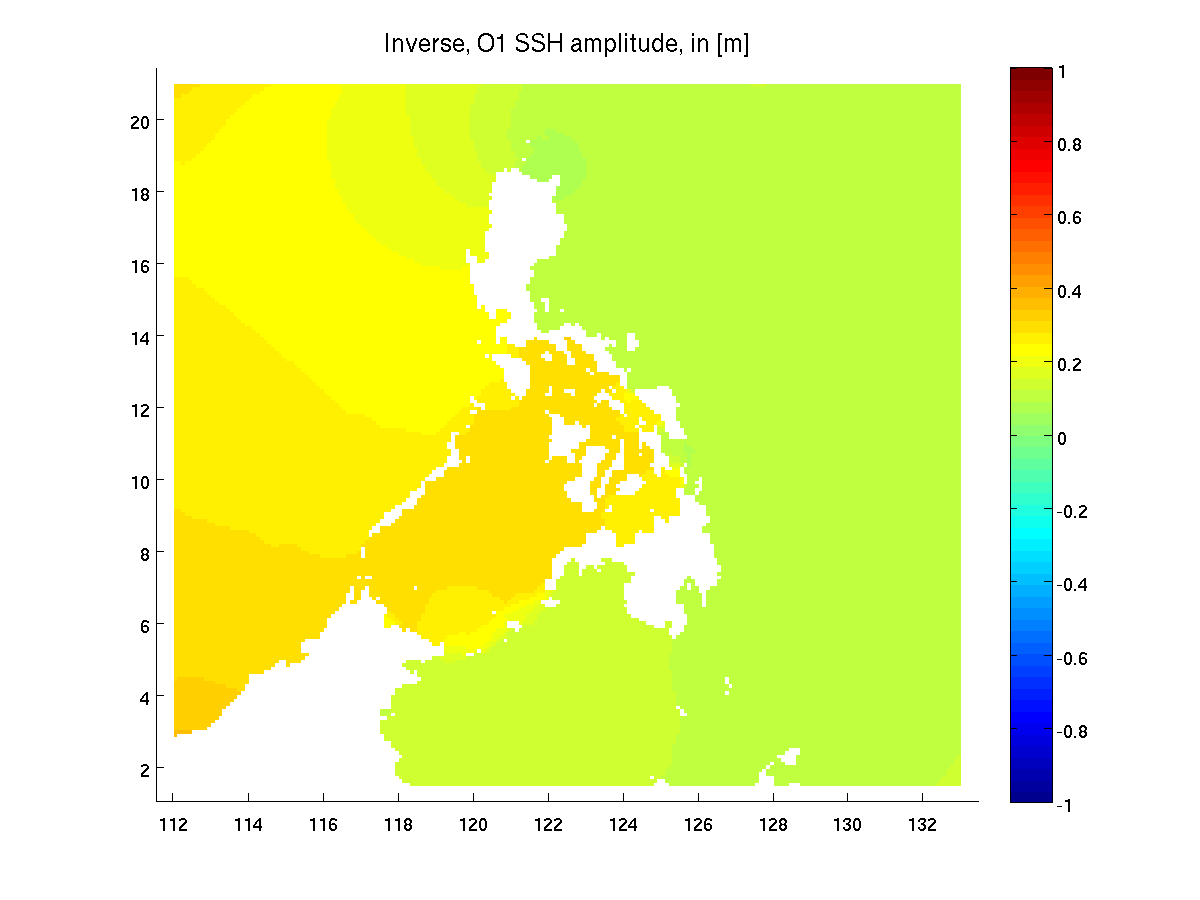
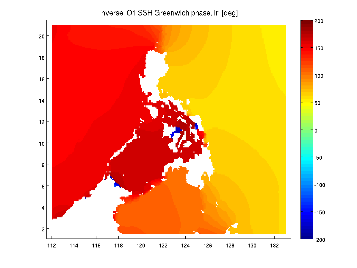
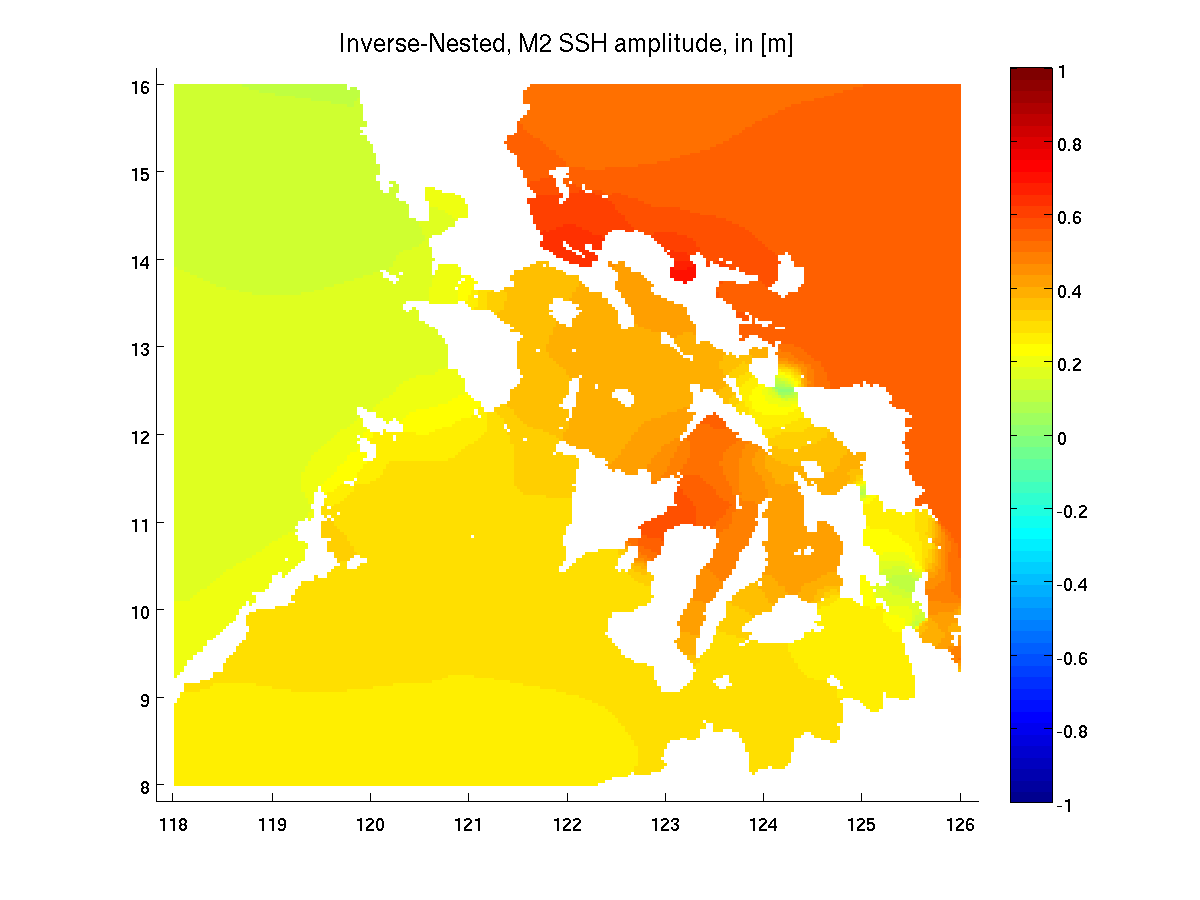
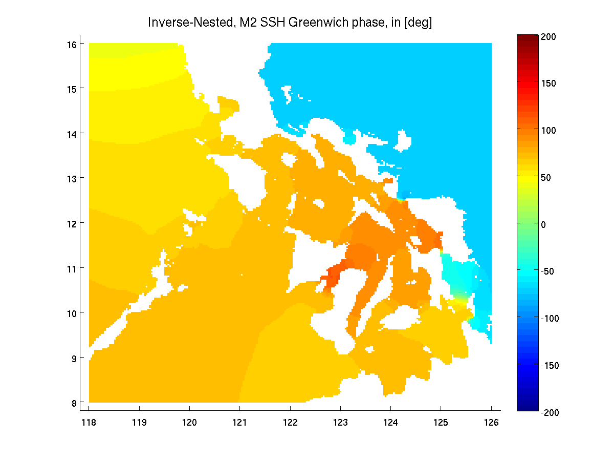
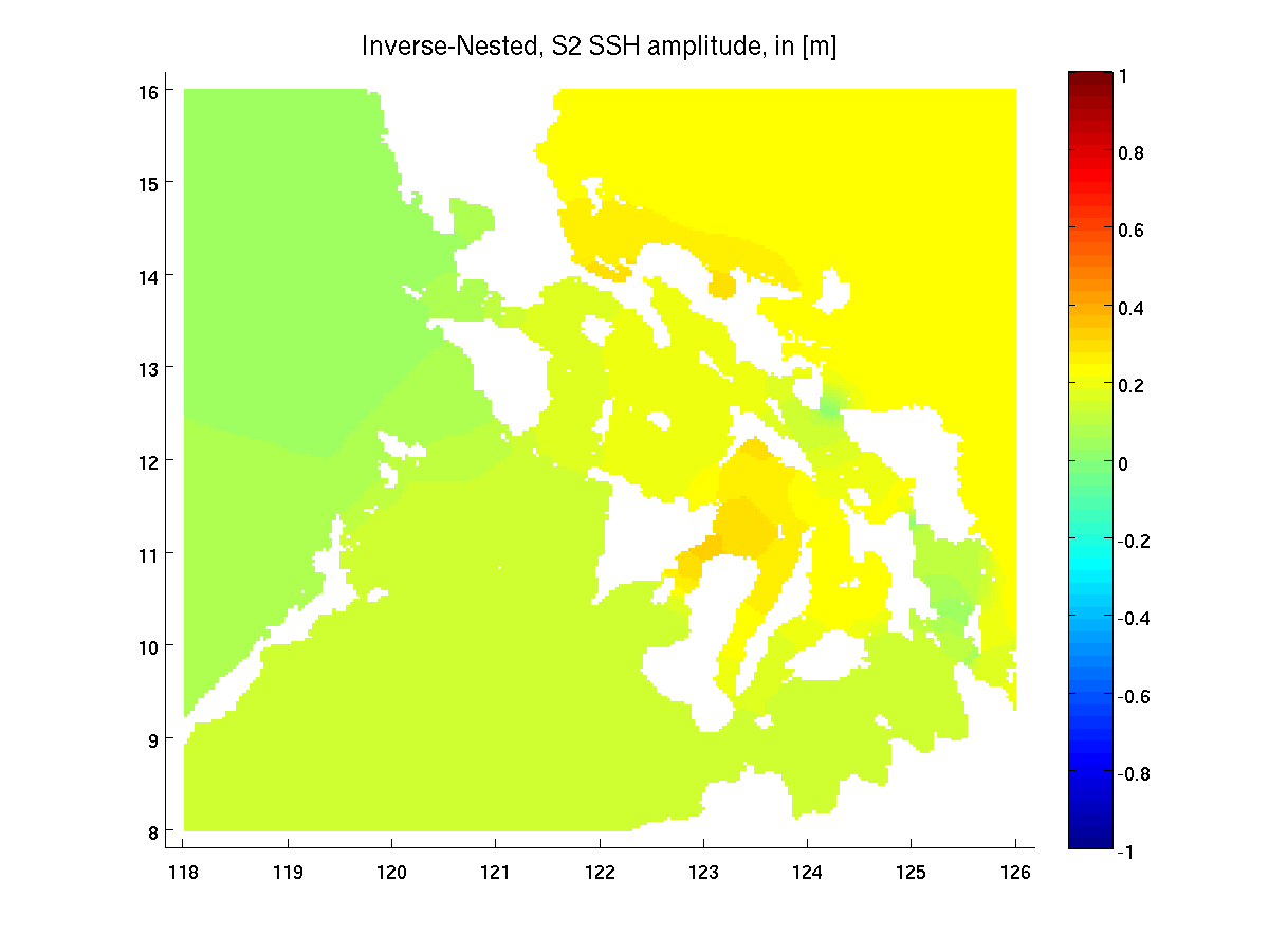
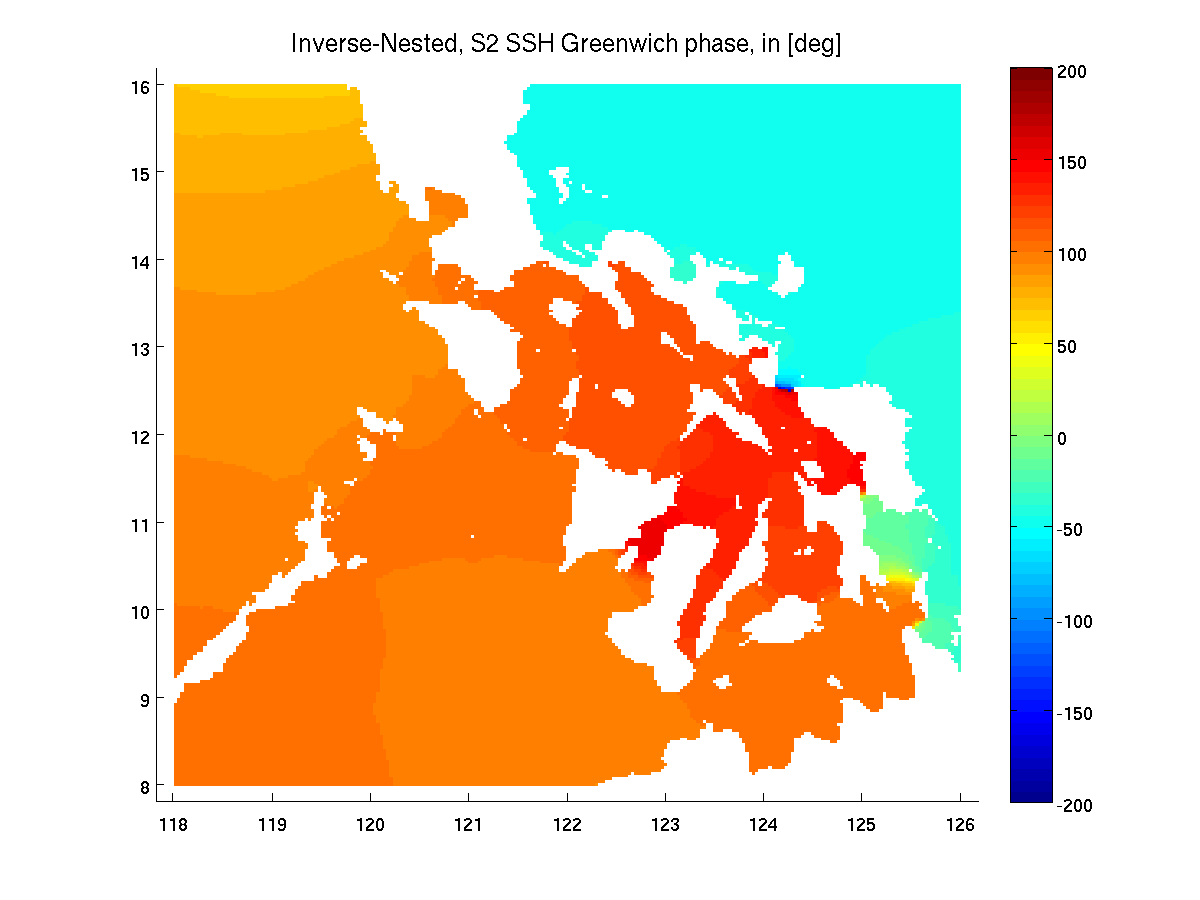
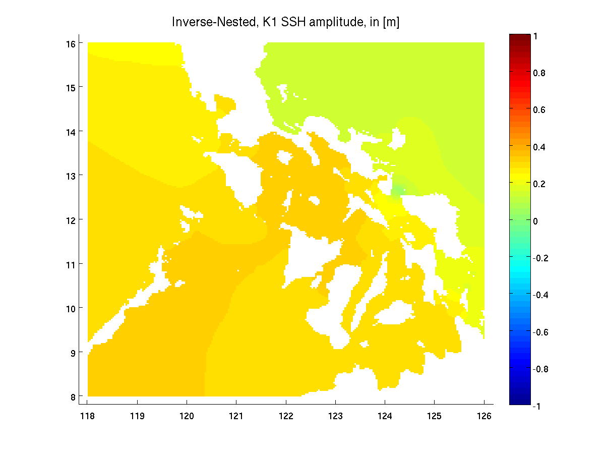
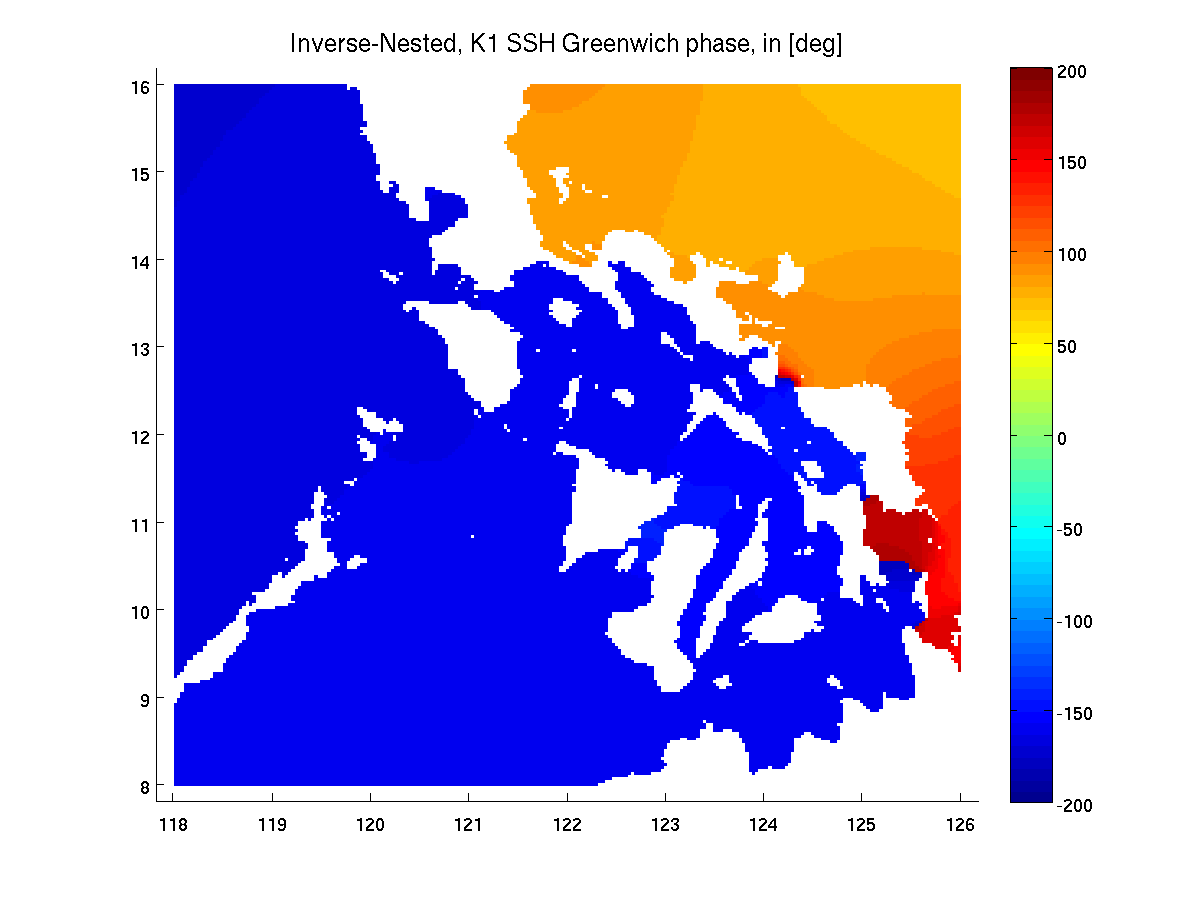
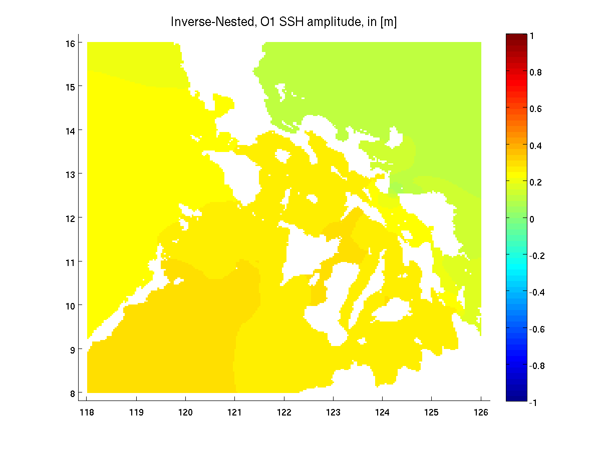
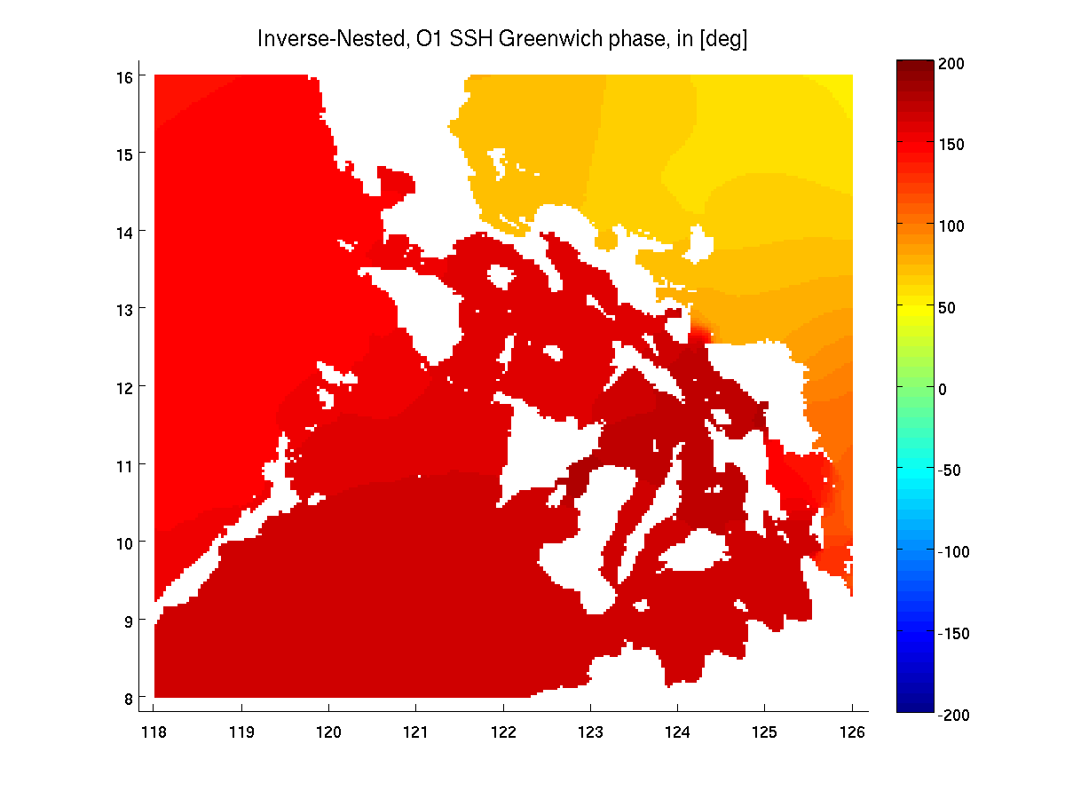
Tidal inversion was performed in the spectral domain for all main
tidal constituents in the Philex region. The resulting tidal field
estimates are plotted at three hour intervals for the
Archipelago domain and nested domain.
Provided here are the barotropic estimates. Data files with barotropic
tidal transports, velocities, and sea surface height at 1 min
resolution can also be provided upon request. The in situ velocity
measurements should be depth averaged before comparing against these
model fields. We look forward to any feedback with regard to how these
estimates compare against observational velocity data in the domain.
For more complete information on the details of the methodology see:
Inverse Barotropic Tidal Estimation For Regional Ocean Applications [PDF].
MSEAS PHILEX IOP09 Page
MSEAS PHILEX Research Page
Philippines Straits DRI home page (Hawaii - password-protected)
Return to the MSEAS home page