Real-Time QPE Simulations
QPE Pilot Study Ocean Physics Forecast
Forecast for 6 September 2008, Issued 4 September 2008
This web page presents the output from two 6 day free surface simulations forced with
COAMPS (wind stress) and NOGAPS (heat-flux, E-P) atmospheric forcing, initialized with a combination of the
Taiwanese data (see
http://mseas.mit.edu/Sea_exercises/QPE/Pilot2008/index_init_data.html) and of a summer
climatology created using June-August profiles and the HydroBase2
software. The bathymetry used is the NCOR bathymetry.
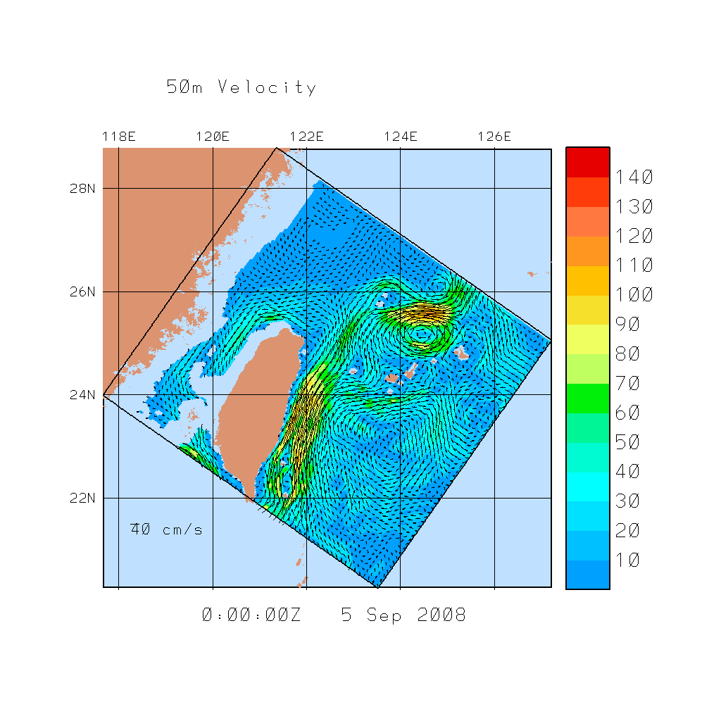
In our simulations so far, the biggest uncertainty seems again to be the transport though
the Taiwan Strait between Taiwan and mainland China. To illustrate this point, we decided
to issue 2 forecasts, one with a northward transport and one with a southward transport
through the Strait. We believe that some sampling just north of Taiwan would substantial
reduce this uncertainty (e.g. some drifter release and/or CTD data).
If we let our initialization algorithm compute this initial transport (i.e. free transport
initialization constrained by geostrophy in the interior and a first-guess level of no
motion), our initialization algorithm leads to a southward 2.5 Sv transport between China
& Taiwan. Of course, this boundary transport changes with time, based on the interior
flow and open boundary conditions.
The other set of simulations shown corresponds to a 1Sv Northward barotropic transport
imposed initially between China & Taiwan.
Even though these differences are only set in the initial conditions, they lead to an
opposite flow north of Taiwan which remains after 7 days of simulation.
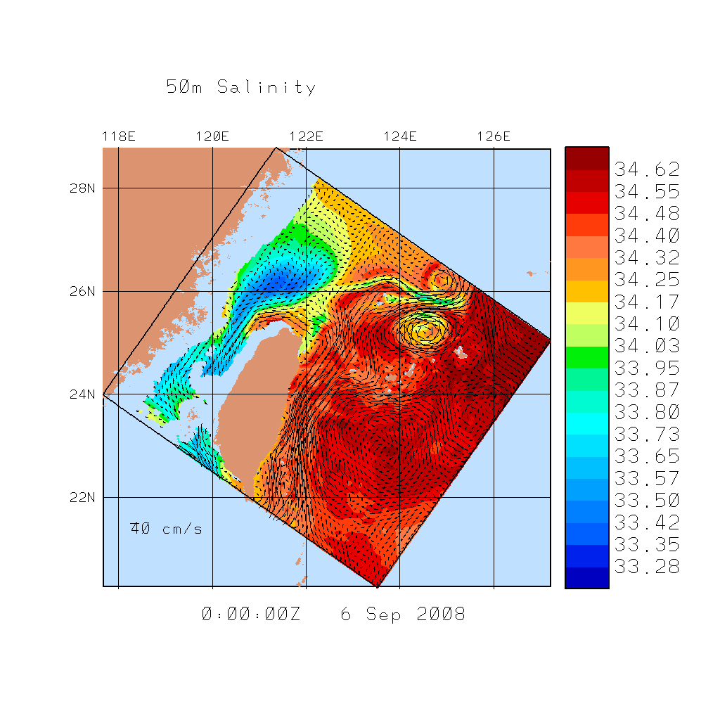
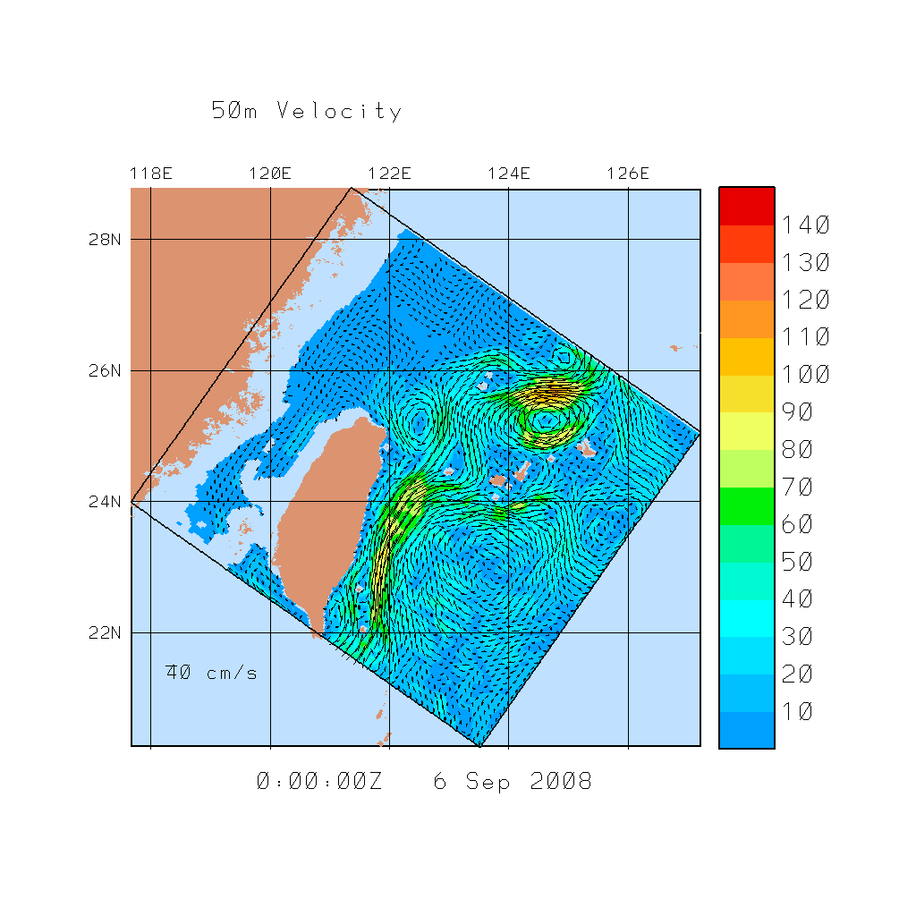
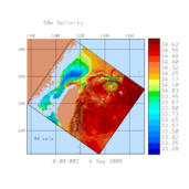
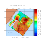
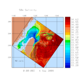
The run with a southward 2.5Sv transport
has a westward flow along the northern Taiwanese
coast, with a tongue of deep Kuroshio water that has upwelled and extends
north-northeast, advected by the Kuroshio which has intruded a bit onto the shelf. On the
other hand, the run with a northward 1Sv transport
has an eastward flow along the
northern Taiwanese coast, with a weaker cold Dome and the creation of a weak cold
cyclonic eddy just north-northeast of the eastward coastal flow along Taiwan.
Based on the Japanese SST and Taiwanese data, and different water masses present (T/S
properties), it appears that the run with a westward coastal flow north of Taiwan (run
with southward flow through the Taiwan Strait) is closer to the truth, but it is not yet
certain.
Of course, we are still tuning a large set of numerical and physical model parameters.
The two runs above are only illustrative of one of the main uncertainty issues we are
dealing with so far.
To see a series of images for each case, click on the link for the "Complete set of Plots" below.
Note that more than 50 simulations were carried out for sensitivity studies on the
numerical and physical parameters. Here, we only provide the results of the
likely better simulation we have achieved so far.
Acoustic simulations from each of these two dynamical simulations, with vertical sections
of transmission loss (TL) and sound speed, can be found
here.
| Nowcasts and Forecasts of Environmental Conditions |
|---|
| Initial Transport |
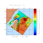
50m Temperature |
50m Salinity |
50m Velocity |
Complete set of Plots |
| Nowcast - 5 September |
Forecast - 6 September |
Nowcast - 5 September |
Forecast - 6 September |
Nowcast - 5 September |
Forecast - 6 September |
2.5Sv S |
 |
 |
 |
 |
 |
 |
X |
1.0Sv N |
 |
 |
 |
 |
 |
 |
X |