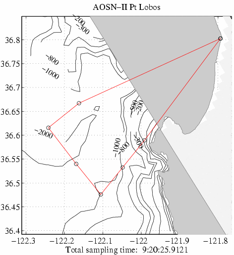
The suggested stations for the R/V Pt Lobos and the expected field forecast along each of the sections are provided below. These were provided to Dr. Francisco Chavez. The text at the bottom of the page is from the email in which this information was sent.
Assuming the following parameters:
        10.0     SPEED   (knot)     Nominal ship speed.
        5.0      SET_TIM (minutes)  Set-up time per station.
        1.0      SAM_SPD (m/s)      Ascent/Descent speed of sampling device.
        1000.0   MAX_DPTH   (m)     Ascent/Descent speed of sampling device.
a sampling scheme was designed. The total sampling time is 9:20 hours (this accounts for about 20 minutes of set-up at Moss Landing). At the end and start lat,lon in the table below, no sampling is needed.
     Station Positions:

  Latitude       Longitude      Station
  (deg min)      (deg min)      Number

36 48.16 N   121 47.63 W
36 35.36 N   121 59.50 W        1
36 31.96 N   122  2.90 W        2
36 28.56 N   122  6.31 W        3
36 32.40 N   122 10.16 W        4
36 36.94 N   122 14.50 W        5
36 40.03 N   122  9.72 W        6
36 48.16 N   121 47.63 W
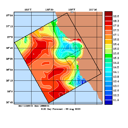
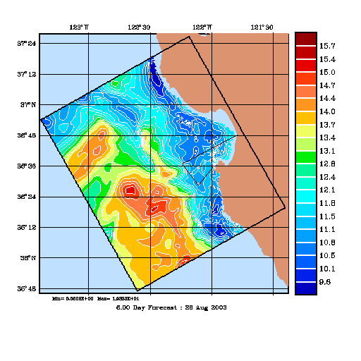
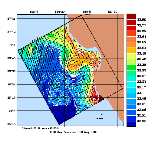
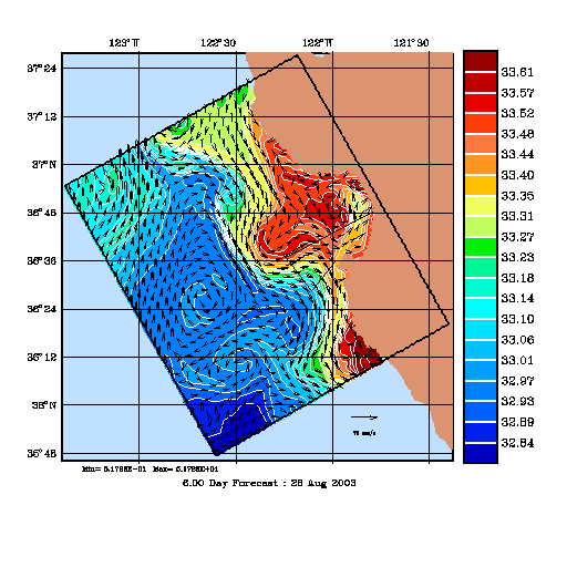
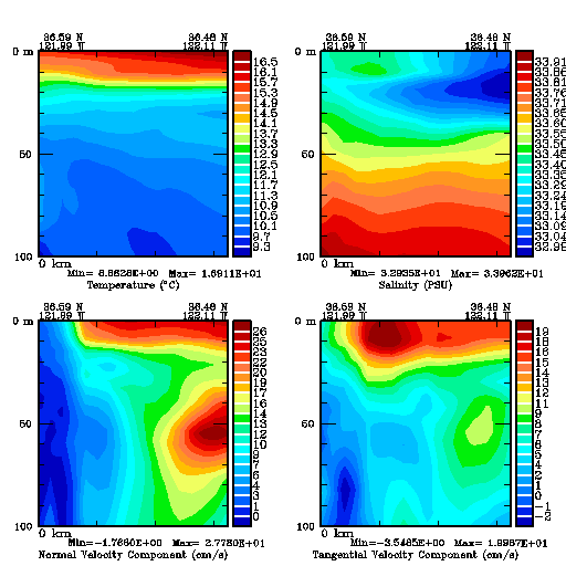
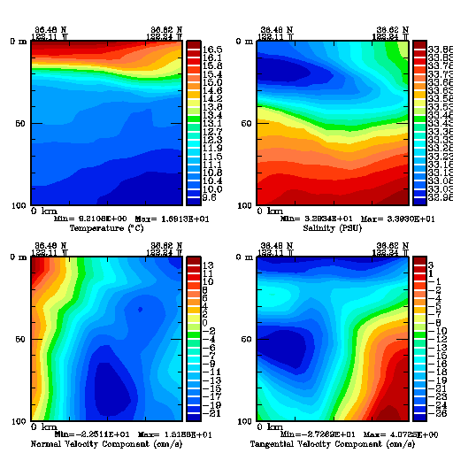
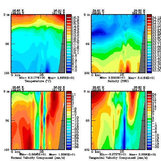
The maps and sections above are from a forecast for Aug 26, 00GMT. It only assimilates data up to Aug 23, 05GMT, and is forced with Aug 24 COAMPS (2 days are atmos. forecast).
In the region, our forecasts show high uncertainties as well as interesting dynamical events. As you may see from the plots, I tried to be conservative on the ship tracks. If on the ship, you see something interesting, please don't hesitate to modify the sampling plans as you wish.
One section goes all the way to Moss Landing and thus goes much further than the last suggested cast (cast 6). I did this to show you the small-scale localized anomalies in T and S near the bottom just above the shelfbreak and related topographic features. Have you observed such things? The anomalies are related to vertical motions near the steep bottom (Canyon, seamounts, steep slope etc). This is very difficult to predict accurately. If you have some data on such processes, they should help us further calibrate the model (most likely our anomalies are too large).
Return to the ESSE product page for 24 August 2003
Go to the AOSN-II full domain product page for 24 August 2003