HOPS Model Results - 23 March
Harvard Ocean Prediction System Model Results
|
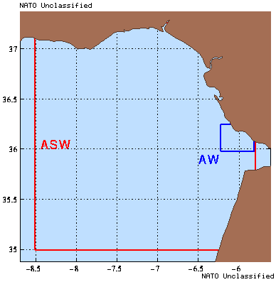
Currently, three models are being used. The first is a subtidal
Primitive Equation model (PE). The PE model predicts the temperature,
salinity and velocity fields in the ASW domain. The second is a barotropic tidal
model, which is used to predict the tidal contributions to the barotopic
component of velocity in the ASW domain. These two models are complementary,
as the actual velocity is the sum of the velocities produced by the two
models. The third model is a ecosystem model which couples a biological model
to the physical PE model.
In addition, simulations are carried out in a small, high resolution domain
(AW) about the operational area with the physical PE model using 1-way nesting.
With 1-way nesting, initial and boundary conditions are extracted from the
large domain and drive the small domain simulation.
|
|
PE
Data from RR98 is assimilated into the Harvard Primitive Equation model in a
fashion which mirrors the manner in which it was collected. The results
presented are of the nowcast days and of the final forecast days. In this
context, we define nowcast and forecast as:
- Nowcast
- Fields taken shortly after full assimilation of a set of data.
Generally fields shown have 1/4 - 1/2 day of dynamical (model)
adjustment to the data.
- Forecast
- Fields taken after all data has been assimilated.
Data available
At the time of model re-initialization (18 March), the following data was
available to be incorporated into the model:
Hydrography
- 518 CTDs & XCTDs
- 635 XBTs & AXBTs
|
Surface Forcing (FNMOC)
- 16 Feb - 21 Mar
|
|
Model run description
The model run has an initialization based on RR98 data.
The model is initialized on 16 February. The hydrographic data is
assimilated on 18, 24 February and 01, 04 & 08 March.
The model run is continuously forced by FNMOC analyses and
FNMOC forecast products.
Ecosystem Model
Biological fields were forecast with a simple 4-compartment
(Nitrate, Ammonium, Phytoplankton, and Detritus) ecosystem model.
Initialization fields were taken from SeaWiFS ocean color
data (Phytoplankton chlorophyll), historical data (Nitrate) or
correlations with known variables (Ammonium and Detritus).
Error Forecast (ESSE)
To forecast the uncertainty in the temperature and salinity
fields, an ensemble of perturbed forecasts were carried out.
The initial perturbations were computed based on the
observational errors and data-dynamics estimated ocean variability.
The technique uses the concepts of Error Subspace Statistical
Estimation (ESSE).
Tidal Prediction
The tidal currents have been calculated using a linearized, barotropic tidal
model designed by Lozano. The model was forced in the oceanic (western and
southern boundaries) regions by the M2 and S2 tidal components from Egbert
et al. (1994) oceanic tidal model, while the Straits of Gibraltar were
forced by Candela et al. (1990) observations.
The model reproduces the Candela et al. (1990) co-tidal charts and
velocities. The model is also in good agreement with the tidal elevation
prediction from The Admiralty Tide tables, but it appears to underestimate the
tidal range at neap tides (probably due to the lack of diurnal component).
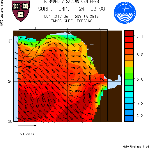
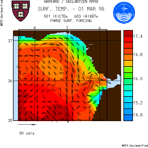
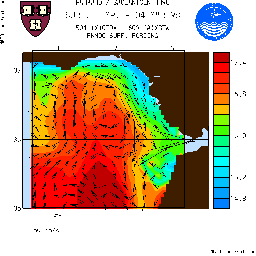
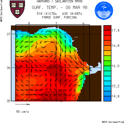
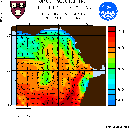
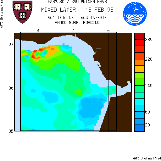
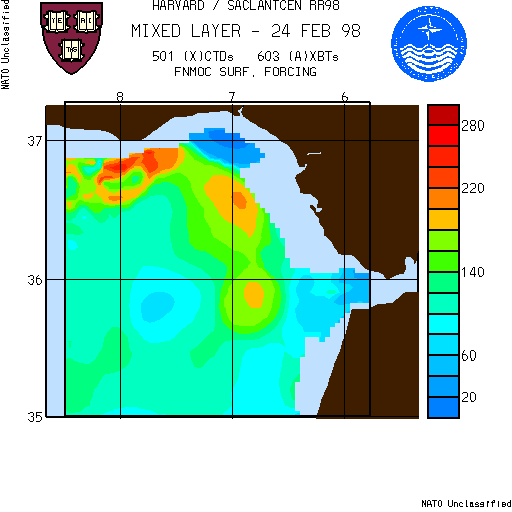
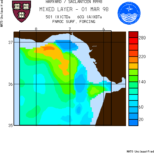
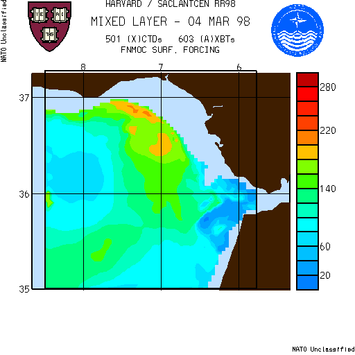
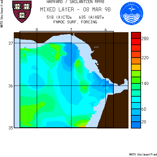
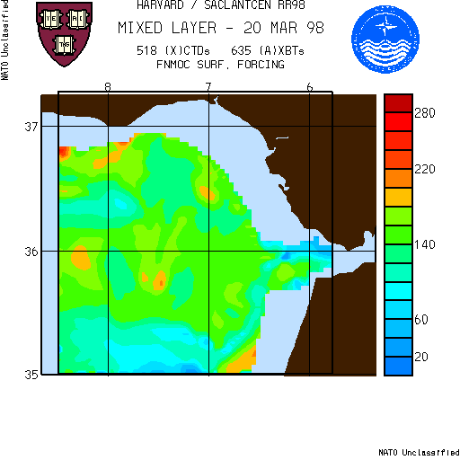
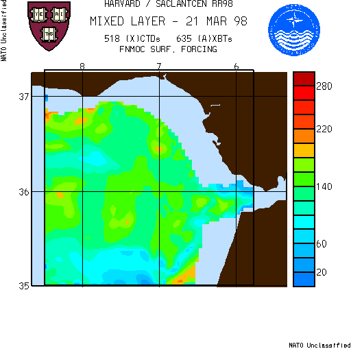
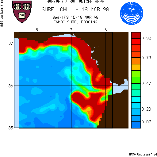
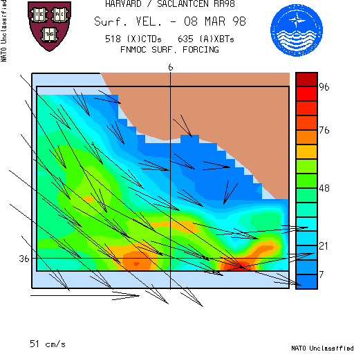
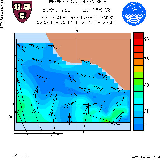
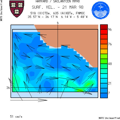
Surface Maps
Five types of plots are distributed at this time.
- Surface temperature with model (sub-tidal) velocity vectors superimposed.
- Tidal velocities, presented at three hour intervals.
- Mixed layer depth estimated from model output fields.
- Surface chlorophyll.
- Forecast Error fields of Temperature & Salinity at 5 & 100
meters.
Return to top of document
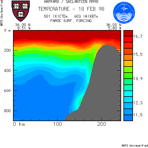
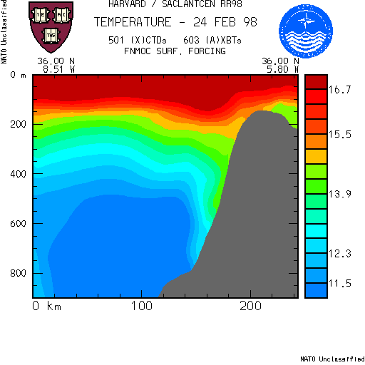
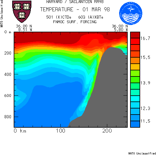
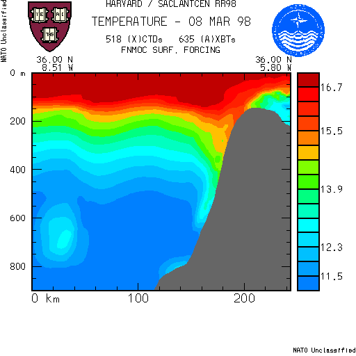
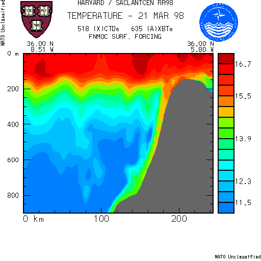
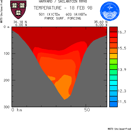
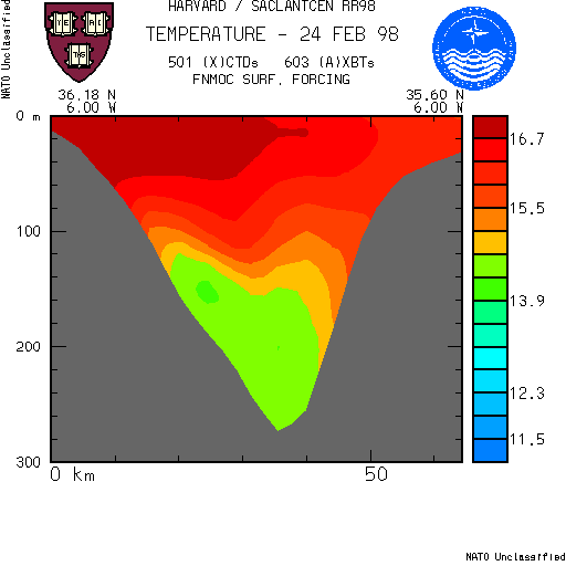
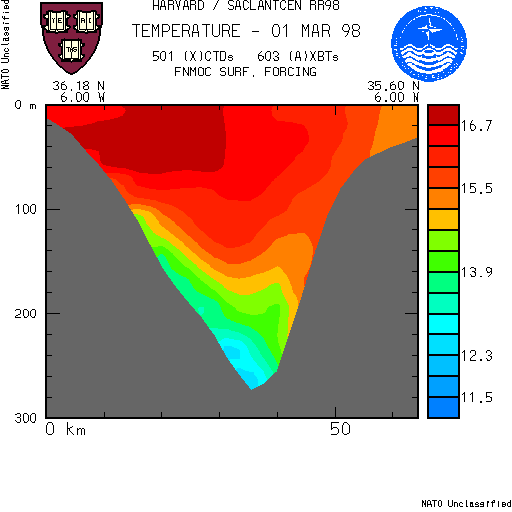
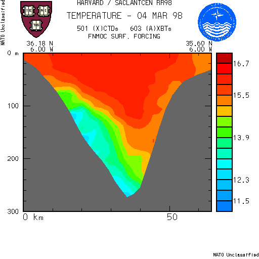
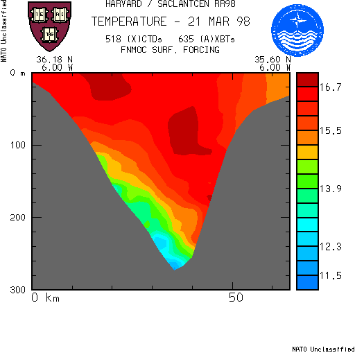
Vertical Sections
Vertical sections of temperature in the Gulf of
Cadiz are extracted from the forecast on the indicated dates.
Return to top of document
Profiles
Temperature profiles are extracted from the output of the Harvard model.
The profiles are on a ¼° grid and stored in JJXX format.
Return to top of document
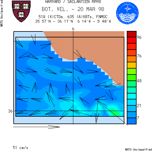
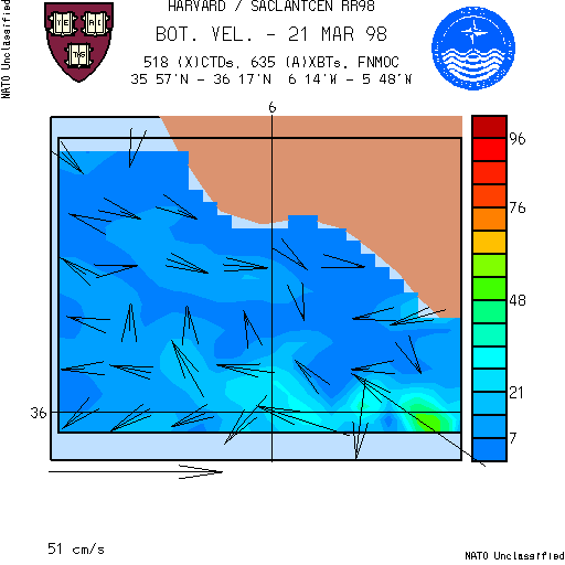
Nested Domain
From the small domain, plots of surface and bottom velocities
are presented.
Return to top of document