


|
|
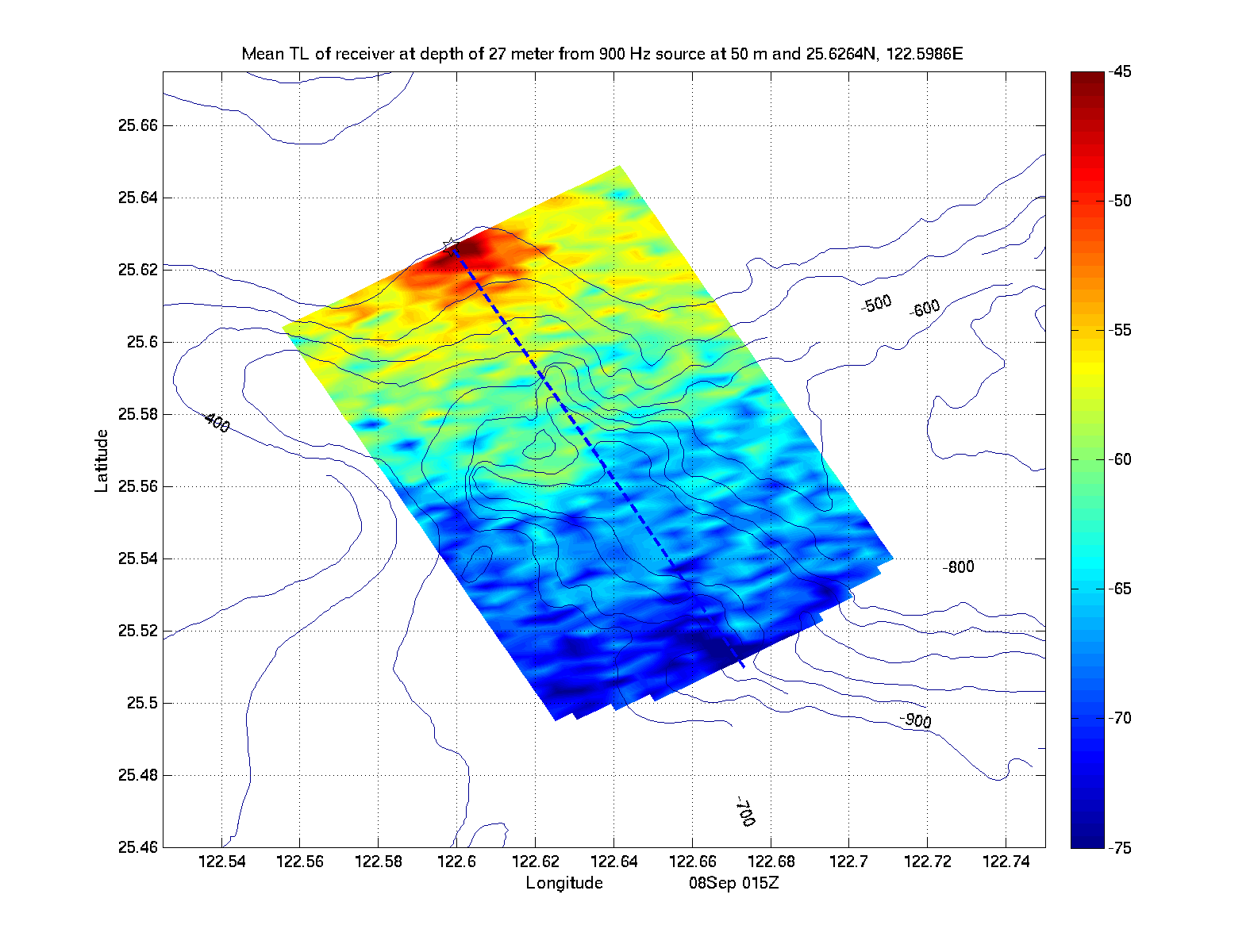
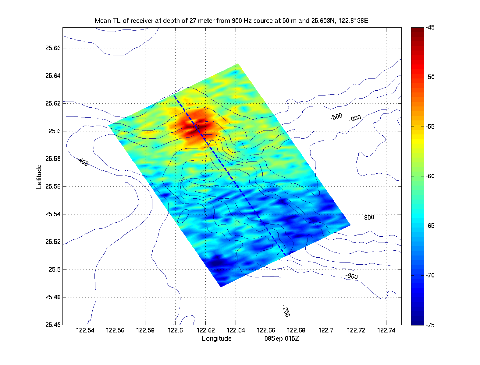
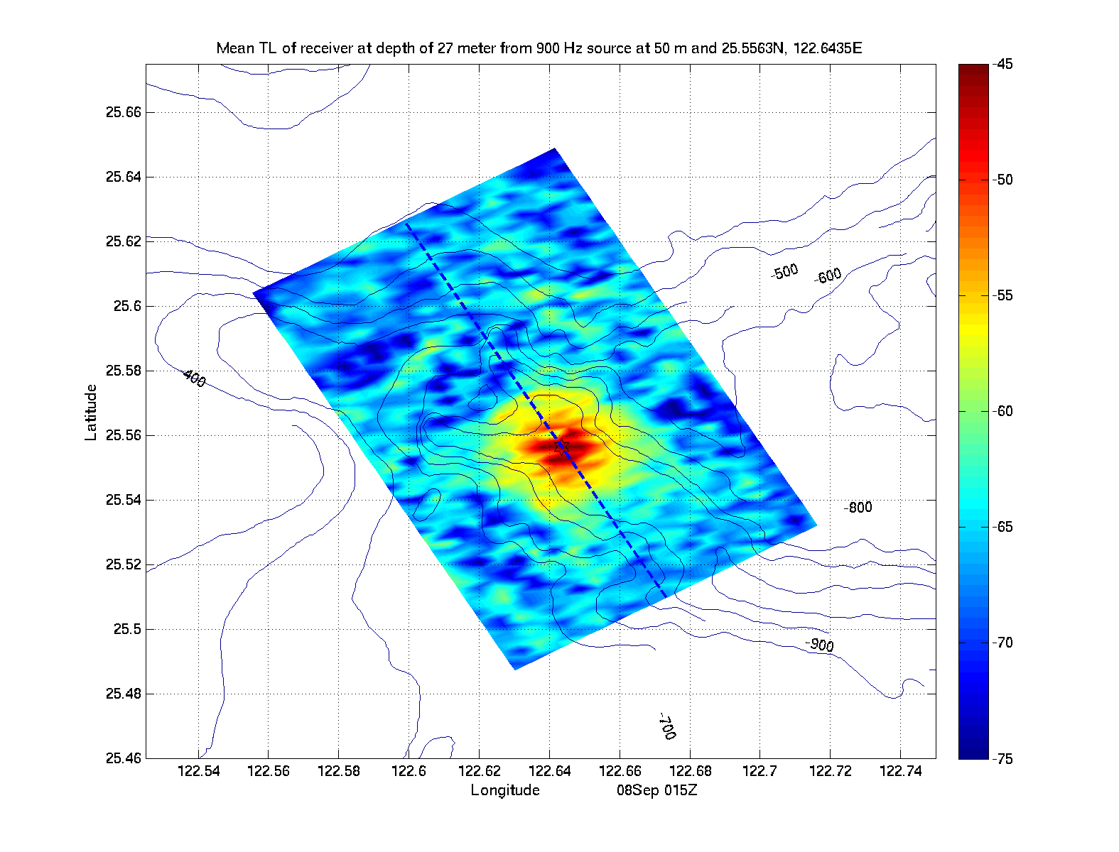
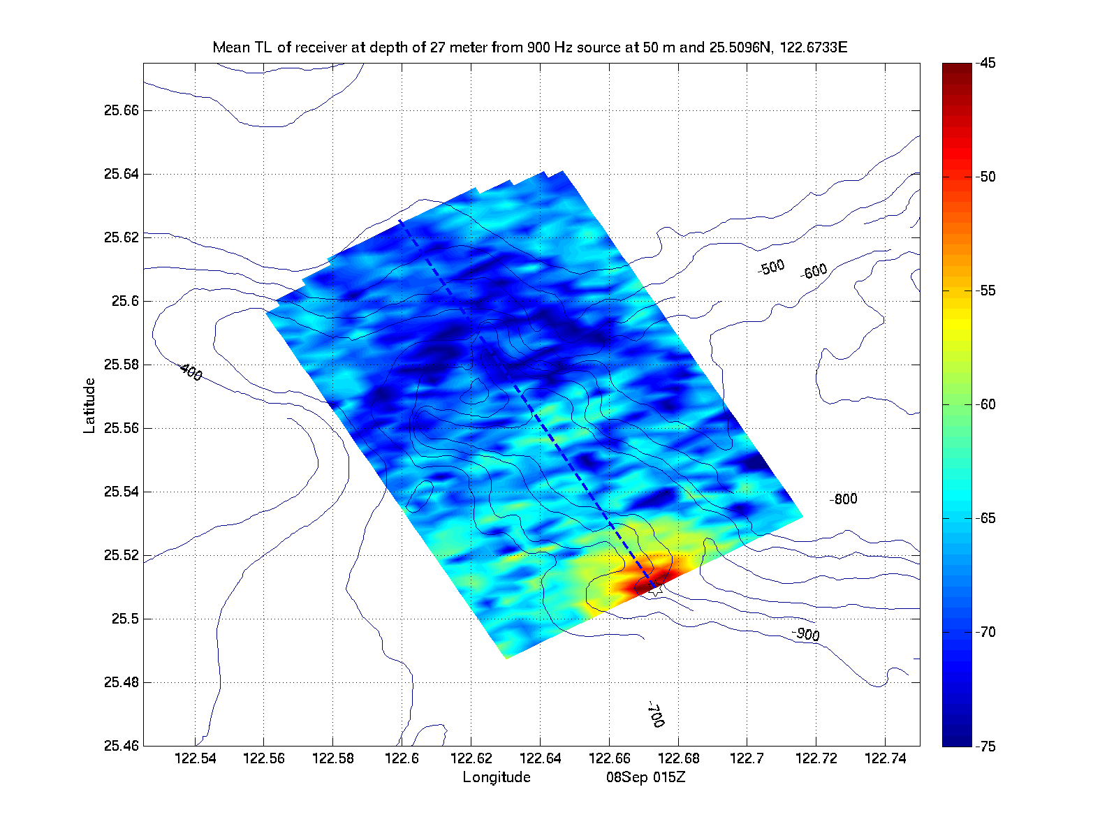
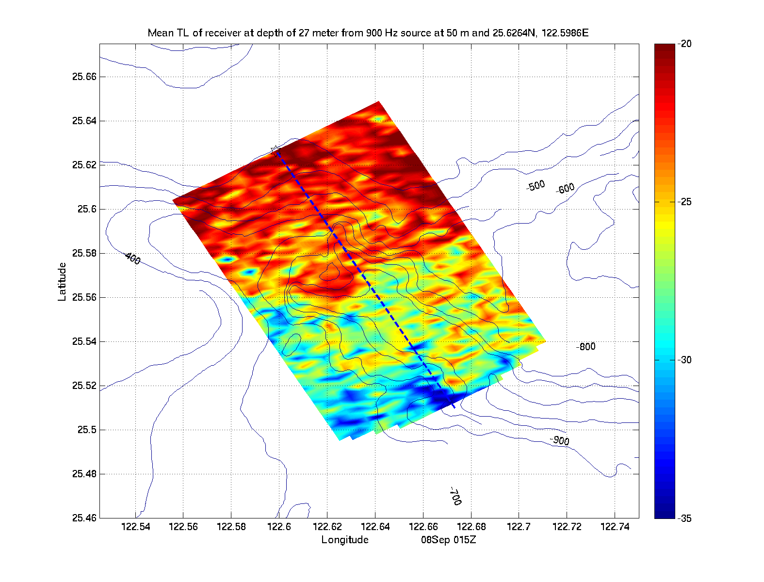
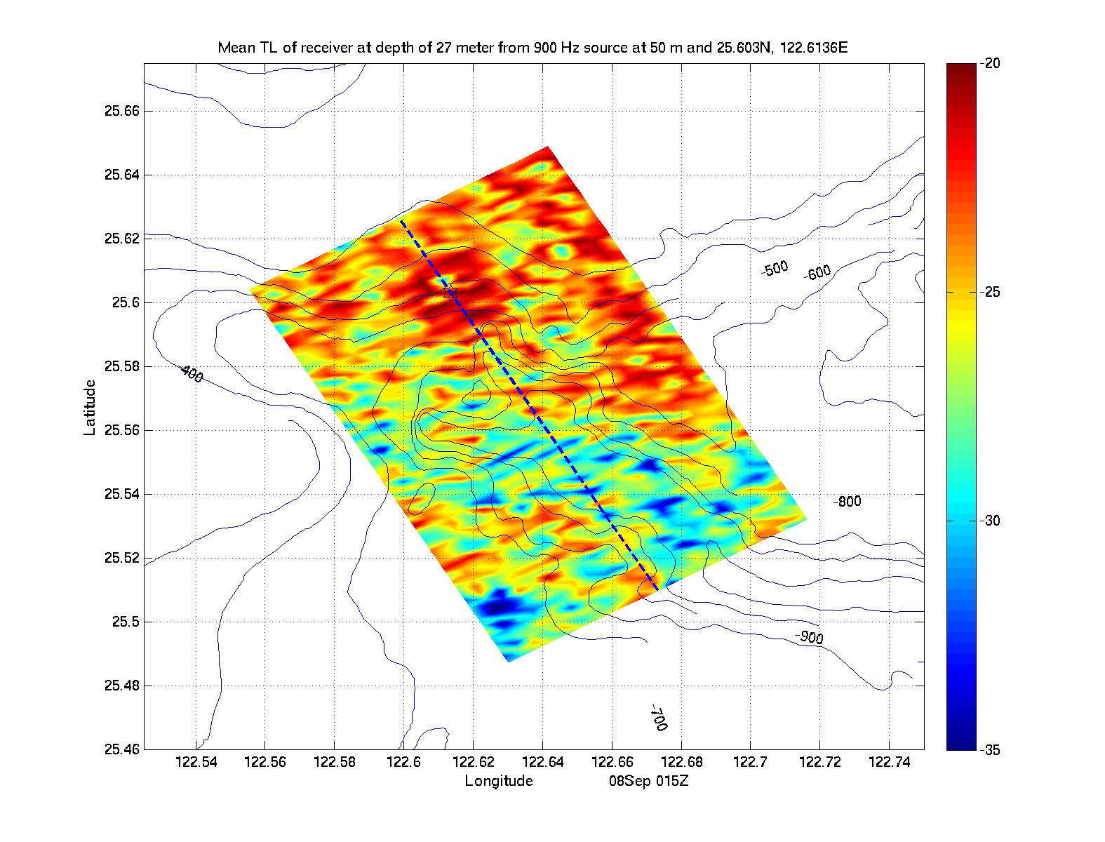
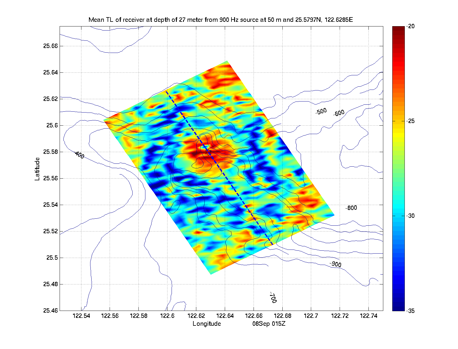
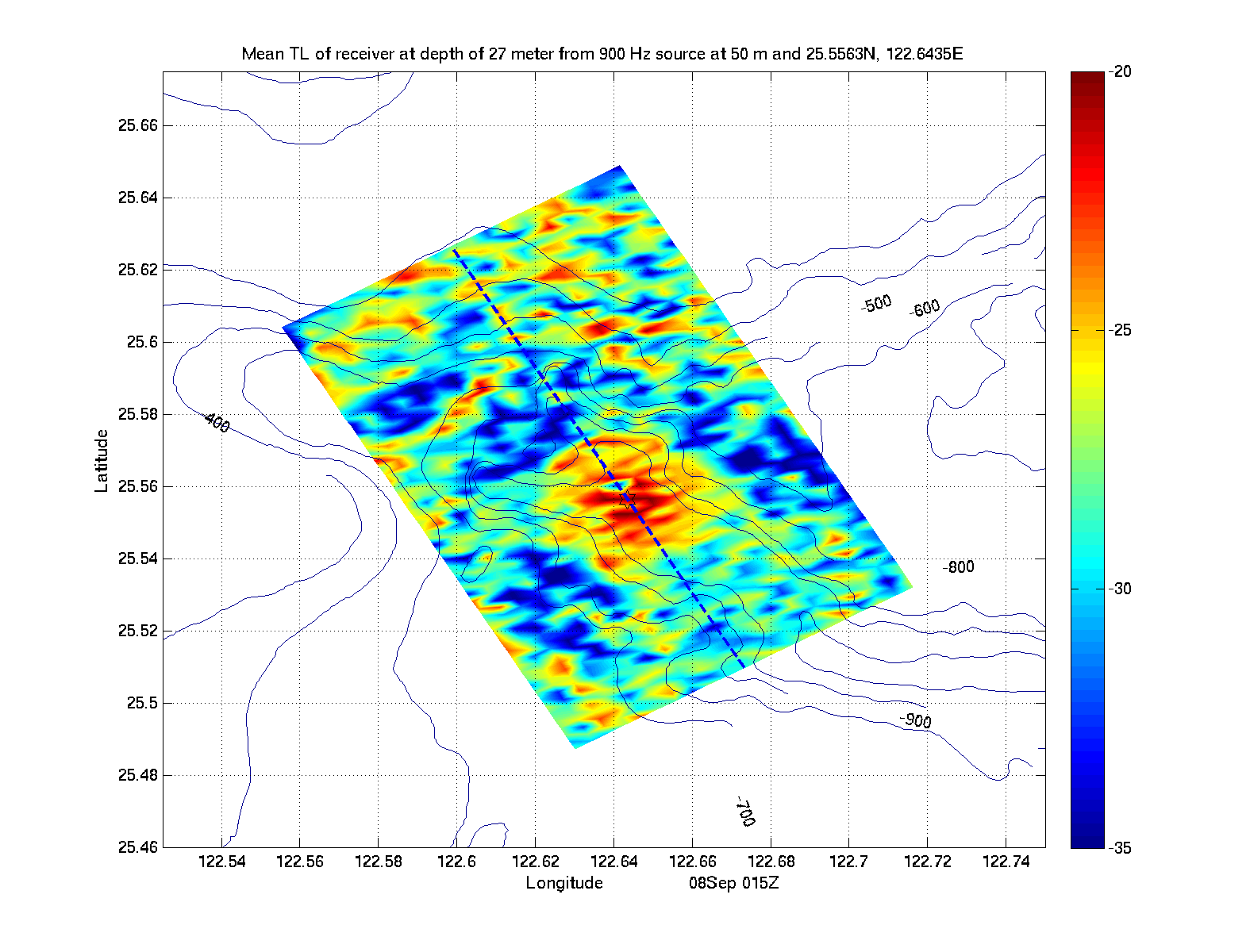
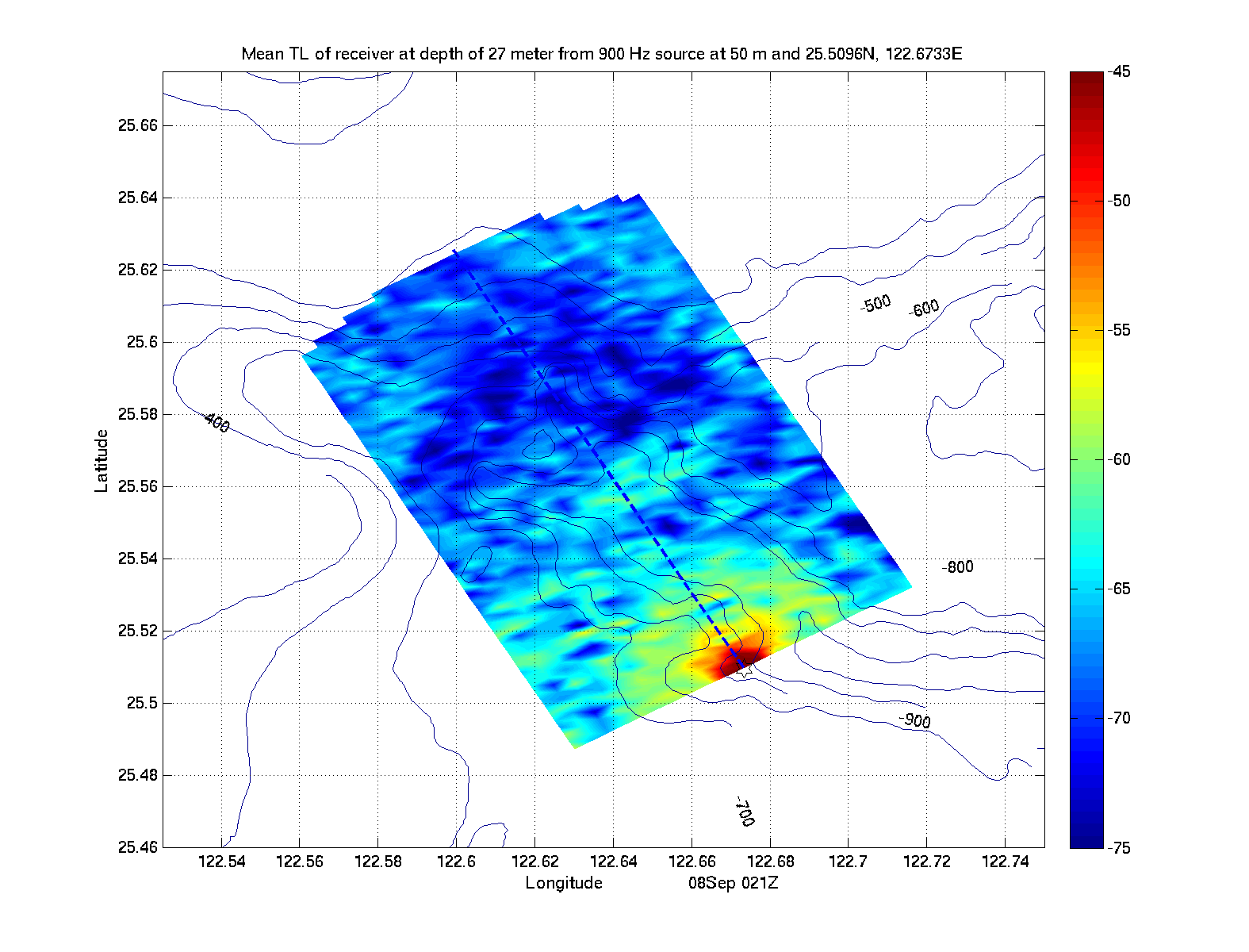
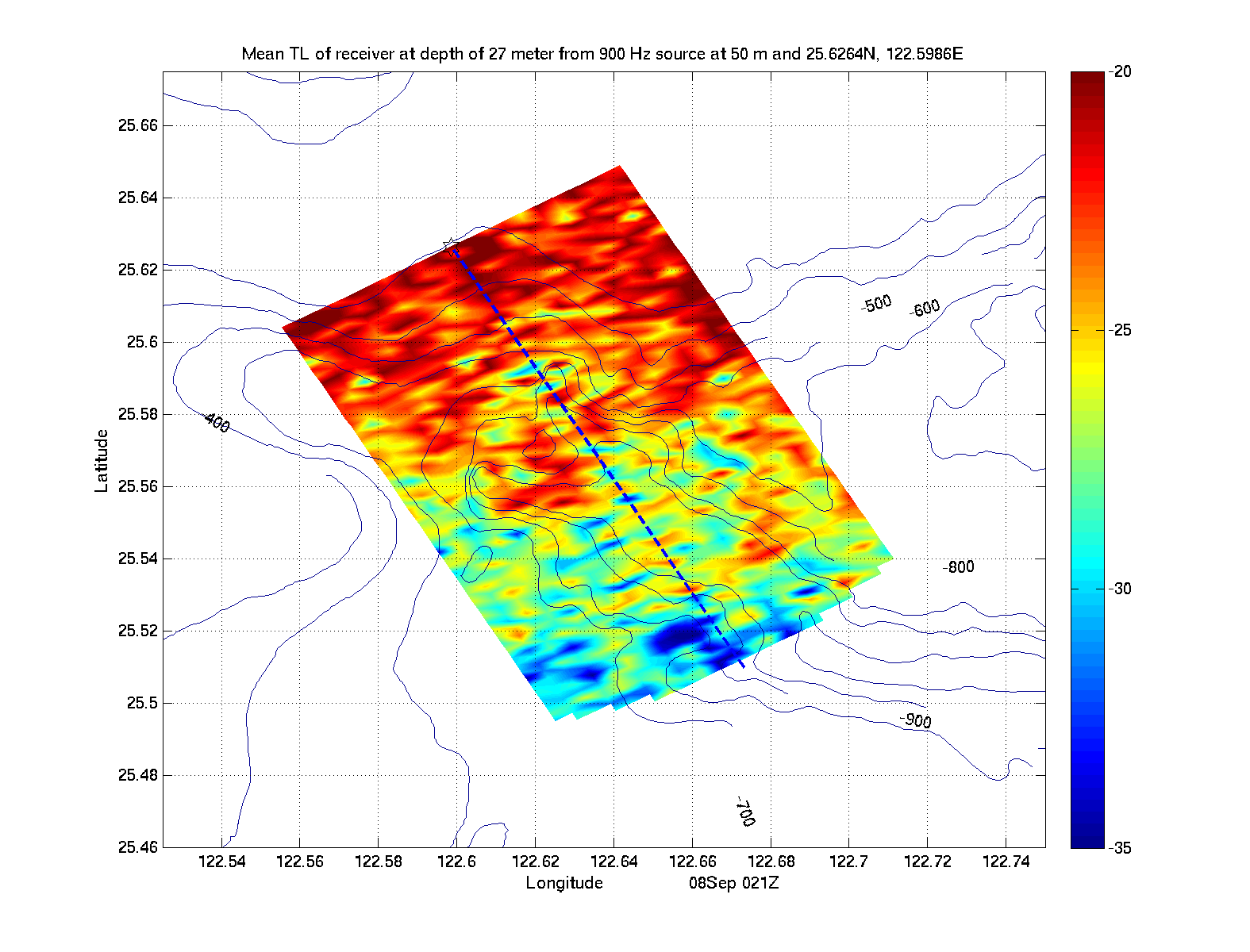
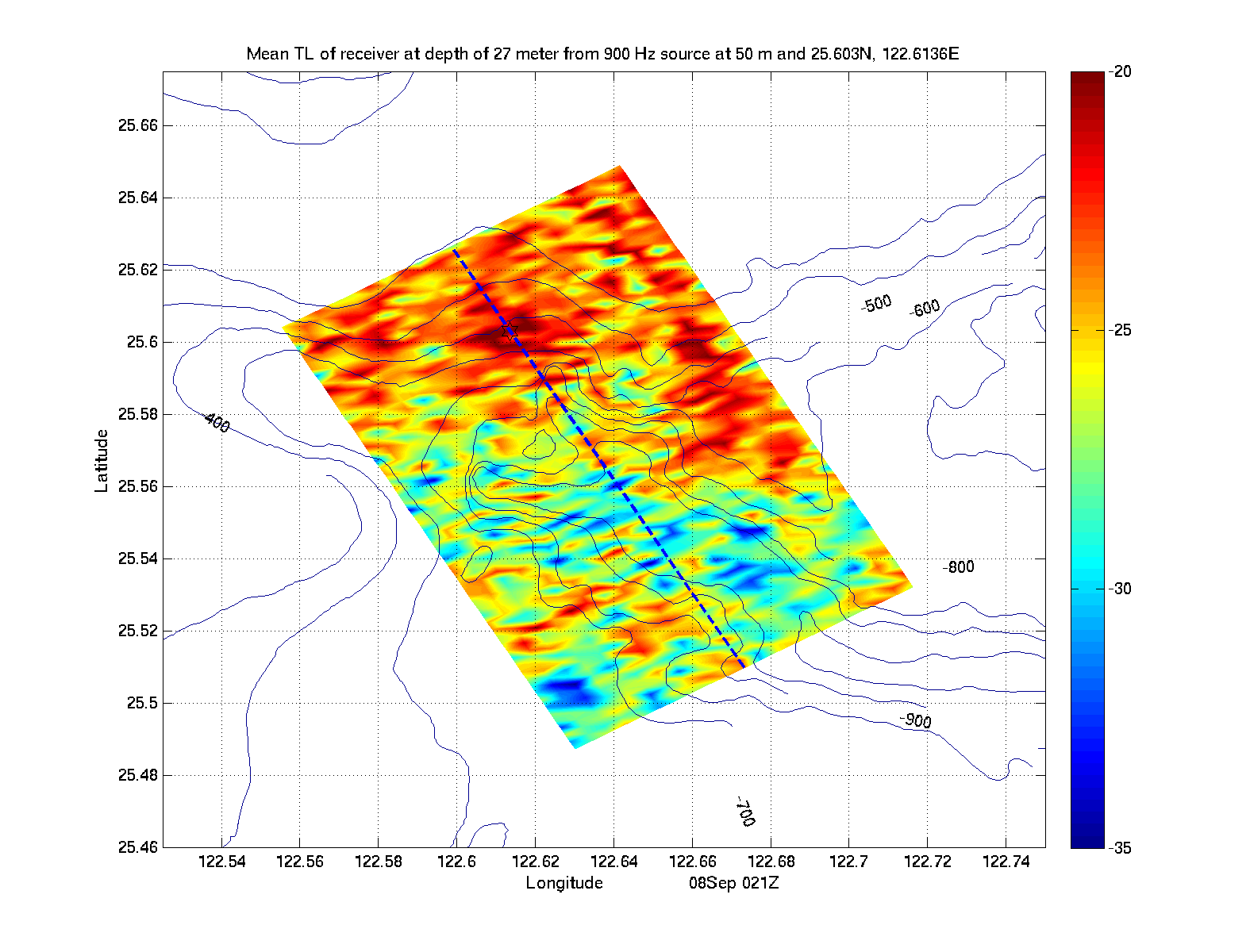
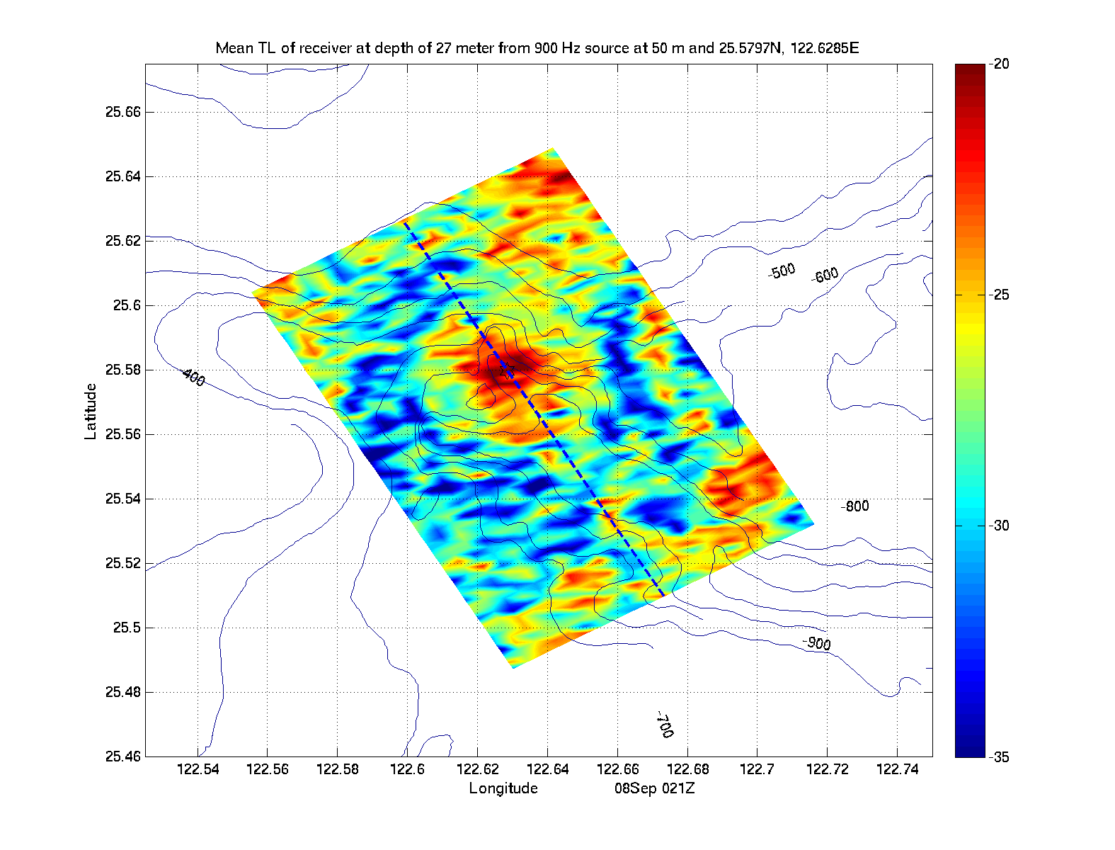
| Source at 50m | |||||
|---|---|---|---|---|---|
| Location 1 | Location 2 | Location 3 | Location 4 | Location 5 | Location 6 |
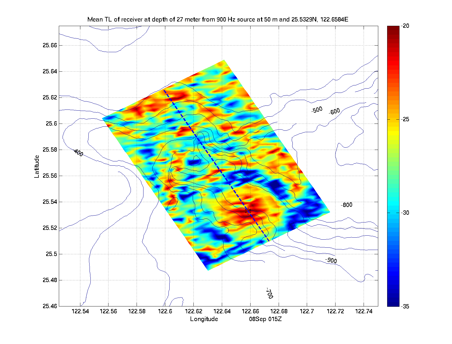
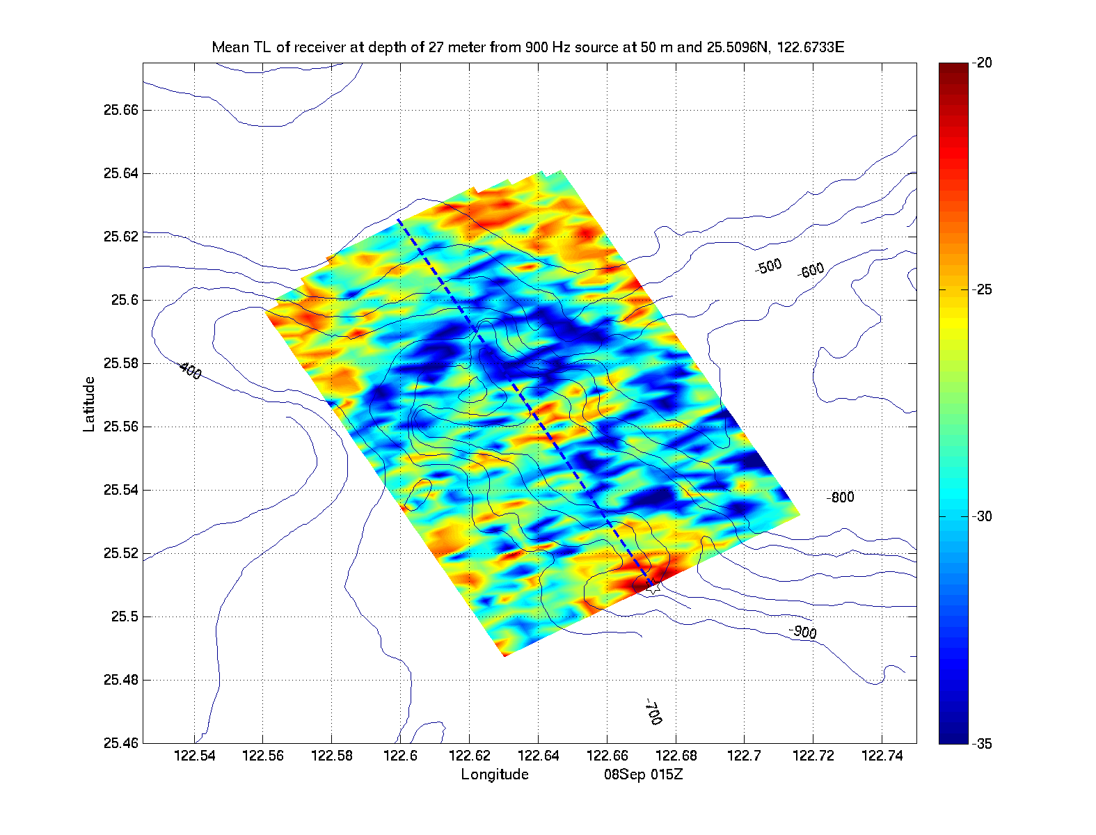
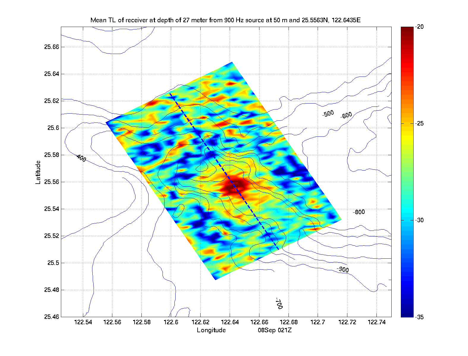
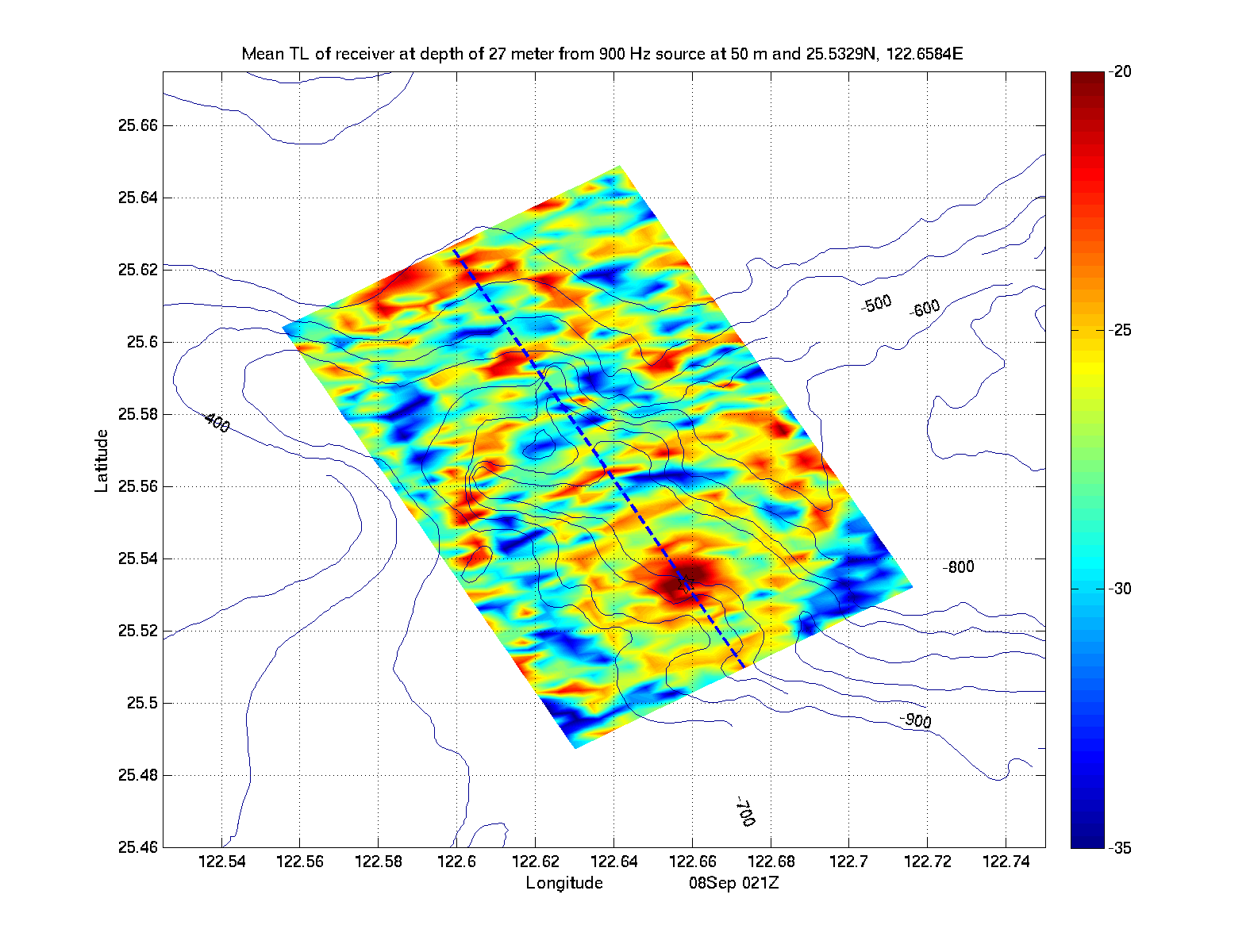
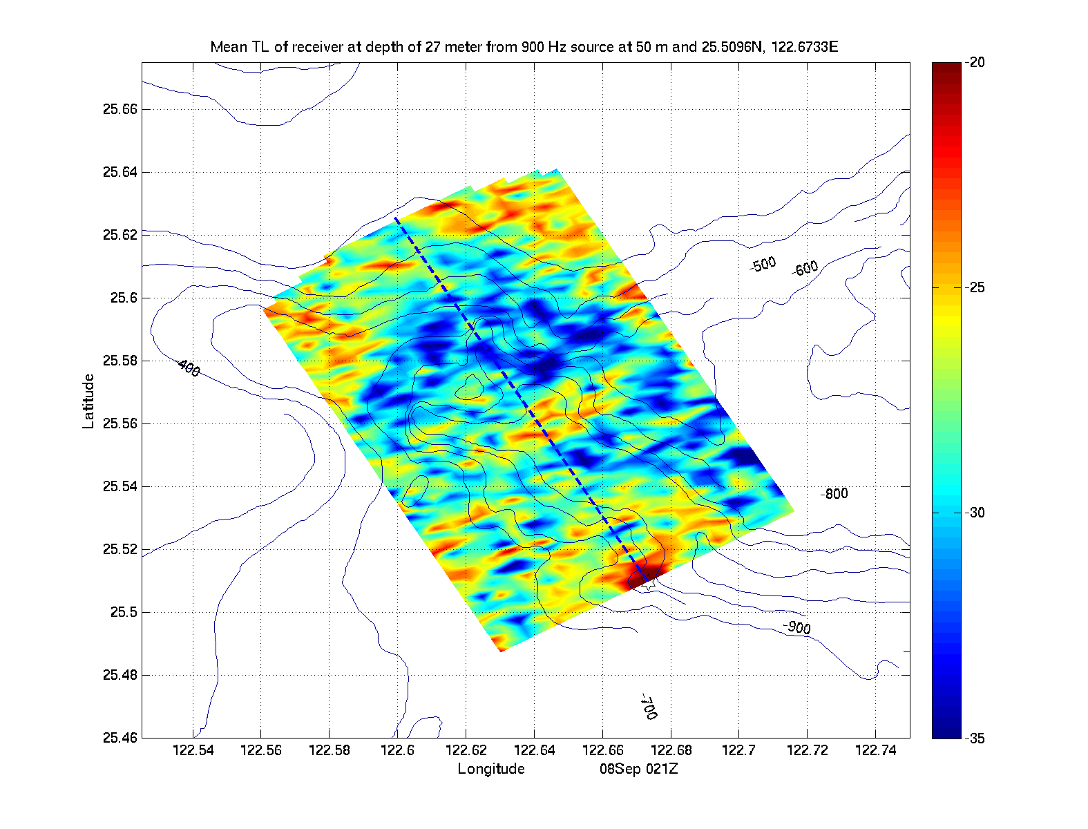
| Receiver at 27m - Spreading Loss | |||||
|
|
|
|
|
|
|
| Receiver at 27m - No Spreading Loss | |||||
|
|
|
|
|
|
|
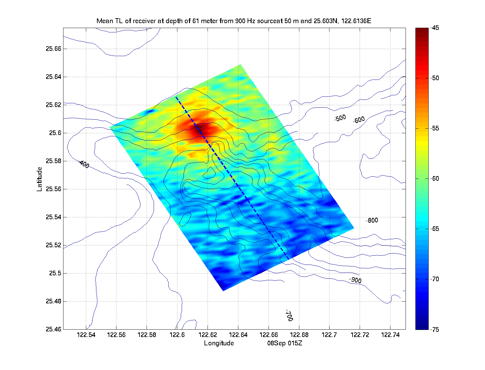
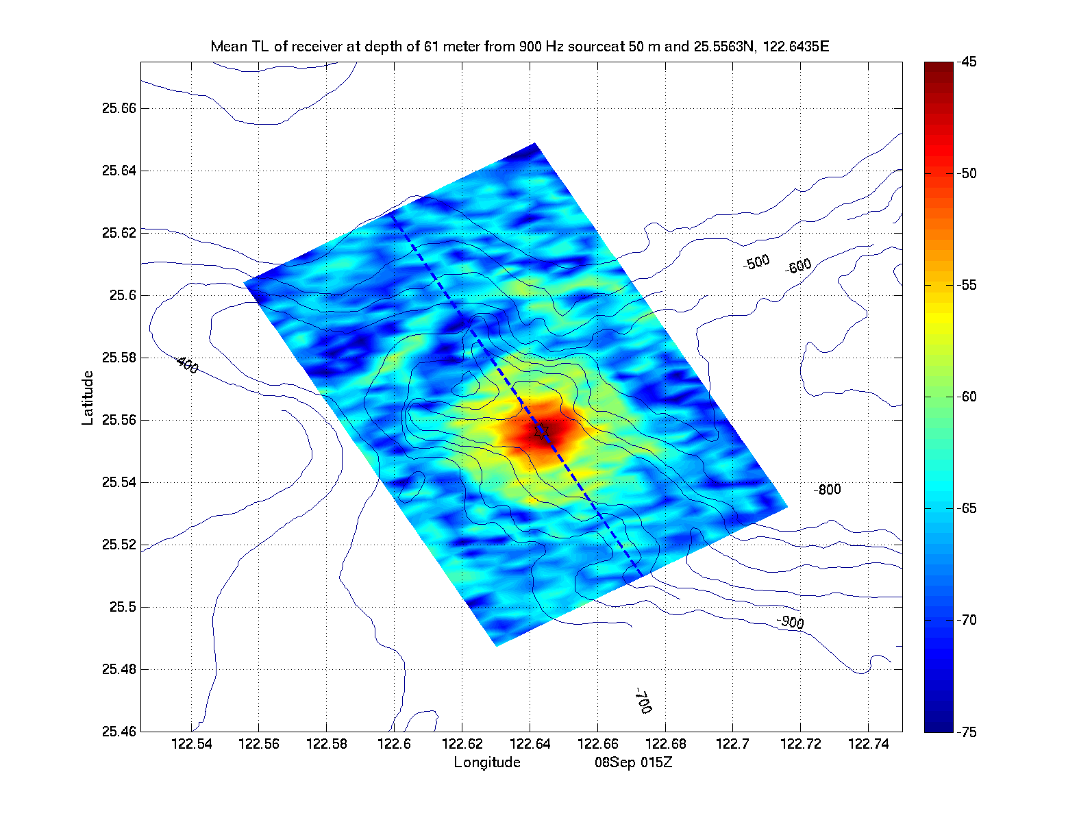
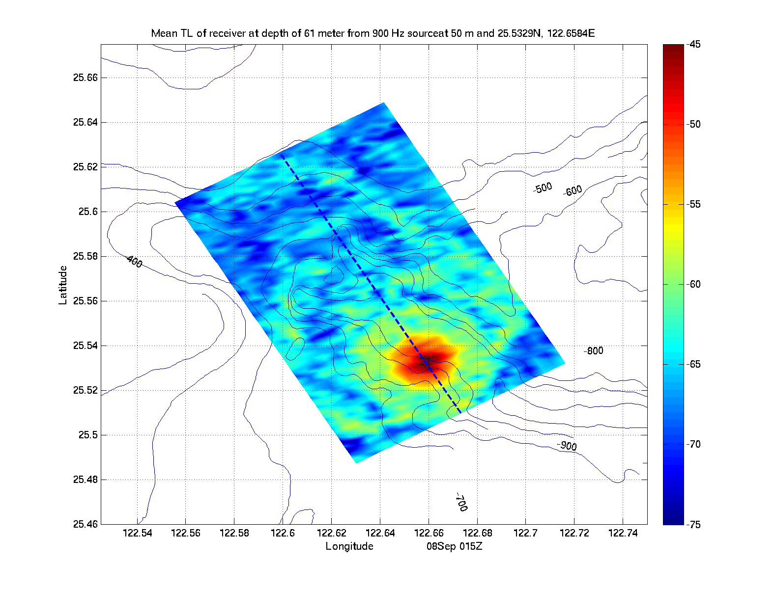
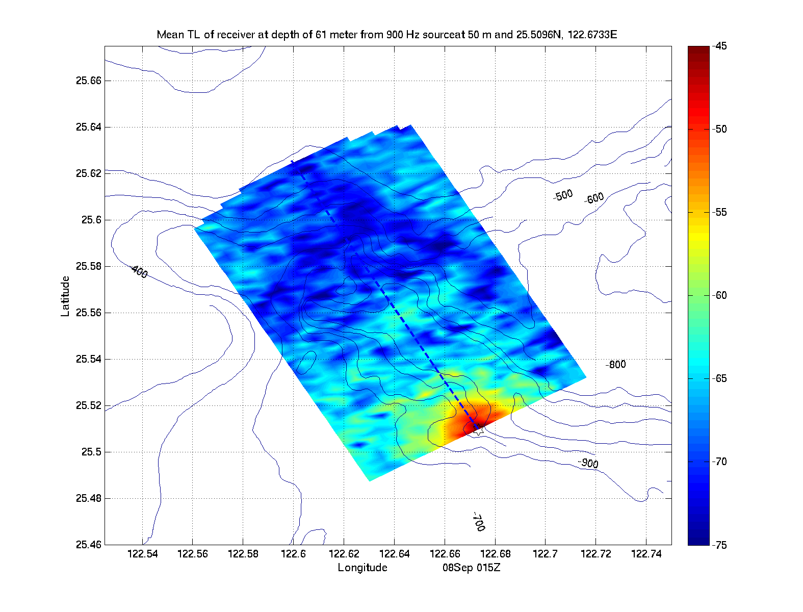
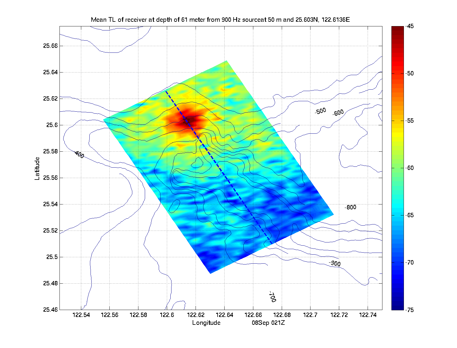
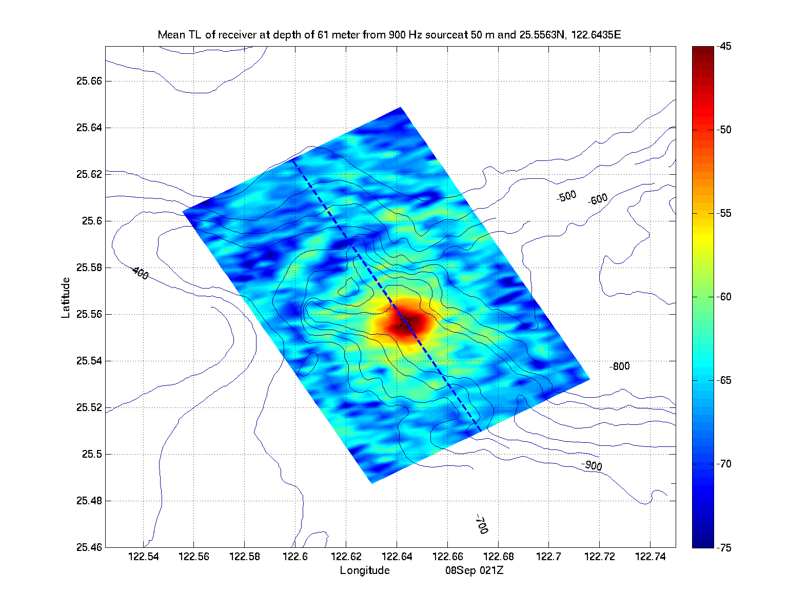
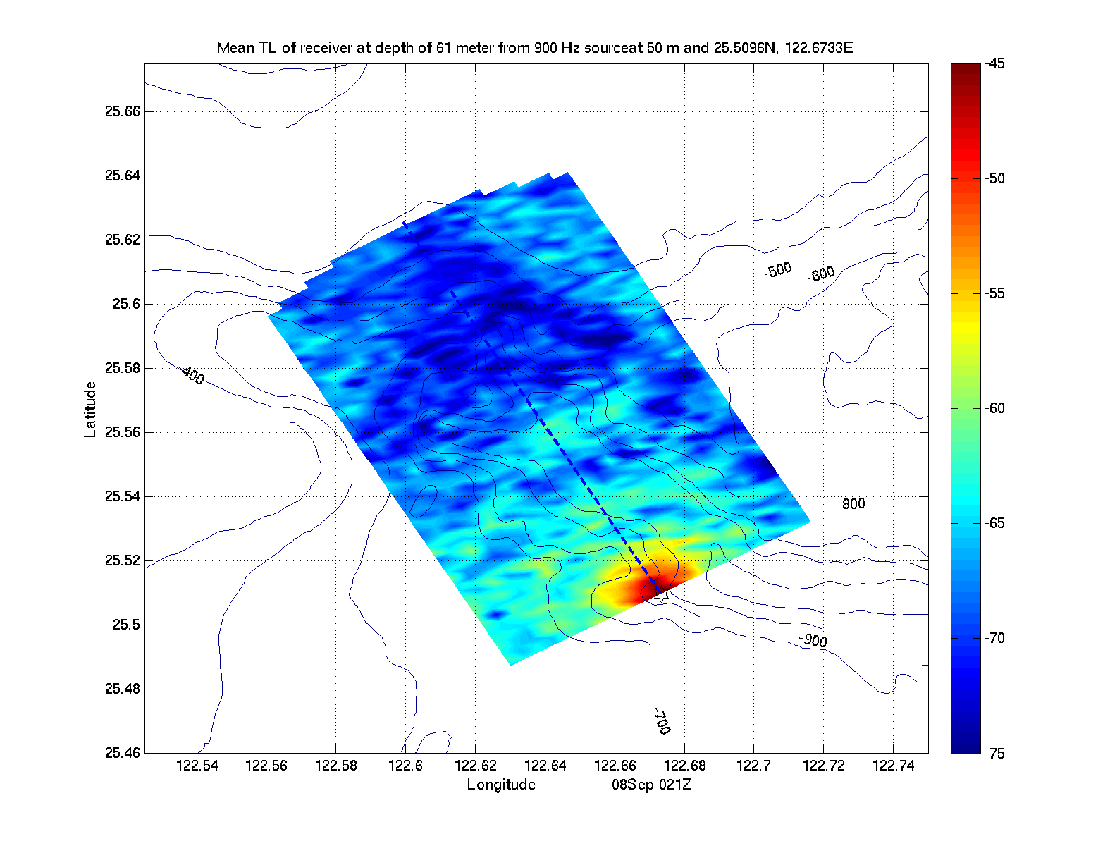
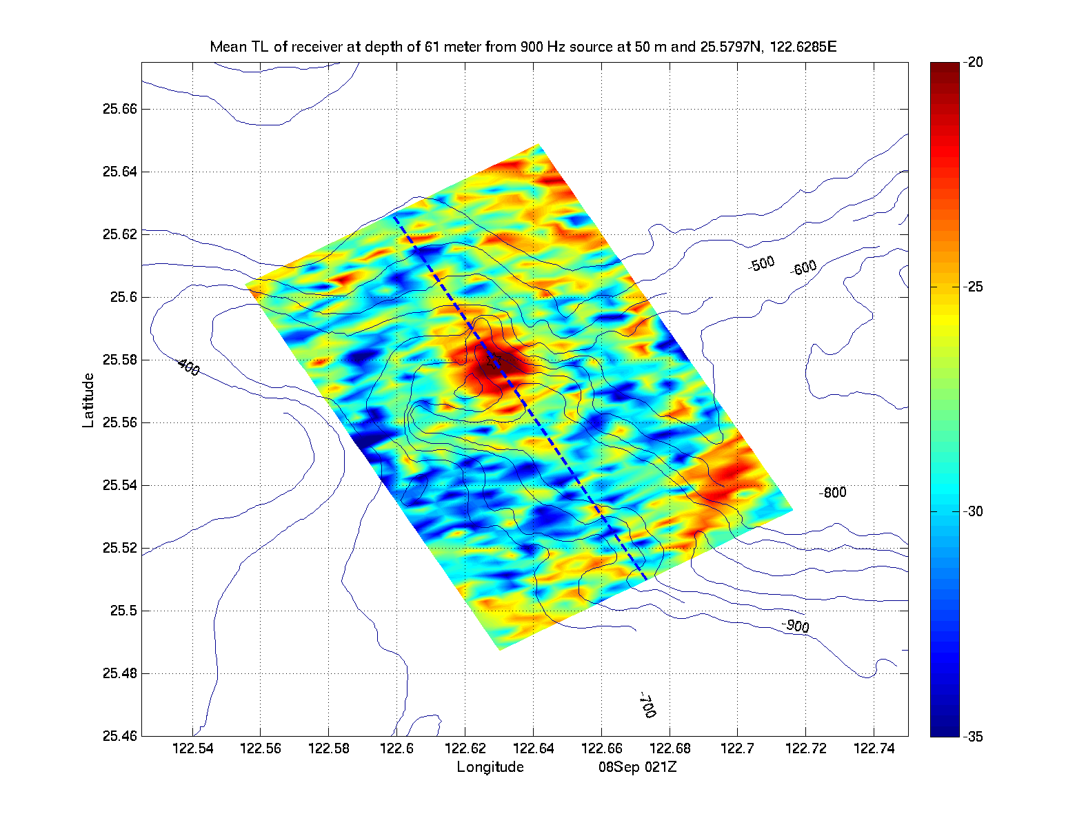
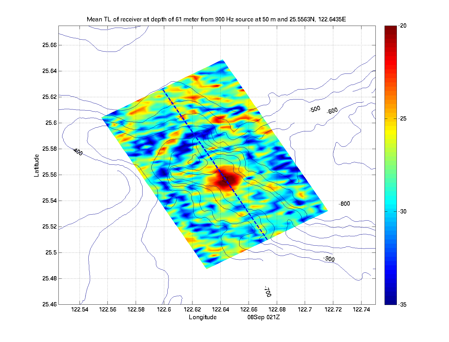
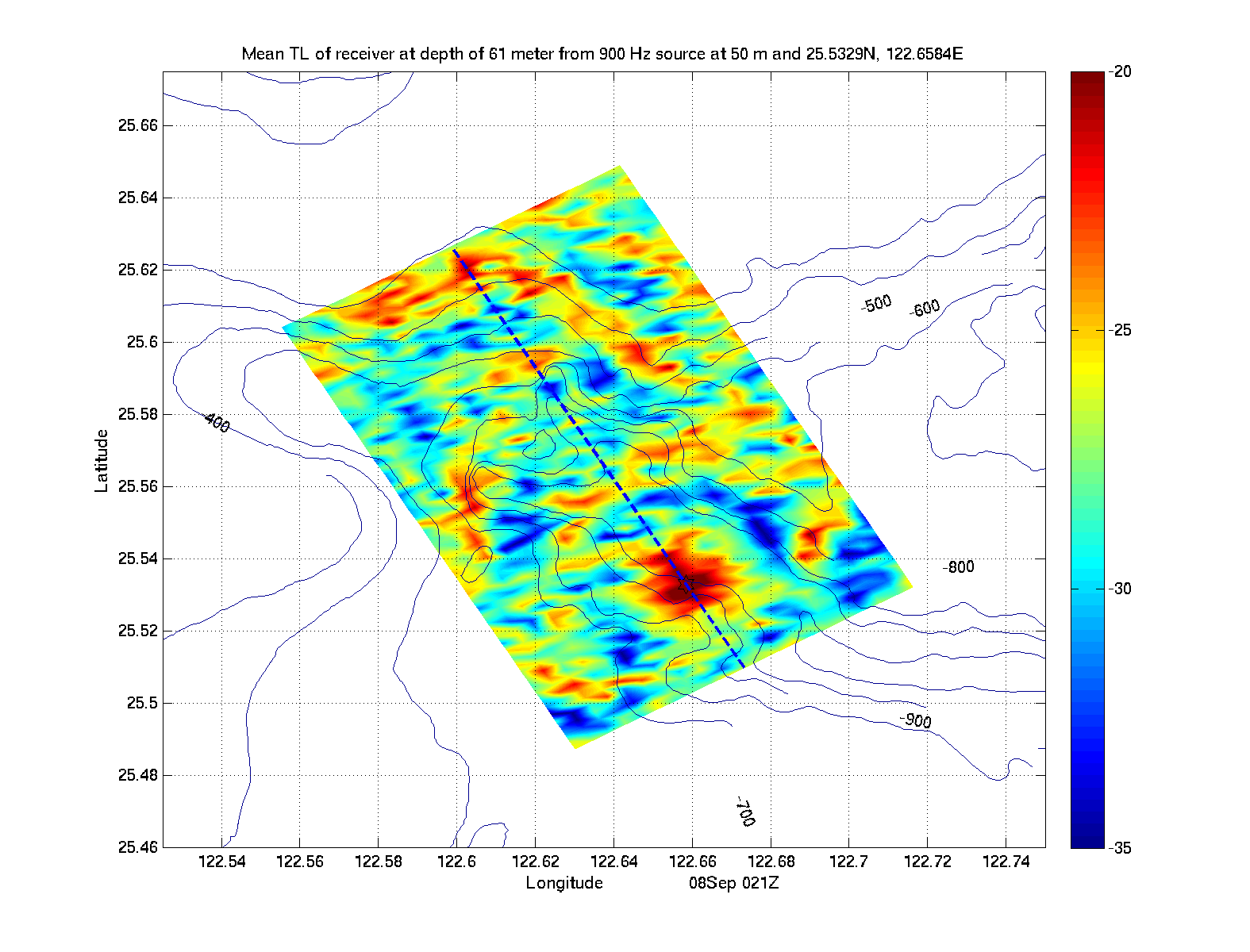
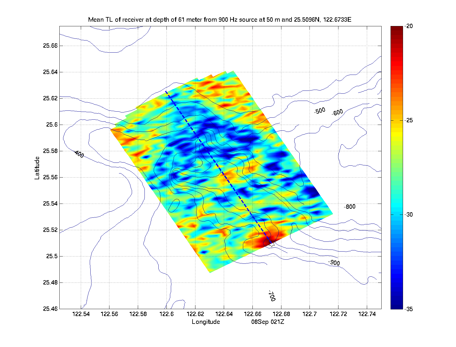
| Receiver at 61m - Spreading Loss | |||||
|
|
|
|
|
|
|
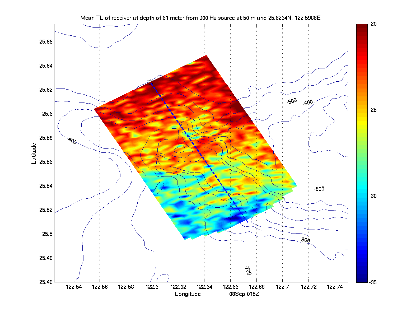
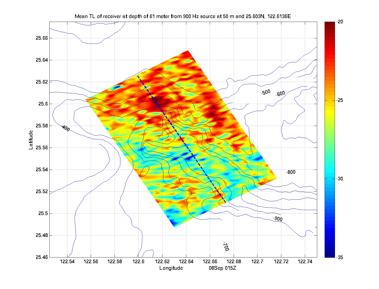
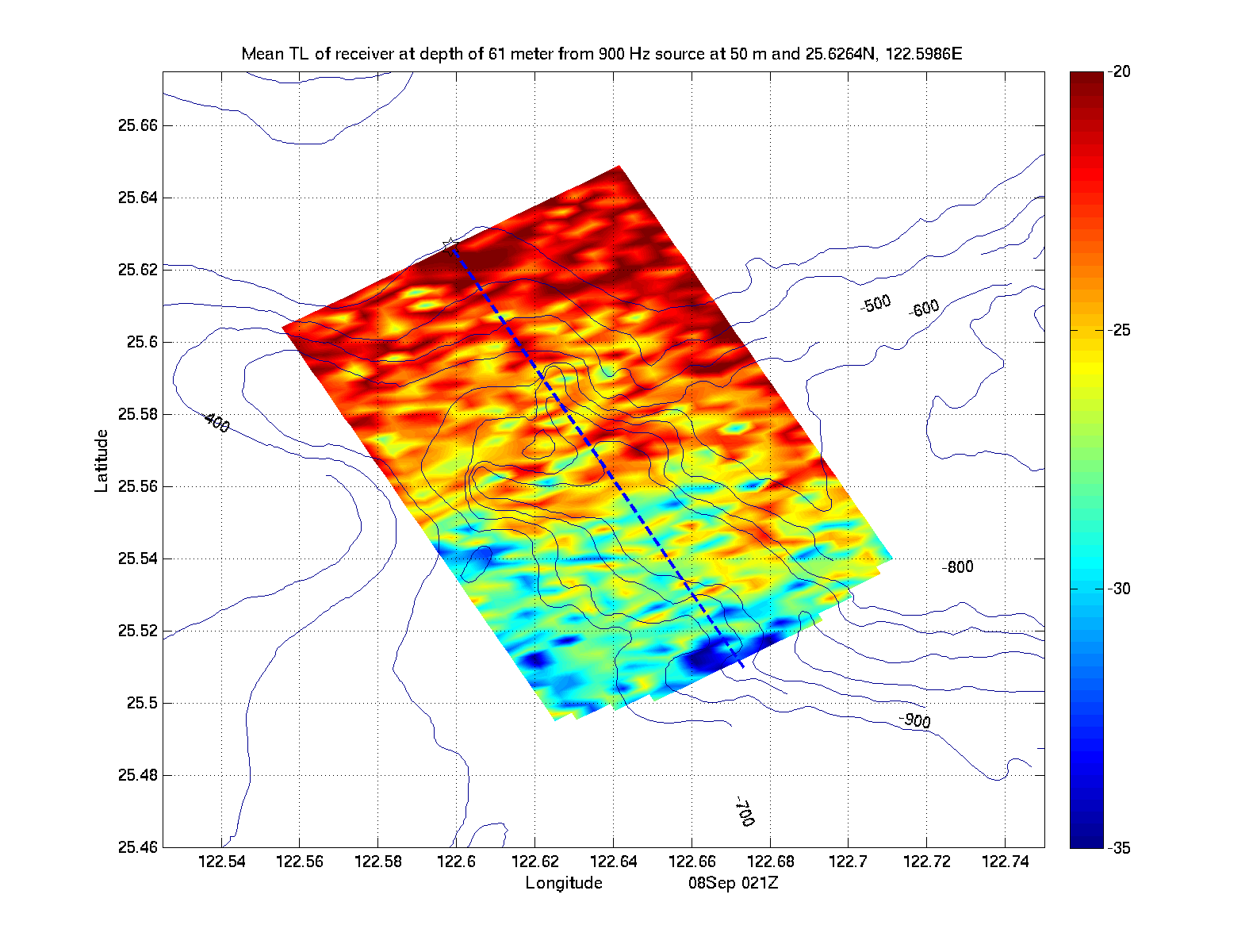
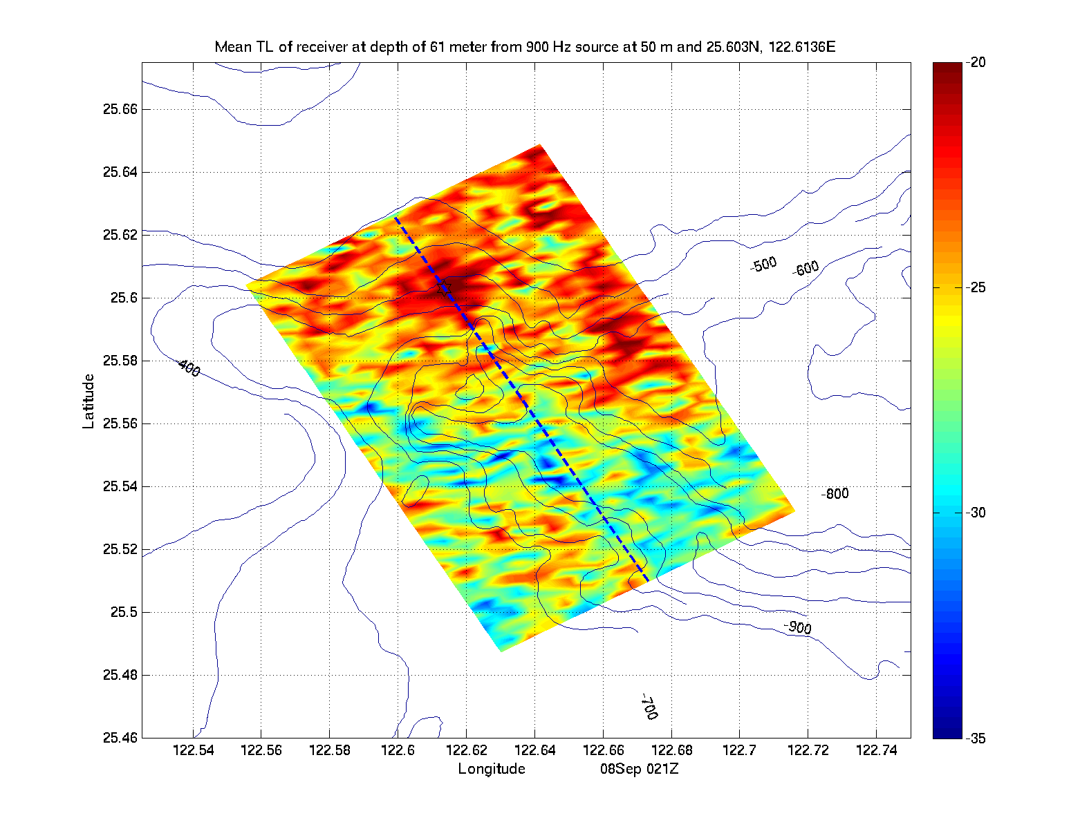
| Receiver at 61m - No Spreading Loss | |||||
|
|
|
|
|
|
|
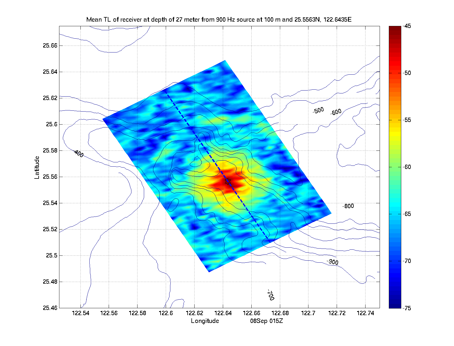
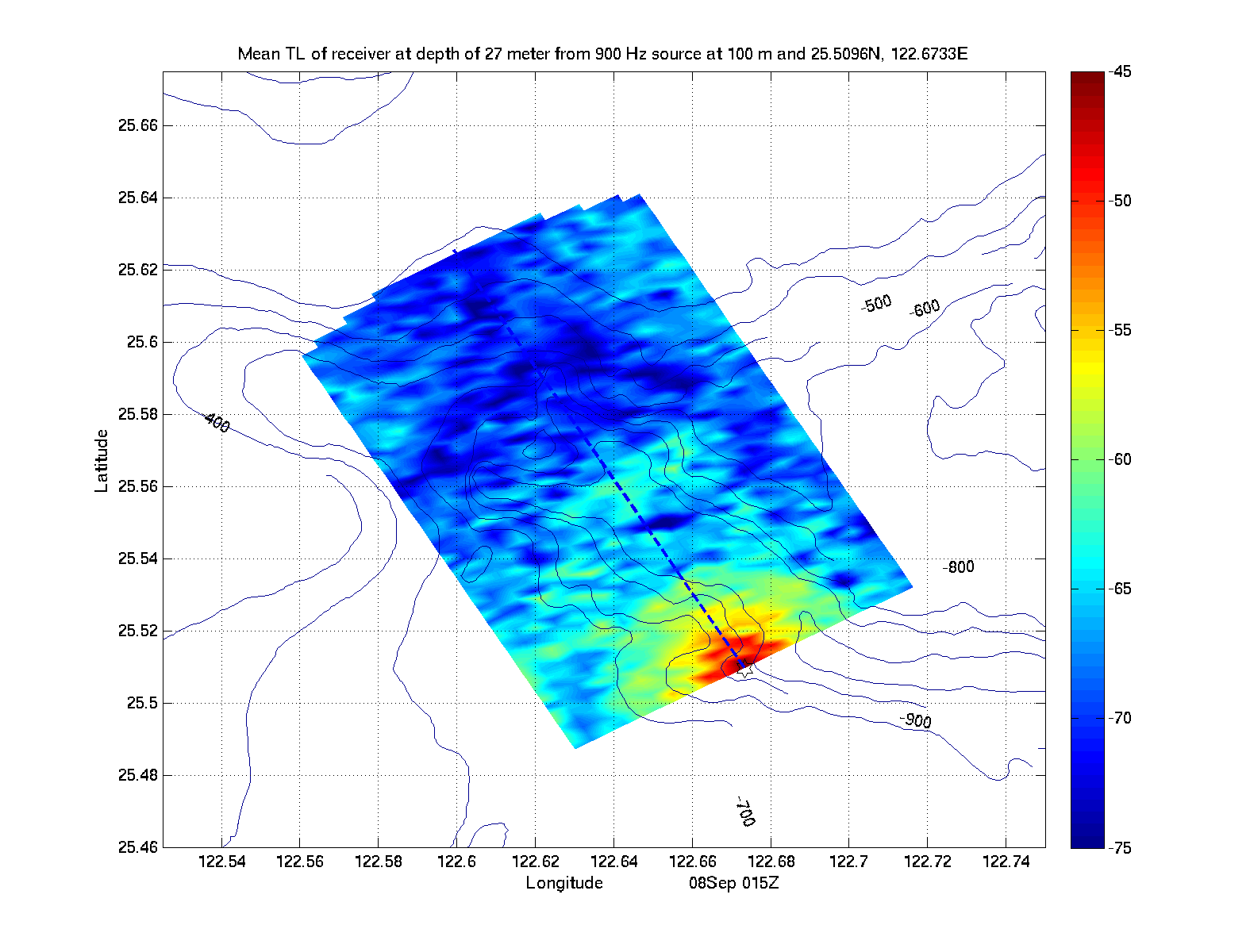
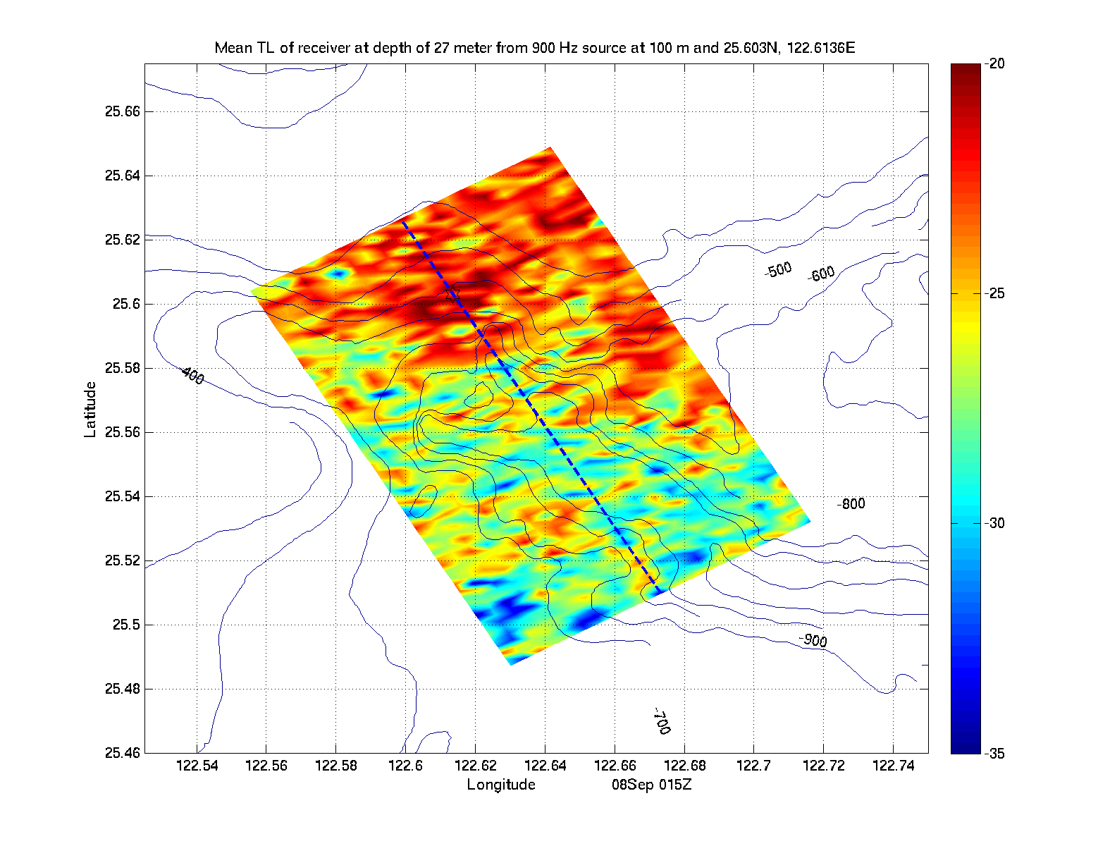
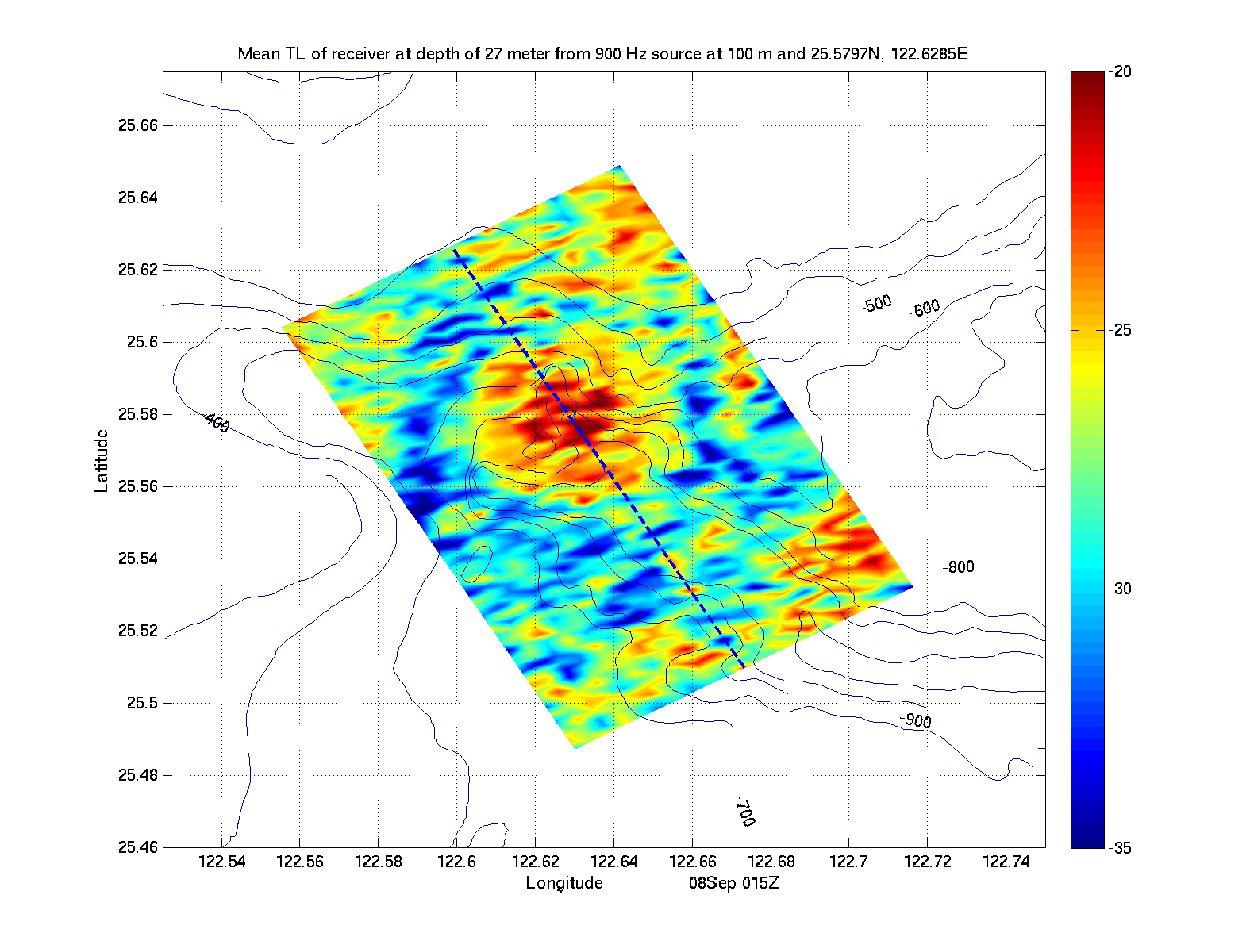
| Source at 100m | |||||
|---|---|---|---|---|---|
| Location 1 | Location 2 | Location 3 | Location 4 | Location 5 | Location 6 |
| Receiver at 27m - Spreading Loss | |||||
|
|

|
|

|
|
| Receiver at 27m - No Spreading Loss | |||||

|
|
|
|

|
|
| Receiver at 61m - Spreading Loss | |||||
|
|

|
|
|
|
| Receiver at 61m - No Spreading Loss | |||||
|
|
|
|
|
|
| Source at 50m | |||||
|---|---|---|---|---|---|
| Location 1 | Location 2 | Location 3 | Location 4 | Location 5 | Location 6 |
| Receiver at 27m - Spreading Loss | |||||
|

|
|

|
|
|
| Receiver at 27m - No Spreading Loss | |||||
|
|
|
|
|
|
| Receiver at 61m - Spreading Loss | |||||

|
|

|
|

|
|
| Receiver at 61m - No Spreading Loss | |||||
|
|
|
|
|
|
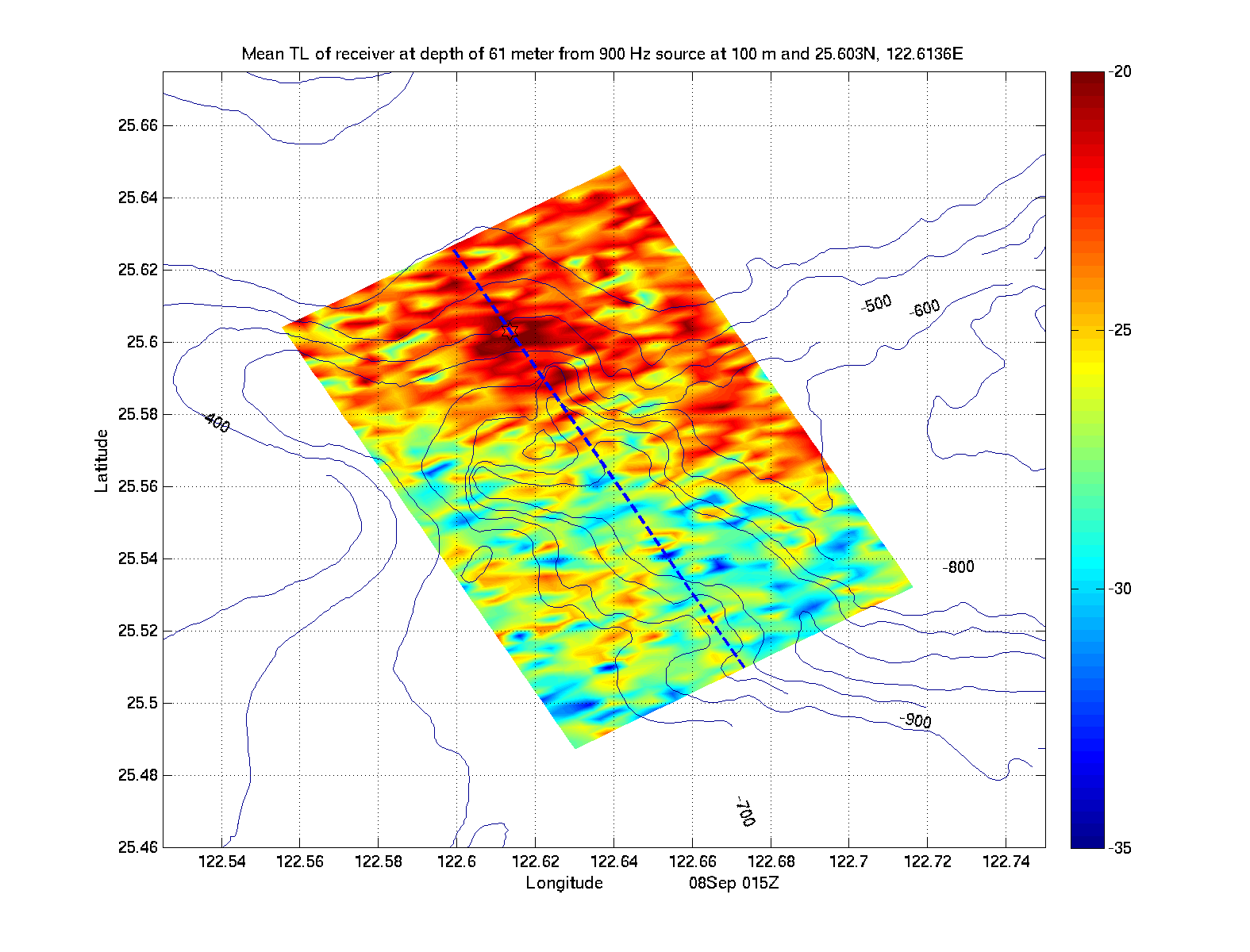
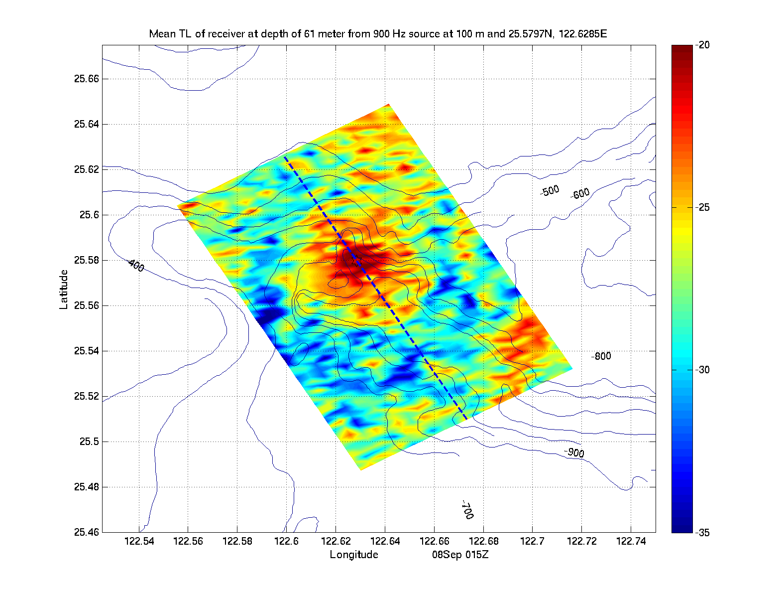
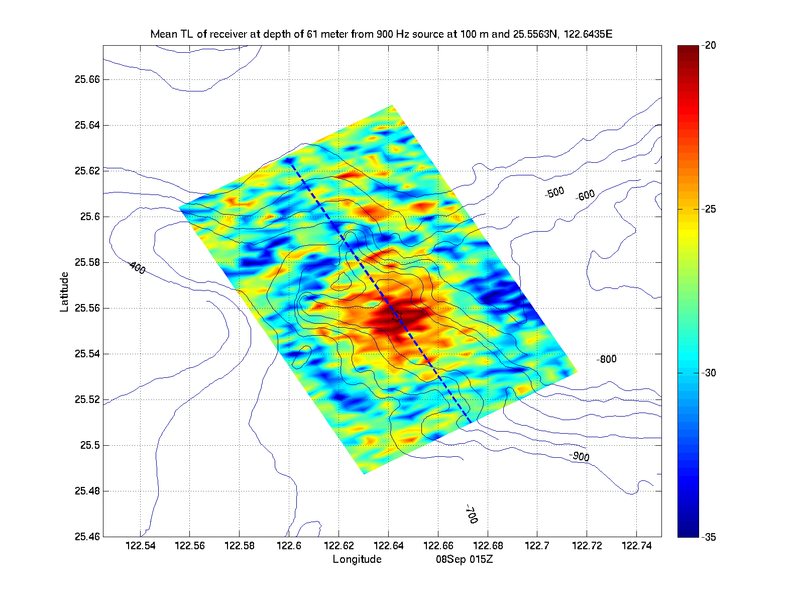
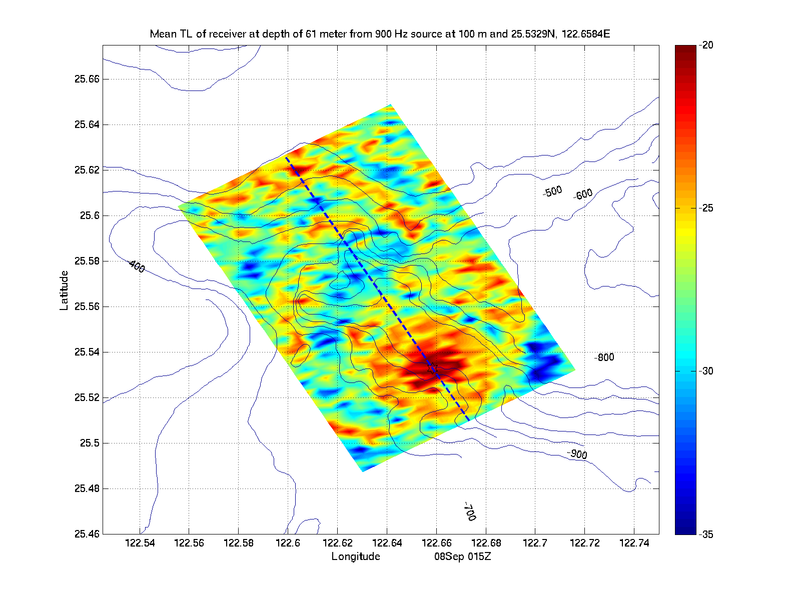
| Source at 100m | |||||
|---|---|---|---|---|---|
| Location 1 | Location 2 | Location 3 | Location 4 | Location 5 | Location 6 |
| Receiver at 27m - Spreading Loss | |||||
|
|
|
|
|
|
|
| Receiver at 27m - No Spreading Loss | |||||
|
|
|
|
|
|
|
| Receiver at 61m - Spreading Loss | |||||
|
|
|
|
|
|
|
| Receiver at 61m - No Spreading Loss | |||||
|
|
|
|
|
|
|
| Return to the MSEAS: | |||
| QPE IOP09 real-time web page | QPE web page | Home page | |