Acoustic Forecasts for 900Hz on 6 September 1500Z, 1800Z and 2100Z, Issued 6 September 2009

This page shows our acoustic variability predictions computed using our predicted ocean state over the QPE Acoustic/OMAS Area. The purpose is to guide acoustic sensor placement. The acoustic modeling covers a 56km by 33 km rectangle area with a 31 by 31 grid resolution. A source (900 and 600 Hz frequency) is placed at each grid point and sound is propagated to 15 km distance in 8 different directions (with 45 degree intervals). An N(=8) by 2D transmission loss TL(latitude,longitude,bearing,depth,range) at each grid point is forecast using the parabolic equation Range-dependent Acoustic Model (RAM). A two-layer depth-dependent geo-acoustic model is applied here: 20 m deep sediment layer on the top of basement with sound sound speed (c) 1,800 m/s, density (ρ) 2.0 g/cm3 and attenuation (α) 0.5 dB/λ. The sediment type depends on the local water depth (WD) :

WD < 140m: Sand sediment (sound speed ratio: 1.038, ρ: 1.90 g/cm3, α: 0.9 dB/λ)
140m < WD < 210m: Muddy-sand (sound speed ratio: 1.021, ρ: 1.76 g/cm3, α: 1.15 dB/λ)
210m < WD: Mud (sound speed ratio: 0.980 , ρ: 1.42 g/cm3, α: 0.1 dB/λ)
1500ZAcoustic Vertical Sections
Acoustic Climate Maps - 60±5 db
1800ZAcoustic Vertical Sections
Acoustic Climate Maps - 60±5 db
2100ZAcoustic Vertical Sections
Acoustic Climate Maps - 60±5 db
NetCDF Files


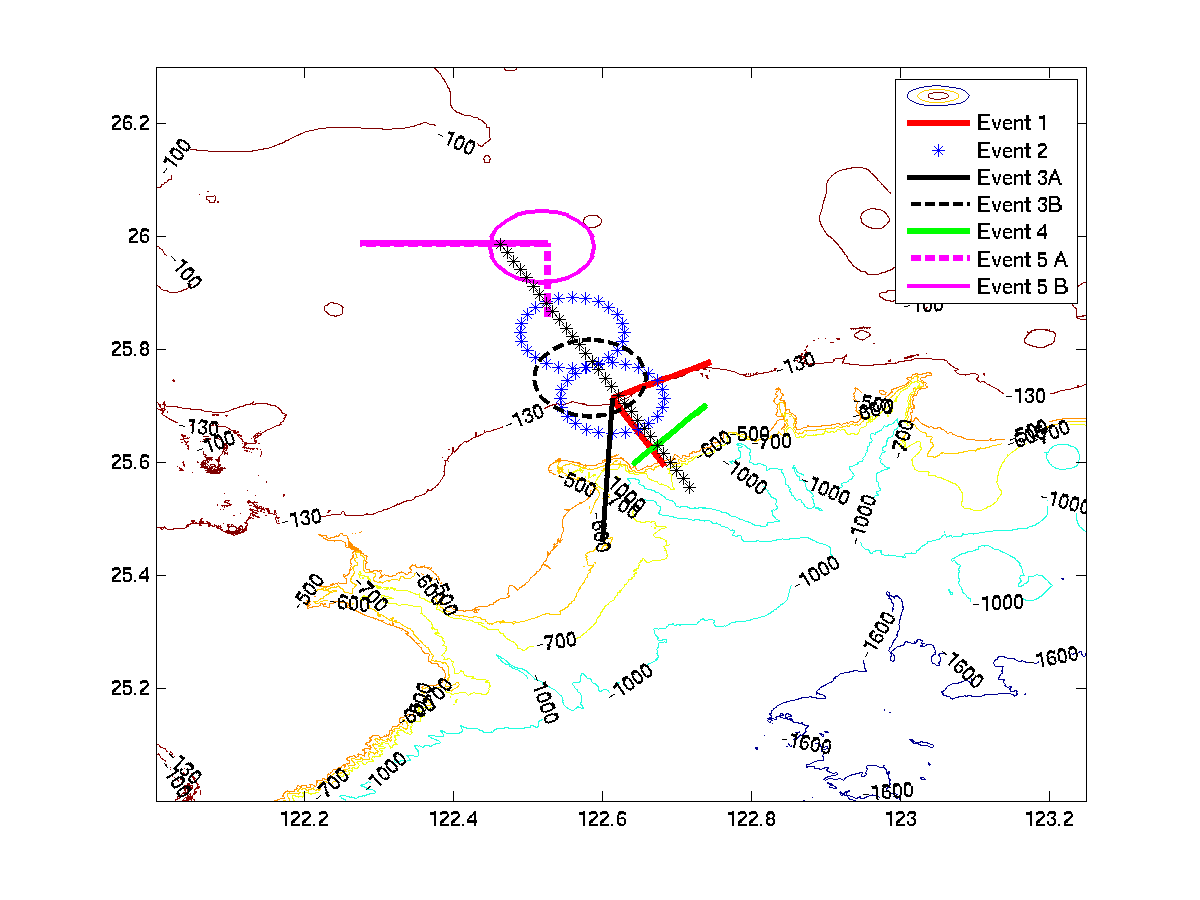
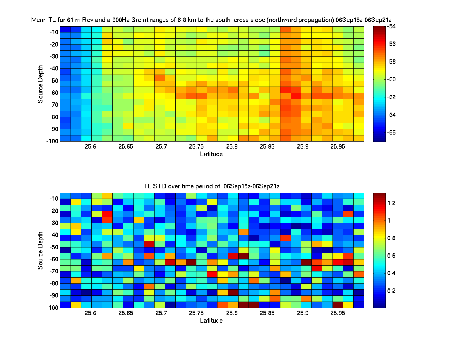
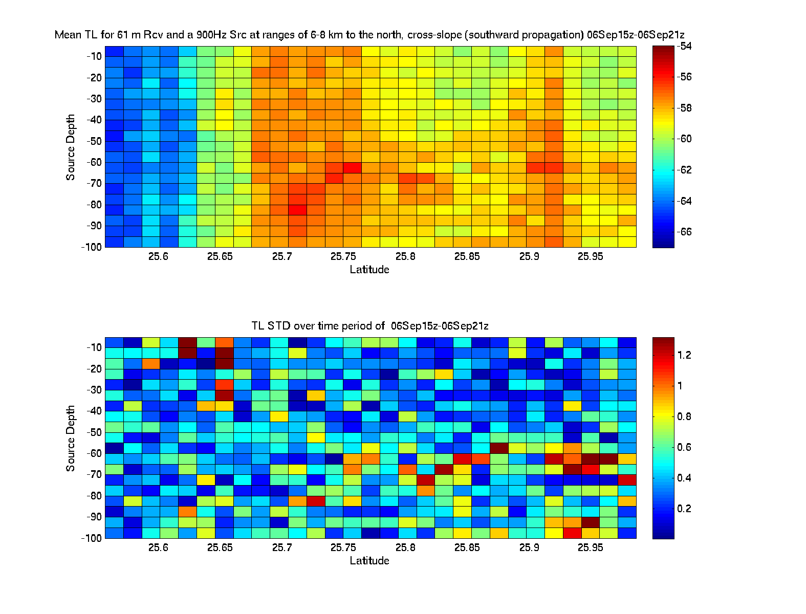
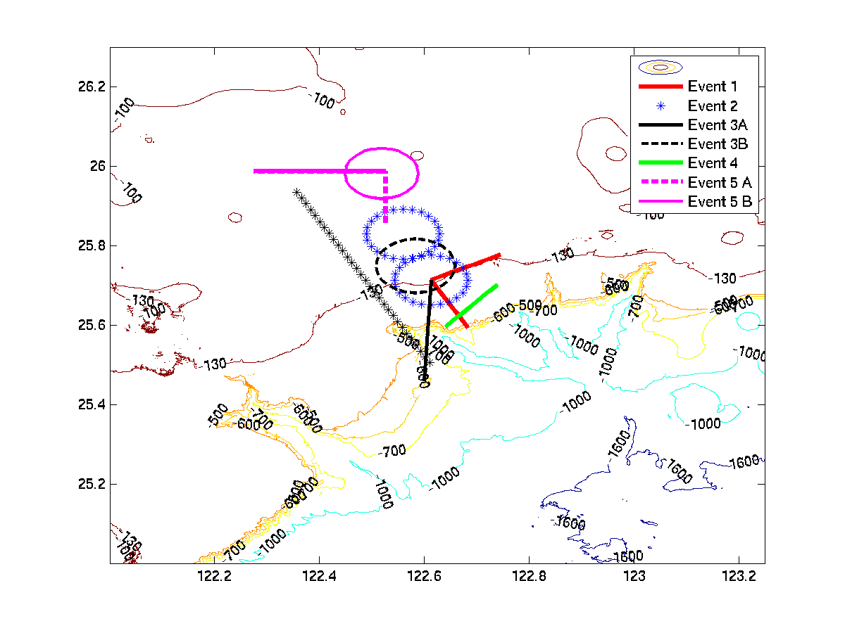
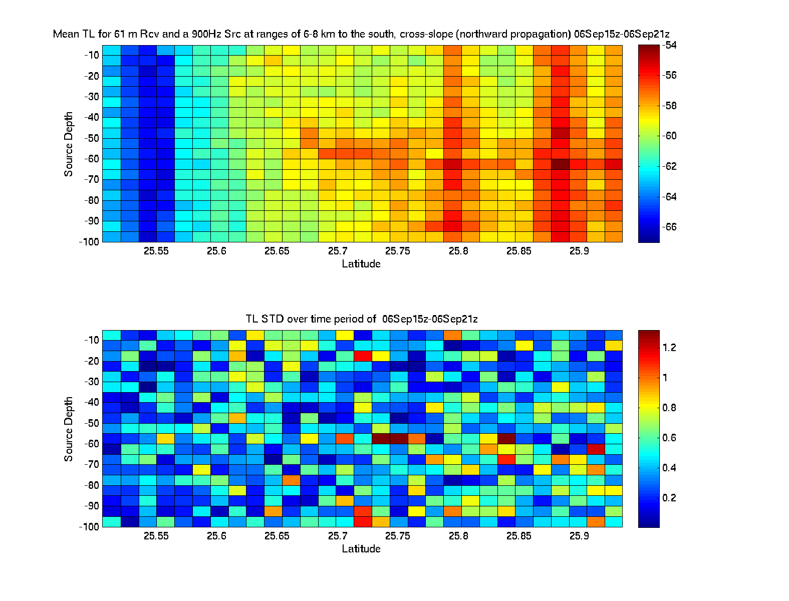
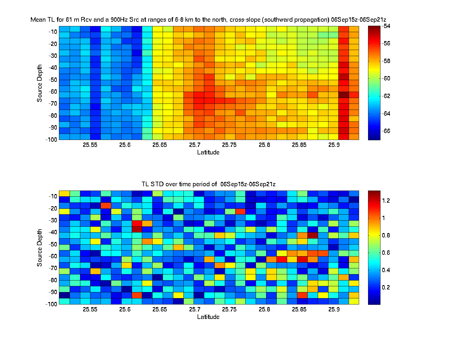
First, we focus below on on two cross-slope sections which intersect the 130m isobath (see plots with locations), which is the a priori chosen location of the acoustic sampling for this Day 2 of Leg 2. In these plots, reciprocity is used. For each the East and West locations there are two the images below. Each vertical section contains a 2D color plot and a 1D std over depth. One image corresponds to an northward propagation, the other to a southward propagation. Consider the northward propagation, for example. The 2D color section indicates that if the receiver is at a given depth and lat-lon (a pixel in the 2D plot), it will hear a source at 6-8km to the south (to the left) with XX db (as colored in the pixel).

Cross-Slope Mean TL Over Zime - East Location
East Location Mean TL Over Time - Northward Propagation Mean TL Over Time - Southward Propagation
Cross-Slope Mean TL Over Zime - West Location
West Location Mean TL Over Time - Northward Propagation Mean TL Over Time - Southward Propagation

Fcst. for 5 Sep. 15Z
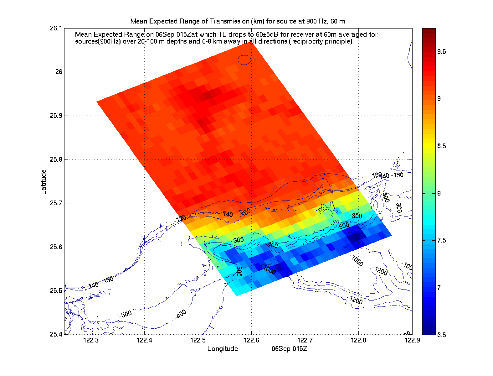
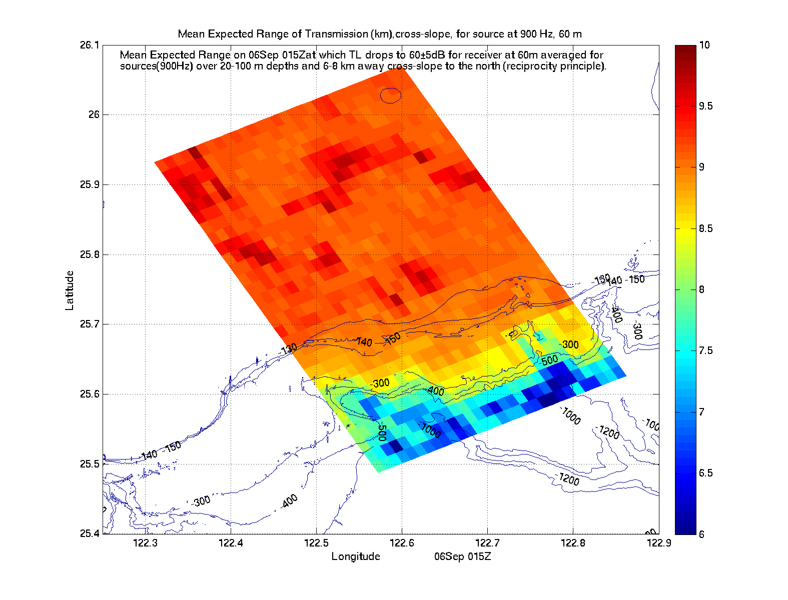
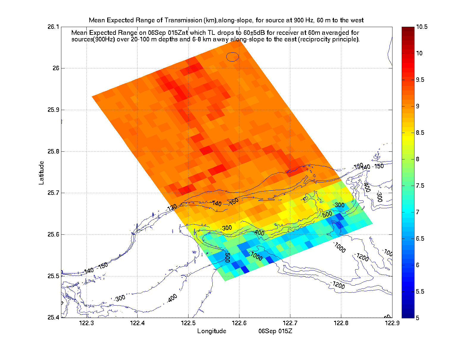
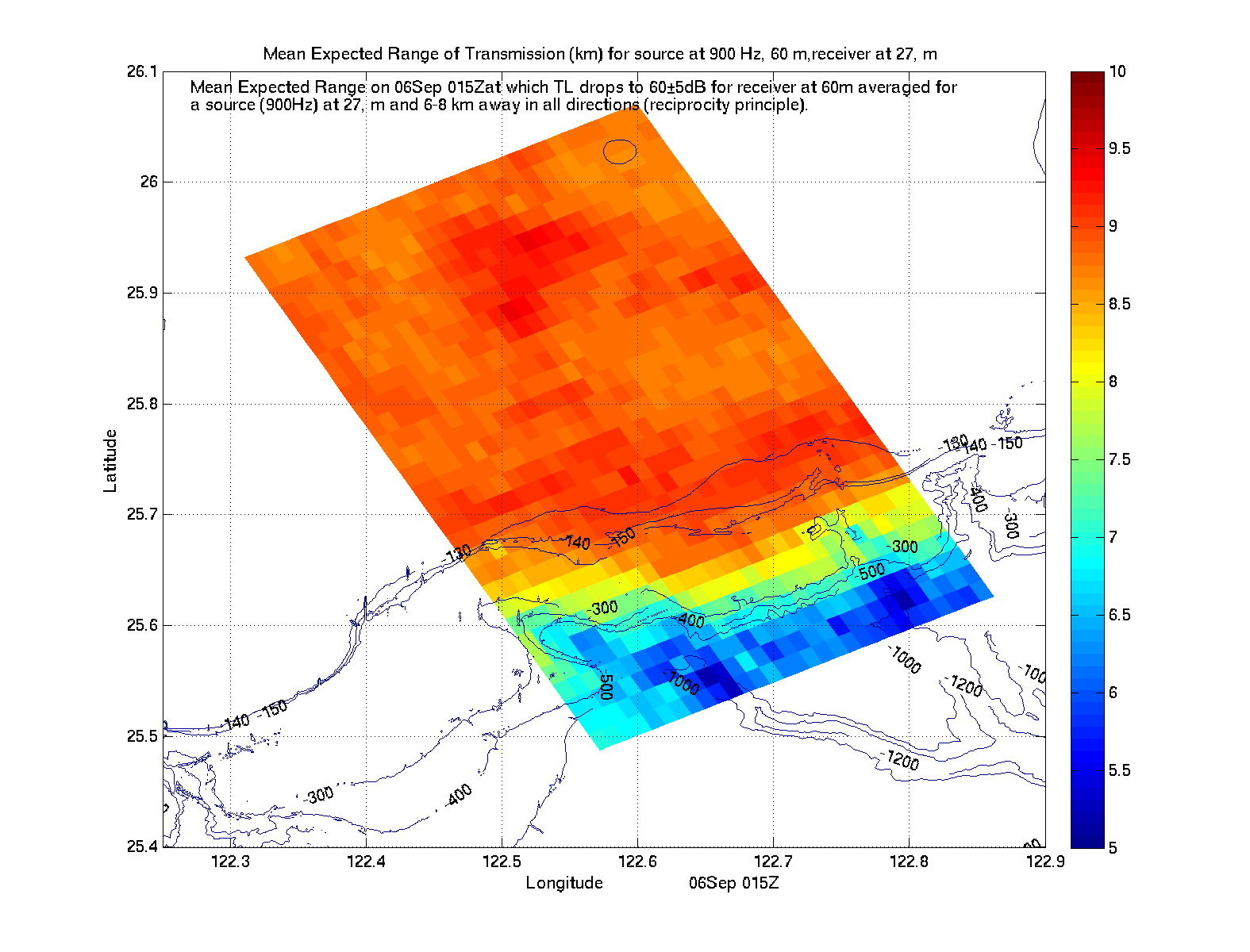
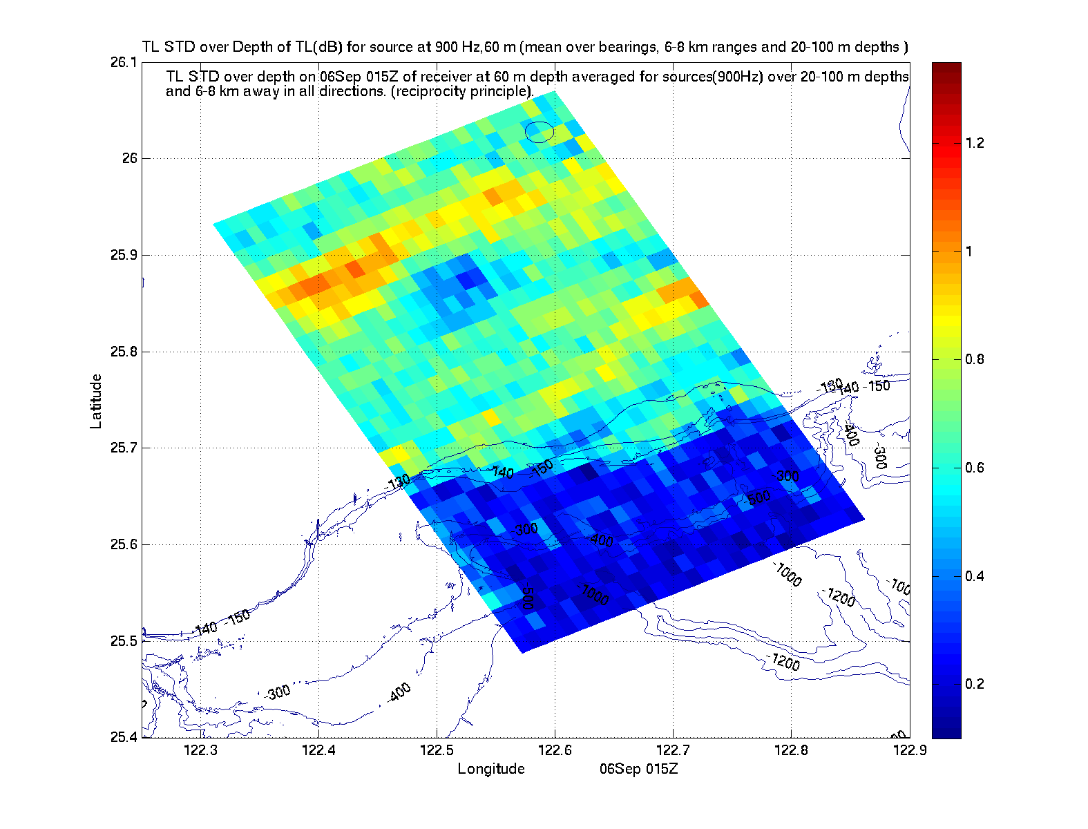
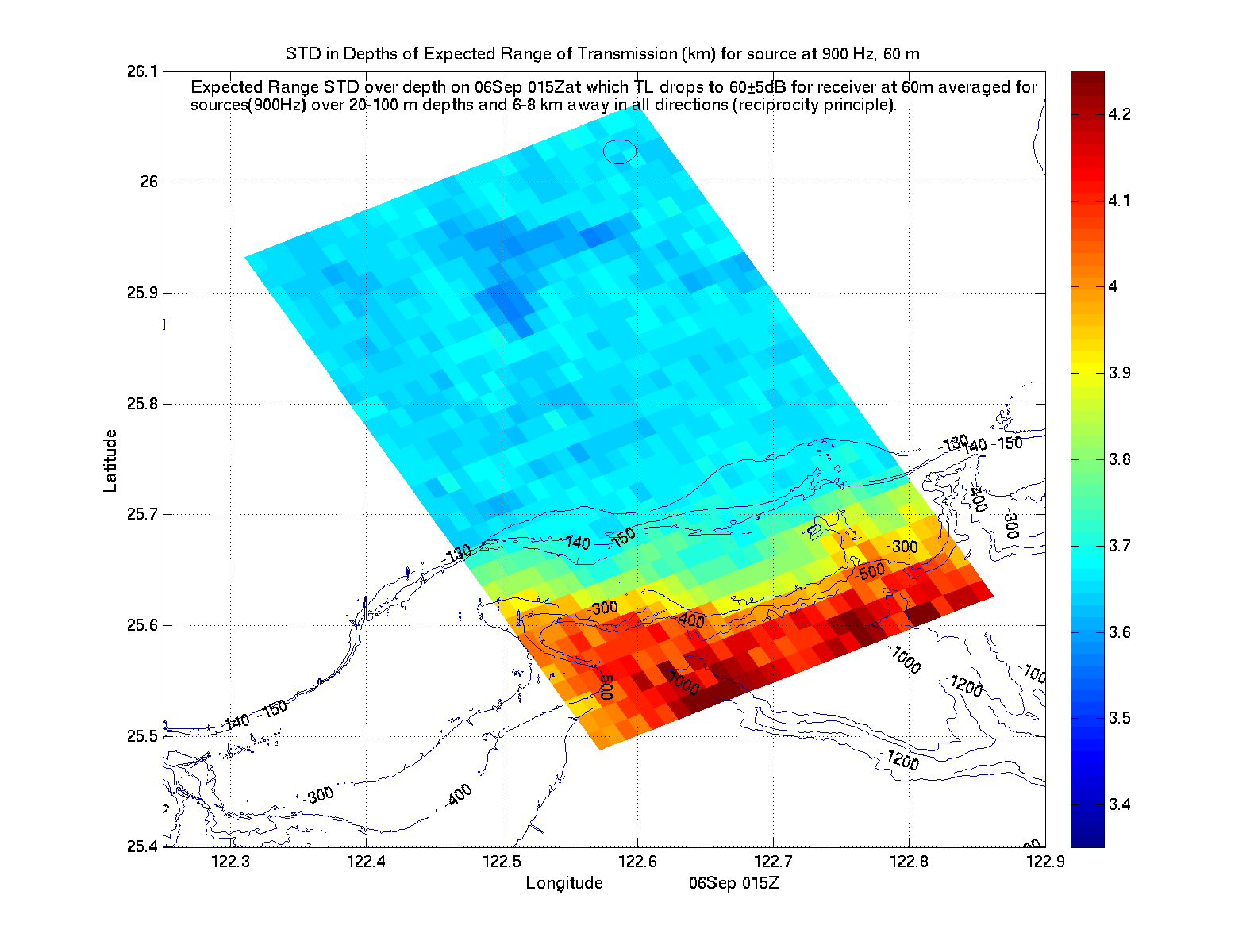
Acoustic Climate Maps for a TL drop to 60±5 db
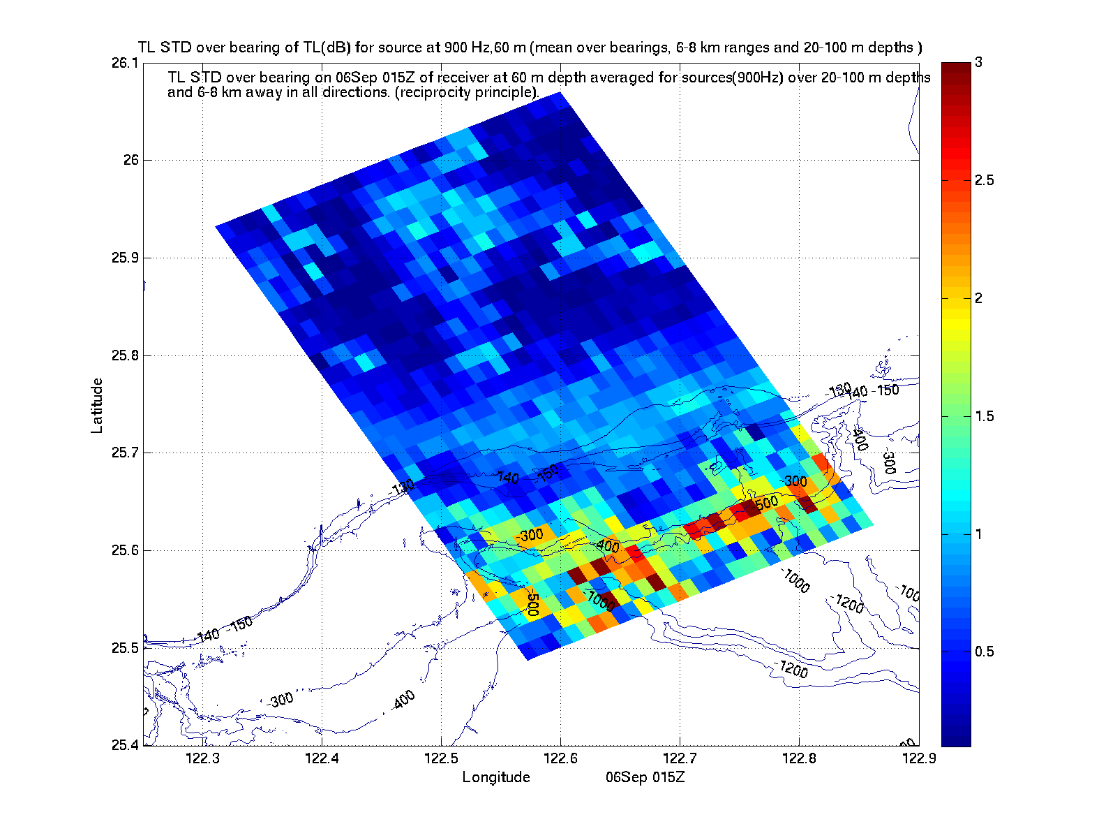
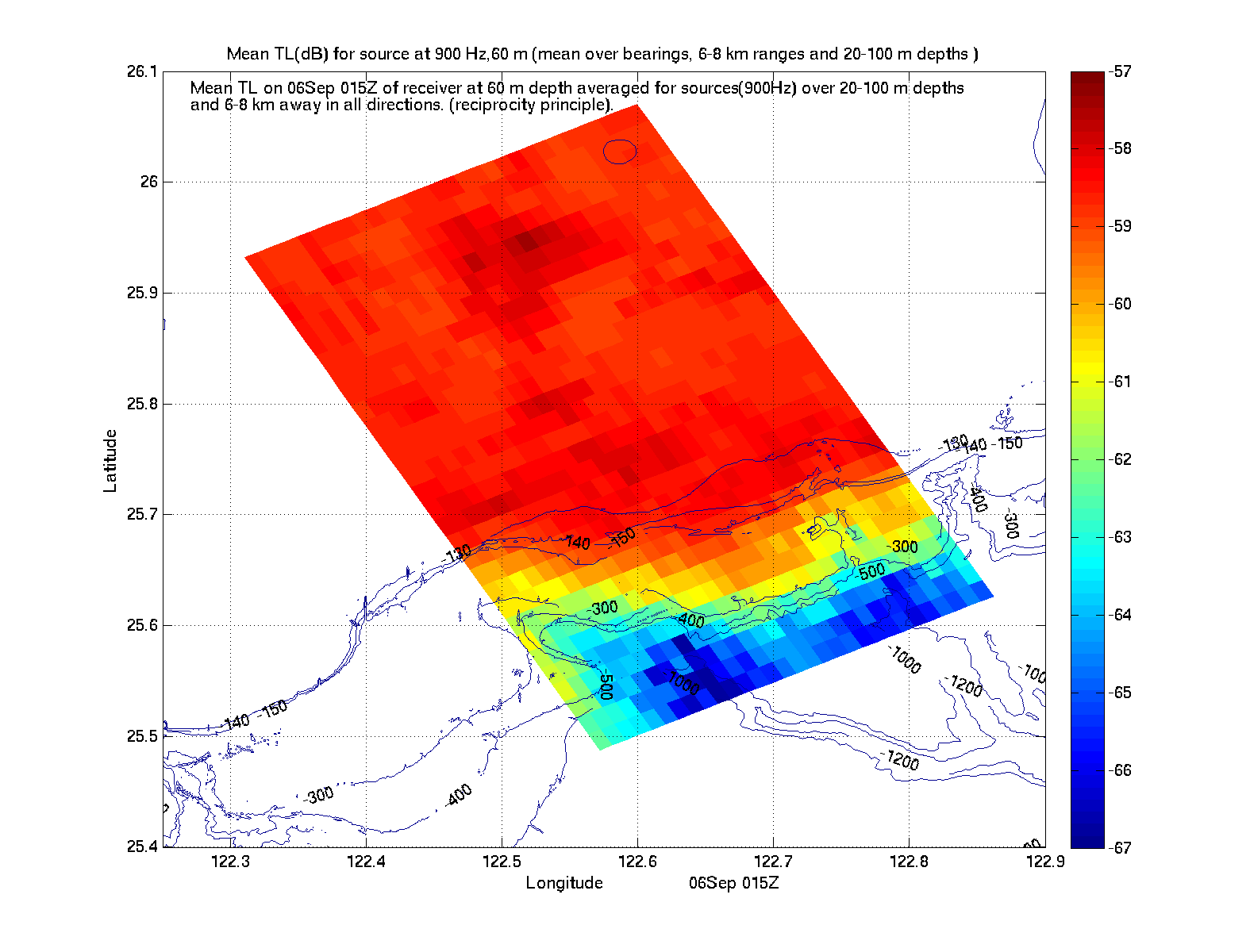
TL(xs,ys,ts)
(TL (db) for source at 900Hz, 60m averaged over all bearings, 6-8km ranges and 20-100m depths)
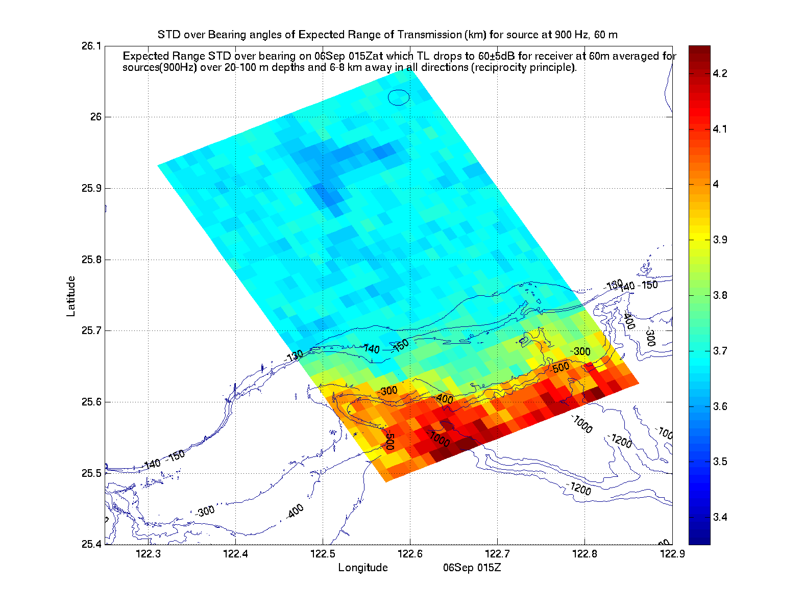
Expected Range (km) at fixed time ts for source at (xs,ys)
(Mean Range on 06Sep 15Z at which TL drops to 60±5 db averaged over all bearings and 20-100m depths, for source at 900Hz, 60m)
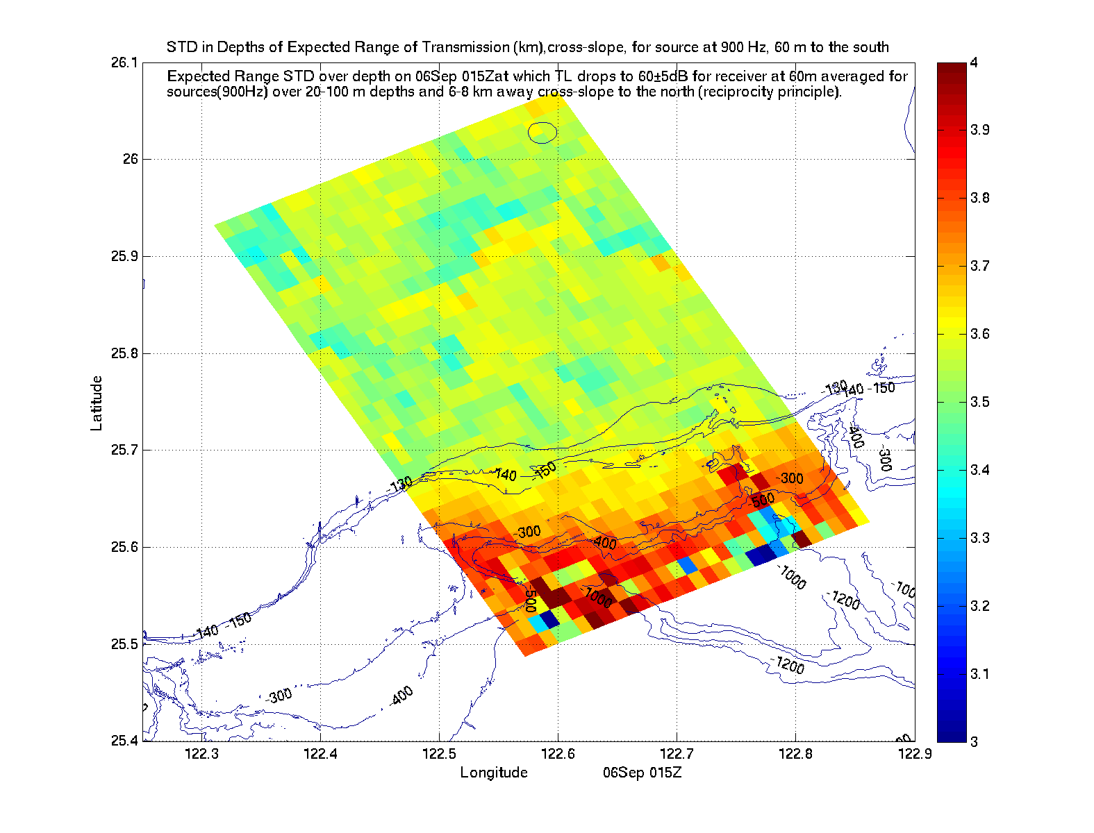
Expected Range (km) in cross-slope direction at fixed time ts for source at (xs,ys)
(Mean Range on 06Sep 15Z at which TL in cross-slope direction drops to 60±5 db averaged over 20-100m depths, for source at 900Hz, 60m)
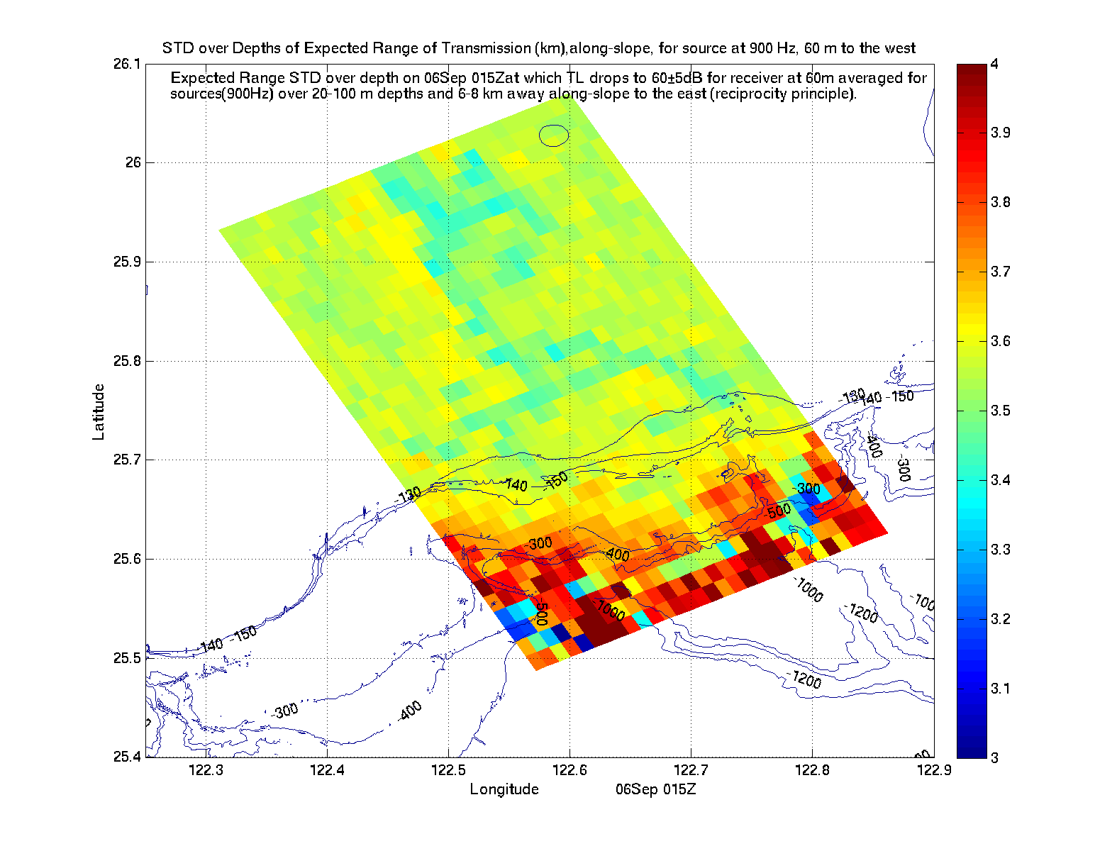
Expected Range (km) in along-slope direction at fixed time ts for source at (xs,ys)
(Mean Range on 06Sep 15Z at which TL in along-slope direction drops to 60±5 db averaged over 20-100m depths, for source at 900Hz, 60m)
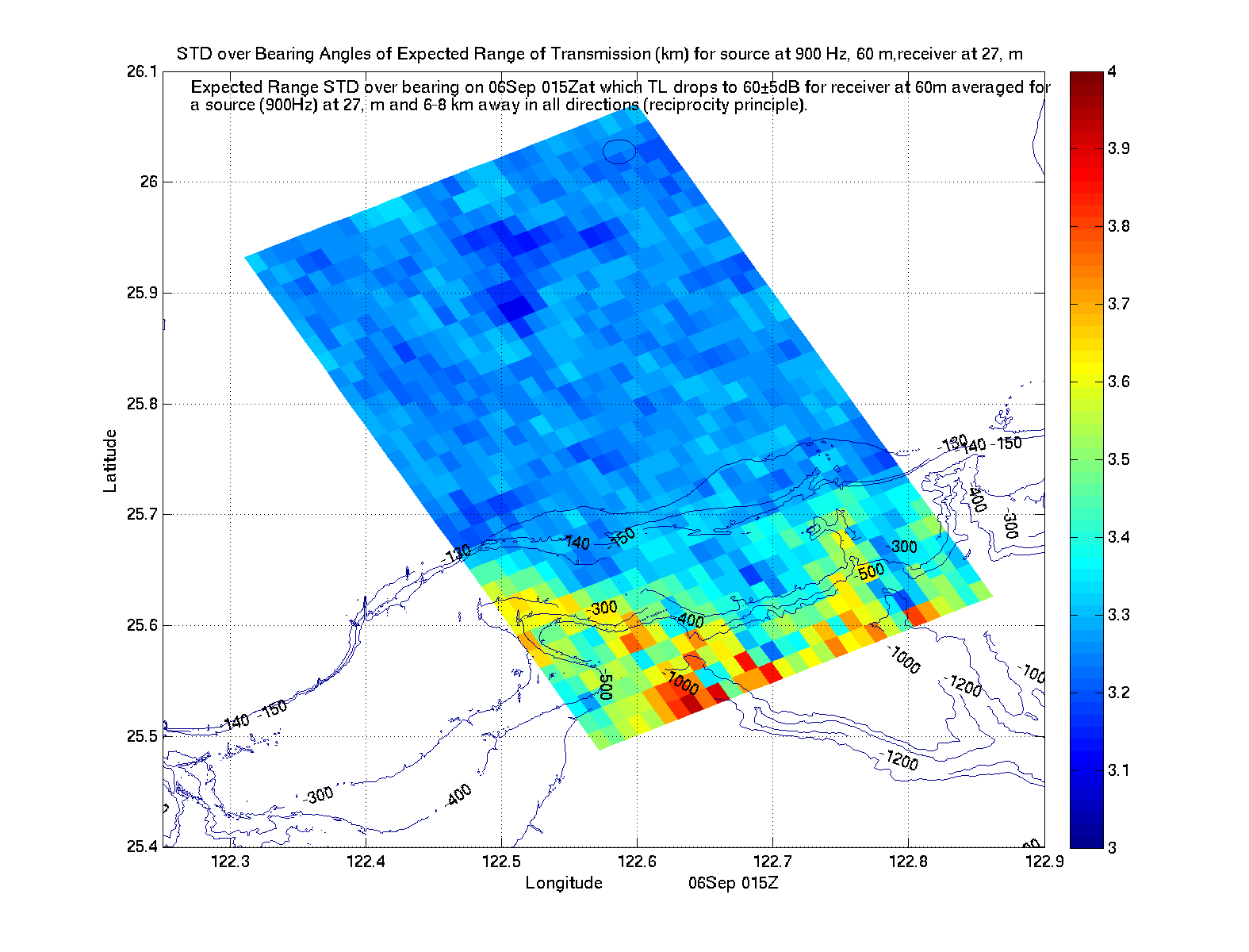
Expected Range (km) at fixed time ts for source at (xs,ys) and receiver at 27m depth
(Mean Range on 06Sep 15Z at which TL drops to 60±5 db for receiver at 27m depth, averaged over all bearings, for source at 900Hz, 60m)
Std Dev in Depth of TL Std Dev in Depth
of Expected Range
Std Dev in Depth
of Expected X-Slope Range
Std Dev in Depth
of Expected Along-Slope Range
Std Dev in Bearing
of Expected Range for 27m Receiver
Std Dev in Bearing of TL Std Dev in Bearing
of Expected Range


UTC and Taiwan time conversion
UTC 0000 0300 0600 0900 1200 1500 1800 2100
CST 0800 1100 1400 1700 2000 2300 0200 (+1) 0500 (+1)

Available Forecast NetCDF Files
Physics Fcst for Sep 5-7  MIT_phys_2009090408_2009090500_2009090700_03h.nc.gz
Acoustics Fcst for Sep05 1500Z MIT_acoustic_TL_2009090408_2009090615_2009090615_00h_900.nc.gz
1800Z MIT_acoustic_TL_2009090408_2009090618_2009090618_00h_900.nc.gz
2100Z MIT_acoustic_TL_2009090408_2009090621_2009090621_00h_900.nc.gz

The file names can be interpreted as follows (all times are in UTC):
       time of last
      analysis field           time of last
      in simulation            fields in file
         yyyymmddHH            yyyymmddHH
MIT_phys_2009072512_2009072812_2009073000_03h.nc.gz
                    yyyymmddHH            HH
                   time of first        frequency with which
                   fields in file       fields are stored in file


Return to the MSEAS:
QPE IOP09 real-time web page QPE web page Home page