

|
P.F.J. Lermusiaux, P.J. Haley, Jr., W.G. Leslie Massachusetts Institute of Technology
|
Ongoing MIT-MSEAS Research Additional OOI Links Presentations Background information |
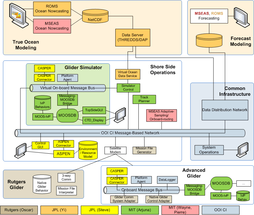 |
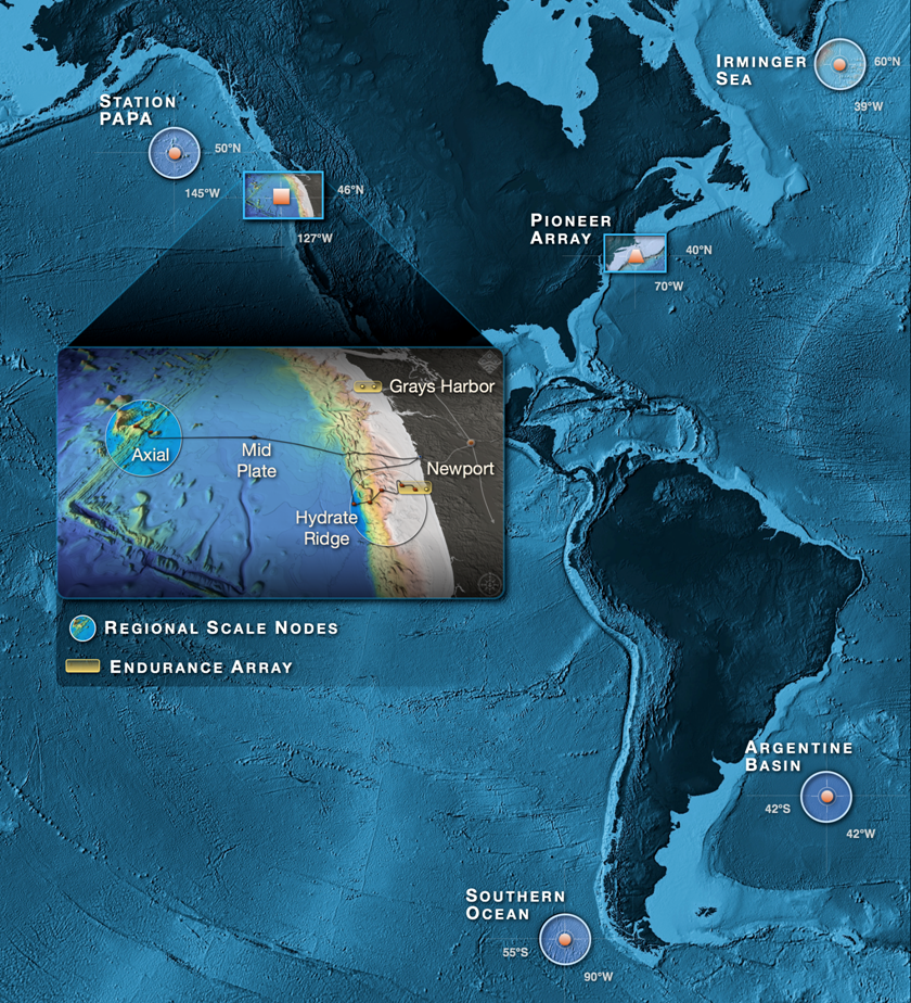
| (left) OOI Schematic; (right) OSSE Architecture | ||
| This research sponsored by the National Science Foundation | ||
Ongoing MIT-MSEAS Research
OOI CyberInfrastructure (CI) has conducted an Observing System Simulation Experiment (OSSE) to test the capabilities of the OOI CI to support field efforts in a distributed ocean observatory in the Mid-Atlantic Bight. The goal was to provide a real oceanographic test bed in which the CI will support field operations of ships and mobile platforms, aggregate data from fixed platforms, shore-based radars, and satellites and offer these data streams to data assimilative forecast models. The MAB region was selected because of the existing communities and the presence of NOAA, ONR coordinated by Oscar Schofield in the context of the MARCOOS effort. The experiment took place October-December 2009. The MIT home page for the real-time exercise is linked above or can be found here.
The OSSE consisted of four main activities:
- ROMS numerical model integration (group of Yi Chao, JPL)
- CASPER/ASPEN mission planning and control (group of Steve Chien, JPL)
- MOOSDB, MOOS-IvP autonomous vehicle control and ocean modeling and adaptive sampling (group of Arjuna Balasuriya, Wayne Leslie, MIT)
- Glider Simulator Environment and Field Deployment in Mid Atlantic Bight (group of Oscar Schofield, Rutgers)
| Top of page |
Additional OOI Links
- Ocean Observatories Initiative (OOI) Home Page
- OOI Infrastructure
- OOI CyberInfrastructure
- Release 3 MIT Preparations - CI Development - OOICI Confluence Site
- LAMSS Meeting Notes "Etherpad"
- Release 3 Planning & Prosecution Task List
- Marine Metadata Inteoperability
OSSE links:
| Top of page |
Presentations
- MSEAS presentation for the OOI Cyberinfrastructure: Ocean Observation Programs Workshop; WHOI 13-14 May 2008 [Powerpoint] [PDF]
| Top of page |
Background
The Ocean Observatories Initiative (OOI) is a NSF Division of Ocean Sciences program that focuses the science, technology, education and outreach of an emerging network of science driven ocean observing systems.
The OOI comprises three types of interconnected observatories spanning global, regional and coastal scales. The global component addresses planetary-scale problems via a network of moored buoys linked to shore via satellite. A regional cabled observatory will wire a single region in the Northeast Pacific Ocean with a high speed optical and power grid. The coastal component of the OOI will expand existing coastal observing assets, providing extended opportunities to characterize the effects of high frequency forcing on the coastal environment. The OOI CyberInfrastructure (CI) constitutes the integrating element that links and binds the three types of marine observatories and associated sensors into a coherent system-of-systems. Indeed, it is most appropriate to view the OOI as a whole, which will allow scientists and citizens to view particular phenomena irrespective of the observing elements (e.g. coastal, global, regional, ships, satellites, IOOS.) to which the observations belong.
For a more complete description of the OOI program go here or go to the OOI home page.
| Top of page |