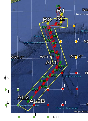
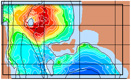
headgraphic
loader graphic

Loading content ...

Sea Exercises

To test and validate new theories, methodologies and systems, it is essential to work with real ocean data. Data motivate discoveries and foster new fundamental ideas. Such sea experiments are our group’s laboratory. We have participated in 47 real-time experiments, with multiple institutions, at both the national and international levels, and involving a plethora of sensors and platforms. Depending on the exercise’s specific goals, we forecast ocean fields and uncertainties, optimize sampling operations, assimilate data and/or describe the multi-scale dynamics. Below is a list of exercises in which we have participated.
  • MASTR Real-Time Sea Experiment 2024
    Yucatan Strait, Gulf of Mexico — February - March 2024
    The MASTR collaborative sea experiment occurs in the Gulf of Mexico from February to April 2024. We employ our MIT-MSEAS data-assimilative Primitive-Equation (PE) submesoscale-to-regional-scale ocean-modeling system for real-time deterministic and probability forecasts of ocean fields and derived quantities. Specific objectives include (i) multi-resolution ensemble forecasts with initial conditions downscaled from multiple models and implicit 2-way nesting, (ii) mutual information forecasts for predictability studies, (iii) optimal adaptive sampling guidance for air and sea sensing platforms, and (iv) reachability forecasts for underwater vehicles. Finally, we provide varied data sets that we process. We thank all of the MASTR team members for their input and collaboration. We also thank NCEP for their atmospheric forcing data.
  • CALYPSO Real-Time Balearic Sea Experiment 2022
    Balearic Sea — February - March and March - June 2022
    The two-part CALYPSO 2022 experiment occurs in the Balearic Sea from February 18 to March 12, 2022 (with modeling work starting February 8) and from March 25 to June 29, 2022 (with modeling work starting on April 13). We employ our MIT-MSEAS data-assimilative Primitive-Equation (PE) submesoscale-to-regional-scale ocean-modeling system for implicit 2-way nested predictions. We issue real-time deterministic and uncertainty forecasts of ocean fields, as well as Lagrangian flow maps, coherent sets, subduction forecasts, and drifter forecasts. Other objectives include (i) issuing nested ensemble forecasts; (ii) forecasts downscaled from multiple models; (iii) forecasts using MSEAS 2D and 3D SeaVizKit, and (iv) performing Lagrangian data assimilation and adaptive sampling. Finally, we provide varied data sets that we process.
  • Deep Sea Mining CCFZ Experiment 2021
    Clarion-Clipperton Fracture Zone - April 2021
    The Deep Sea Mining Real-Time Sea Experiment occurs in the Clarion-Clipperton Fracture Zone from April 16 to May 2, 2021 (with modeling work starting April 1). We employ our MIT-MSEAS data-assimilative Primitive-Equation (PE) ocean-modeling system for implicit 2-way nested predictions and Lagrangian analyses. We issue real-time forecasts of ocean fields, plumes, and Lagrangian transports, and coherent sets. We also provide varied data sets that we process. The experiment occurs in close collaboration with the ENDLab team members.
  • CALYPSO Real-Time Experiment 2019
    Alboran Sea – March - April 2019
    The CALYPSO 2019 experiment occurs in the Alboran Sea from March 26 to April 10, 2019. Our specific objectives are to: (i) Utilize our new Lagrangian transport theory and methods to forecast, characterize and quantify ocean processes involved in the three-dimensional transports and transformation of water masses and subduction dynamics in the Alboran Sea; (ii) Apply and expand our multi-resolution submesoscale-to-regional-scale ocean modeling, 2-way nesting, and uncertainty predictions, for real-time forecasting and process studies; (iii) Help design field experiments and predict sampling strategies that maximize information on 4D pathways and dynamics in the region.
  • BBN POSYDON Sea Experiment 2018
    Mid-Atlantic/New York Bight Region - August 2018
    The POSYDON POINT Sea Experiment 2018 occurs in the Middle Atlantic - New York Bight Region in August 2018. In collaboration with the POINT team, our objectives are to utilize the MIT Multidisciplinary Simulation, Estimation, and Assimilation System (MSEAS) to: (i) forecast the probability of high-resolution ocean fields using our probabilistic prediction methodology; (ii) transfer the corresponding distribution of the sound speed field to three-dimensional underwater sound propagation uncertainties; (iii) collect sufficient data to evaluate the accuracy of the Bayesian tomographic inversion and of its posterior estimates of range between transducers and sound velocity profiles (SVPs).
  • NSF-ALPHA Sea Experiment 2018
    Nantucket and Martha's Vineyard - August 2018
    The NSF-ALPHA 2018 Real-Time Main Sea Experiment occurs in the Nantucket and Martha's Vineyard coastal region during August 6-18, 2018. The MIT-MSEAS Primitive-Equation (PE) ocean-modeling system and Lagrangian analyses are utilized in real-time to provide ocean forecasts for Lagrangian transports and coherent structures, and for their uncertainties, on multiple time and space scales. Real-time predictions for optimal Lagrangian sampling are also provided. The experiment occur in close collaboration with the NSF-ALPHA team members.
  • BBN POSYDON Engineering Sea Test 2018
    Mid-Atlantic/New York Bight Region - May 2018
    The POSYDON Engineering Sea Test 2018 occurs in the Middle Atlantic - New York Bight Region in May 2018. It is a test of both the BBN data collection instruments and the MSEAS software to be used in the upcoming August 2018 Sea Exercise.
  • Deep Sea Mining Sea Experiment 2018 (PLUMEX)
    Southern California Bight - February 2018
    The PLUMEX 2018 Deep-Sea-Mining Real-Time Sea Experiment occurs in the Southern California Bight region from February 23 to March 5, 2018. We employ our MIT-MSEAS data-assimilative Primitive-Equation (PE) ocean-modeling system for implicit 2-way nested ensemble predictions and Lagrangian analyses. We issue real-time forecasts of ocean fields, plume flow maps, Lagrangian transports, and coherent sets, and their associated uncertainties. We also provide varied data sets that we process. The experiment occurs in close collaboration with the PLUMEX team members.
  • NSF-ALPHA Sea Experiment 2017
    Nantucket and Martha's Vineyard - August 2017
    The NSF-ALPHA 2017 Real-Time Sea Experiment occur in the Nantucket and Martha's Vineyard coastal region during August 11-18, 2017. The MIT-MSEAS Primitive-Equation (PE) ocean-modeling system and Lagrangian analyses are utilized in real-time to provide ocean forecasts for Lagrangian transports and coherent structures. The experiment occur in close collaboration with the NSF-ALPHA team members.
  • NSF-ALPHA Virtual Forecasting Exercises 2017
    Nantucket and Martha's Vineyard — June - July 2017
    he NSF-ALPHA 2017 Virtual Forecasting Exercises were for the Nantucket and Martha's Vineyard coastal region during June 14-16 and July 18-21 2017. The MIT-MSEAS Primitive-Equation (PE) ocean-modeling system and Lagrangian analyses were utilized in real-time to test Lagrangian transport and coherent structure analyses. The exercises occur in close collaboration with the NSF-ALPHA team members.
  • MSEAS forecasts for FLEAT around islands in the Pacific ocean
    Guam and Yap - April 2017
    The MIT-MSEAS PE ocean forecasts for FLEAT in the Pacific Ocean were issued for: (i) the Guam region for acoustics studies in January 2017, in collaboration with Dr. Kevin Heaney; (ii) the Yap region for the second week of April 2017, in collaboration with Dr. Gunnar Voet, to help in planning ocean sampling surveys for Lee waves and overflows at ocean ridges.
  • NASCar-Ops Sea Exercise 2017
    Arabian Sea - February 2017
    The NASCar-OPS Sea Exercise 2017 occurs in the Arabian Sea in February-March 2017. In collaboration with the DRI-NASCar team, our objectives are to utilize the MIT Multidisciplinary Simulation, Estimation, and Assimilation System (MSEAS) to: (i) forecast the regional high-resolution ocean fields and their probability, using our Error Subspace Statistical Estimation methodology; (ii) utilize these fields to forecast the reachability sets, reachability fronts, and time-optimal paths of underwater vehicles including gliders and floats; (iii) forecast the uncertainty of such reachability fields and optimal paths. We thank Dr. Andrey Shcherbina for his input, the HYCOM team for their real-time ocean fields, and the NCEP GFSp25 and NAVGEM 0p5 teams for their real-time atmospheric flux forecasts.
  • BBN POSYDON Sea Exercise 2017
    Middle Atlantic - New York Bight Region - February 2017
    The POSYDON Sea Exercise 2017 occurs in the Middle Atlantic - New York Bight Region for the first two weeks of February 2017. In collaboration with the POINT team, our objectives are to utilize the MIT Multidisciplinary Simulation, Estimation, and Assimilation System (MSEAS) to: (i) forecast the probability of high-resolution ocean fields using our Error Subspace Statistical Estimation methodology; (ii) transfer the corresponding distribution of the sound speed field to three-dimensional underwater sound propagation uncertainties; (iii) collect sufficient data to evaluate the accuracy of the Bayesian tomographic inversion and of its posterior estimates of range between transducers and sound velocity profiles (SVPs).
  • AforSSIE-16 Sea Exercises for Time-Optimal Path Planning
    Vineyard Sound and Buzzards Bay Region - October 2016
    These real-time sea exercises are to: (i) Apply in real-time at sea the time-optimal autonomy theory and software developed at MIT, and (ii) further develop, validate and apply our multi-scale MSEAS ocean modeling systems to be used as inputs to such optimal path planning. The time-optimal path planning is for AUVs to reach specific regions in fastest time and. The MIT real-time exercises are completed in collaboration with colleagues from WHOI (Andy Girard Diana Wickman, and Ben Allen) and Lincoln Lab (Joe Edwards and Josh Smith).
  • AforSSIE-15 Sea Exercises for Optimal Path Planning
    Vineyard Sound and Buzzards Bay Region - July 2015
    These real-time sea exercises are to further develop our multi-scale MSEAS ocean modeling systems to be used as real-time inputs to optimal path planning. The time-optimal path planning is for AUVs to intercept moving targets in the fastest time and then engage with the targets, for example, underway surface vessels. The MIT real-time exercises utilize inputs from colleagues from WHOI (Glen Gawarkiewicz and Ben Allen) and Lincoln Lab (Joe Edwards and Kristen Railey).
  • NOMR12
    Gulf of Lion - June 2012
    In September/October 2012, there will be a Rapid Environmental Assessment sea trial in the Gulf of Lion (Noble Mariner 2012 - NOMR12). The objective is to collect a huge CTD data set from CTD, ADCP, drifters, and at least 6 gliders. The plan is for a 5 day long initialization survey with a research vessel and gliders, followed by a 2 week long survey for update and adaptive sampling, and finally a high-resolution validation survey with all available instruments. The intent of the intense oceanographic survey is to provide high resolution data for ocean forecasting and validation of ocean models.
  • Observing System Simulation Experiment (OSSE) – OOI
    New Jersey Coast - November 2009
    The MSEAS group supported the OOI OSSE through real-time ocean modeling and forecasting, data assimilation and uncertainty estimation, and adaptive sampling. The integrated OSSE prototype was developed in a simulator environment which allows for the testing of glider and AUV parameters in the MSEAS simulated ocean.
  • QPE Intensive Observation Period – 2009
    Taiwan - August 2009
    Nowcast and forecast products with dynamics and uncertainty descriptions and adaptive sampling recommendations were provided for physical (T, S, velocity) and acoustical (sound speed and transmission loss) variables for the period 18 August - 10 September 2009. We have completed a comprehensive set of computational, sensitivity and dynamical studies on the coupling of ocean simulations with 3D acoustics, which clearly show the importance of 3D effects in complex Canyon geometries.
  • Kauai 2009
    Kauai - July 2009
    We provided dynamical ocean and acoustic predictions in real-time including guidance for optimal ocean and acoustic sampling. Ocean conditions were initialized using historical knowledge determined from literature, sea surface height, sea surface temperature and data of opportunity. Acoustic predictions were generated using the RAM acoustic model and newly developed parallel software. We compute the whole "acoustic climate" in a 3D region, providing transmission loss (TL) for any source and receiver locations in the region as a function of time and frequency.
  • Philippine Straits Dynamics – PHILEX IOP09
    Phillipines - February 2009
    We are studying multiscale dynamics in the region, thus far without the use of any synoptic in situ data, so as to evaluate modeling capabilities when only sparse, remotely sensed, sea surface height data is available for assimilation. The oceanographic findings include: a description of the main circulation features, the evolution of flow fields within three major straits, the estimation of transports to and from the Sulu Sea and the corresponding balances, and finally, an investigation of multiscale mechanisms involved in the formation of the deep Sulu Sea water.
  • Quantifying, Predicting and Exploiting Uncertainty (Pilot Study)
    Taiwan - August 2008
    The QPE Pilot Study took place 22 Aug - 13 Sep 2008. The experiment was designed to acquire baseline hydrographic data for future experiments and to explore acoustic propagation properties in the intensive acoustic area. Nowcast and forecast products with dynamics and uncertainty descriptions and adaptive sampling recommendations were provided for physical (T, S, velocity) and acoustical (sound speed and transmission loss) variables for the period 6 - 12 September 2008.
  • Persistent Littoral Undersea Surveillance Network
    PN07 - Dabob Bay - September 2007
    Estimates of the environmental-acoustic environment in Dabob Bay, Washington were determined for a week-long exercise. The ocean fields are combined with a range-dependent seabed model to estimate the fields used for acoustic predictions. The acoustic model utilized is the Coupled SACLANTCEN normal mode propagation loss model (C-SNAP).
  • Maritime Rapid Enviromental Assessment 2007 (MREA07)
    Ligurian Sea, Mediterranean - April 2007
  • Autonomous Wide Aperture Cluster for Surveillance (AWACS)
    Middle Atlantic Bight Shelfbreak Front, Hudson Canyon - September 2006
  • Persistent Littoral Undersea Surveillance Network
    Point Ano Nuevo, Monterey Bay - August 2006
  • Adaptive Sampling and Prediction (ASAP)
    Monterey Bay - August 2006
  • DART-05: Dynamics of the Adriatic in Real-Time
  • Focused Acoustic Forecasting (FAF05): Physical-Acoustical Adaptive Sampling
  • MREA04/BP04: Real-Time Mini-HOPS modeling
    Portuguese coastal waters - March 2004
  • AOSN-II: Real-Time Predictive Skill Experiment with Adaptive Sampling
  • MREA03/BP03: Real-Time Mini-HOPS modeling
    Ligurian Sea/Elba - May 2003
  • Prestige Oil Spill Forecasts
    Portugese and Spanish coasts, Eastern Atlantic - November 2002
  • ASCOT-02: Assessment of Skill for Coastal Ocean Transients
    Tyrrhenian Sea/Ligurian Sea/Elba/Procchio Bay - May 2002
  • ASCOT-01: Assessment of Skill for Coastal Ocean Transients
    Massachusetts Bay/Gulf of Maine - June 2001
  • GOATS/MEANS 2000: HOPS Nowcast and Forecast Products
    Ligurian Sea/Elba/Procchio Bay - September 2000
  • AFMIS: Advanced Fisheries Management and Information System. Real-time Demonstration of Concept
  • Deceased Right Whale #2701. Predicted drift paths
    Offshore from Block Island, NY - January 2000
  • Egypt Air Flight 990 – Floating Debris Dispersion
    New England Continental Shelf-break - October 1999
  • Stacatto – Death of a Right Whale. Staccato drift hindcast Possible Strike Positions 15-20 April 1999
  • LOOPS: Massachusetts Bay Sea Trial-98. Littoral Ocean Observing and Prediction System
  • Rapid Response 98
    Gulf of Cadiz - February 1998