

Advanced Lagrangian Predictions for Hazards Assessments (NSF-ALPHA)
MSEAS Group Page
|
P.F.J. Lermusiaux, P.J. Haley, S. Jana, C. Mirabito, C. Kulkarni, A. Dutt, A. Gupta, F. Feppon, T. Peacock Massachusetts Institute of Technology
|
Project Summary Ongoing MIT-MSEAS Research MSEAS NSF-ALPHA-supported Publications Additional NSF-ALPHA Links Background Information
|
|

|
| This research is sponsored by the National Science Foundation. | |||
Project Summary
Hazards due to the fundamental process of advection of natural and anthropogenic material in environmental flows are ubiquitous and profoundly impact society; preparedness and effective response can save many lives, untold environmental damage and enormous financial cost. Recent catastrophic examples include: oil spill advection during the Deep Water Horizon disaster, the passage of the ash cloud from the Eyjafjallajökull volcano through commercial air space, and the trail of radioactive waste from the Fukushima reactor disaster. On a day-to-day operational level, search-and-rescue operations at sea rely critically on correctly modeling and interpreting flow transport in order to inform life-or-death decisions. Understanding how flow transport is organized and predicting where things go in complex environmental flows remains a formidable scientific challenge, however, due to unsteady nonlinear and multiscale flows, ambiguities in defining material transport, multiple sources of uncertainty, the difficulty of identifying and acquiring pertinent data to assimilate into models, the variability of predictions across different models, and the complexity of analyzing vast data sets and visually representing the results.
The NSF-ALPHA (Advanced Lagrangian Predictions for Hazards Assessments) team (MIT, WHOI, Virginia Tech and UC Berkeley) proposes transformational progress in tackling these science issues by exploiting and advancing recent fundamental breakthroughs in four-dimensional (3D plus time) Lagrangian methods. An integrated theoretical, computational and observational approach will be employed to develop, implement and utilize these cutting-edge Lagrangian methods with data-driven modeling for the purpose of uncovering, quantifying and predicting key transport processes and structures during regional flow-based hazards in the ocean and atmosphere. The challenges are broad in scope, encompassing engineering, geosciences, applied mathematics, and computational and information science and engineering.
The overall goal of the ALPHA project is to employ an integrated theoretical, computational and observational approach to develop, implement and utilize these cutting-edge Lagrangian methods with data-driven modeling for the purpose of uncovering, quantifying and predicting key transport processes and four-dimensional (3D plus time) structures during regional flow-based hazards in the ocean and atmosphere.
Background information is available below.
| Top of page |
Ongoing MIT-MSEAS Research
Long-Term (Collaborative) MIT-MSEAS Goal:
Develop and apply ocean modeling, data assimilation and Lagrangian methods for regional transport process studies during flow-based hazards
Specific MIT-MSEAS Objectives:
- Utilize multi-faceted ocean modeling and simulations for transport process studies with Lagrangian methods
- Incubate new stochastic and multiscale Lagragian Coherent Structures (LCS) methods and implement/integrate promising schemes for realistic 3D plus time simulations
- Develop and apply Bayesian Lagrangian (coherent structures) data assimilation and targeted (adaptive) sampling
- Contribute to real-time field tests and hazards of opportunity
- Advance understanding of flow-based transport processes
- Provide ocean data, simulations, methodology and software, to the ALPHA team
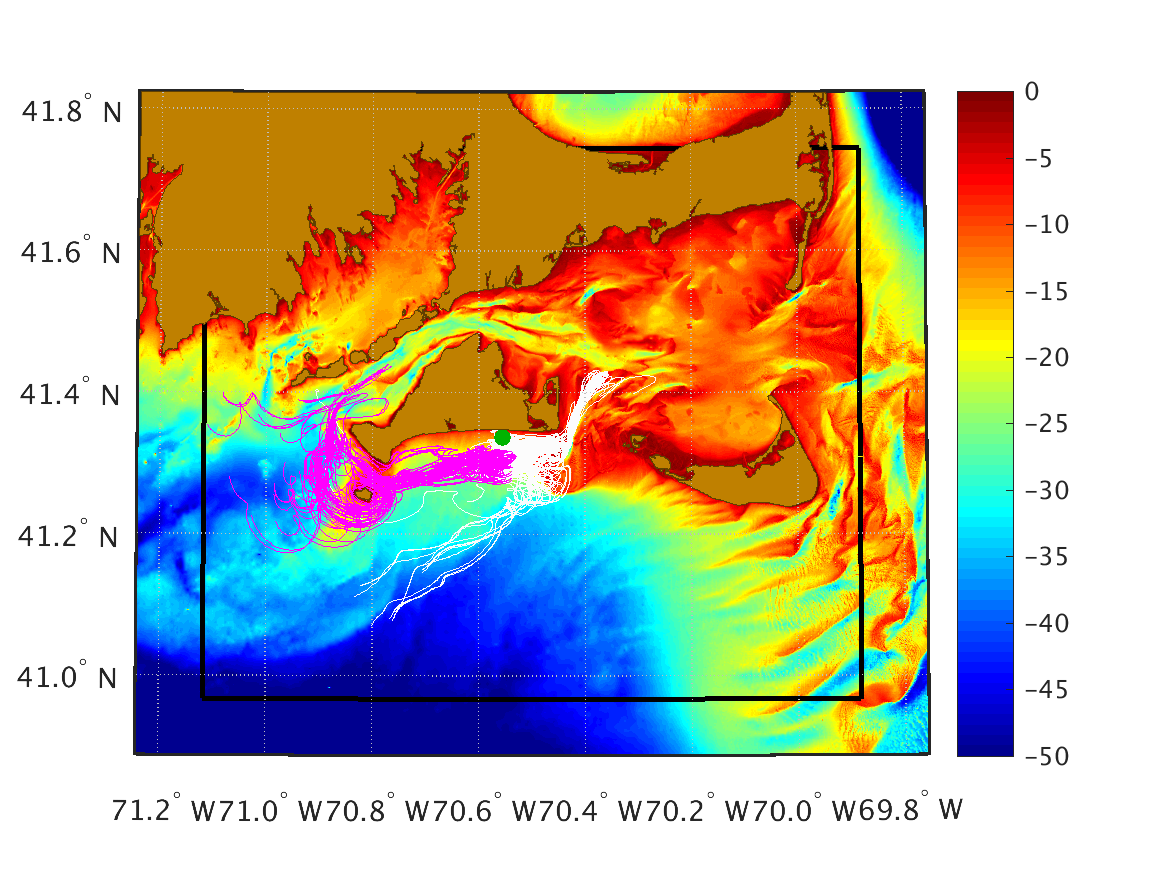
Reanalysis of July/August/September 2014
We have completed the initial reanalysis of ocean dynamical fields in the Nantucket and Martha's Vineyard coastal region during the July/August/September 2014 time period. We provide the MSEAS-PE ocean re-analysis simulations as well as the data processed by the MSEAS group for input, initialization, and/or forcing to these simulations.
Virtual Sea Exercise of June 2017
We are conducting virtual real-time sea exercises in the Nantucket and Martha's Vineyard coastal region during June and July 2017. To test our real-time systems, we provide in real-time varied data processed by our group, the MSEAS-PE ocean field forecasts, and Lagrangian transport and coherent structure analyses.
Virtual sea exercise for June and July 2017: processed data, MSEAS-PE ocean fields, and data sources
Real-Time Sea Exercise of August 2017
We are conducting real-time sea exercises in the Nantucket and Martha's Vineyard coastal region during August 2017. We provide in real-time varied data processed by our group, the MSEAS-PE ocean field forecasts, and Lagrangian transport and coherent structure analyses.
2017 Real-Time Sea Exercise page
Real-Time Sea Exercise of August 2018
We are conducting real-time sea exercises in the Nantucket and Martha's Vineyard coastal region during August 2018. We provide in real-time varied data processed by our group, the MSEAS-PE ocean field forecasts (plus interactive maps), and Lagrangian transport and coherent structure analyses.
2018 Real-Time Sea Exercise page
Publications
MSEAS NSF-ALPHA-supported Publications
Awards
| Top of page |
Additional NSF-ALPHA Links
| Top of page |
Background Information
The NSF-ALPHA team approach exploits and advances novel LCS methods to support the integration of observing, modeling and data analysis systems, enabling a transformational advance in current capabilities for forecasting and mitigating environmental flow hazards. To rigorously validate our analytical and computational advances we will perform ocean and atmosphere field tests, followed by a capstone coupled air-sea experiment simulating a hazard scenario. Leveraging existing sea and air observing capabilities, the field studies will be performed in the New England region of the East Coast, in the vicinity of the Martha’s Vineyard Coastal Observatory (MVCO), and at Virginia Tech’s Kentland farm airfield, which is a FAA-designated unmanned aircraft systems (UAS) test site. During these studies, the LCS methodology will be integrated with in situ and remote observations, adaptive autonomous observing platforms, advanced multi-resolution modeling, data-assimilative predictions with uncertainty, and efficient computations and visualizations. Notable features of the MVCO site selected for the coupled air-sea hazard scenario include: (1) Proximity to a nearby airfield to support simultaneous ocean and airborne studies; (2) Several ongoing or planned industrial activities within the region (e.g. nuclear power stations, wind farm construction) that have the potential to initiate hazards; (3) The existence of three-dimensional ocean jet structures, via which pollution could potentially impact regional ecosystems and fisheries; (4) Proximity to our US Coast Guard partner based at Rhode Island. Furthermore, we propose to provide a rapid response capability to a regional oceanic hazard of opportunity during the tenure of the project.
The research of our multi-institution (MIT, WHOI, Virginia Tech, UC Berkeley) ALPHA team encompasses engineering, geosciences, computational and information science and engineering, and applied mathematics. Our research is highly interdisciplinary, in large part because the underlying topic of unsteady flow transport is so fundamental that it transcends traditional disciplinary boundaries. We have extensive connections with international collaborators (ETH Zurich, U. of Western Australia, U. of New South Wales, Bologna U.), regional and government agencies (NERACOOS, US Coast Guard, USGS), local K-to-12 schools and communities (e.g. Gloucester and New Bedford fishermen), and major industrial partners (Shell Oil, SINTEF, IBM), thereby ensuring regional, national and global impact. The project is led by Prof. Thomas Peacock (MIT).
| Top of page |