|
P.F.J. Lermusiaux, P.J. Haley, Jr., W.G. Leslie, C. Mirabito Massachusetts Institute of Technology
|
Ongoing MIT-MSEAS Research Additional QPE Links Presentations Background information References MSEAS QPE Publications |


|
| This research sponsored by the Office of Naval Research. | ||
Ongoing MIT-MSEAS Research
Most of the information of the more recent research activities are available at the following links: 2009- QPE Intensive Observation Period - August/September 2009: Main Page with all Real-Time results
- QPE IOP 2009: Final Atmospheric Forcing Fields
- QPE Pilot Study - August/September 2008: Main Page with all Real-Time results
- Synopsis Presentation of MIT QPE 2008 Pilot Study results: [PDF file]
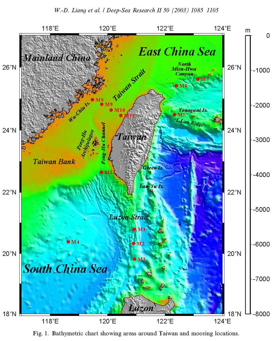
The long-term goal of our QPE effort has been to research, integrate, demonstrate and utilize end-to-end prediction and DA systems to better study, understand, forecast and exploit environmental and acoustic fields and uncertainties for efficient sonar operations. Specific objectives are to: (i) improve the understanding of dynamics, predictabilities and uncertainties in the southern East China Sea (ECS) and Northern Philippine Sea region; (ii) study, model and quantify the interactions of Kuroshio meanders, mesoscale features and internal tides and waves, based on process and sensitivity studies; (iii) Further research coupled environmental and acoustic modeling and data assimilation; and (iv) Design observation system properties and adaptive sampling schemes to optimize the placement of sensor systems for the reduction of uncertainty and best exploitation of the environment.
Additional research simulations
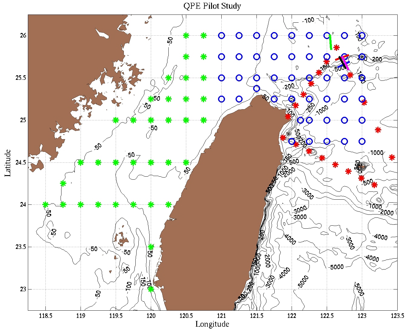
- Acoustic Propagation Sensitivity Simulations During an August 2008 planning meeting at MIT, five 20 km long acoustic propagation paths were identified to explore acoustic propagation properties in the intensive acoustic area. The link below contains the results of a series of acoustic simulations along these sections, using the C-SNAP range-dependent one-way coupled modes model. These simulations are carried out within two different ocean field estimates in the region, one with a weak and the other with a stronger Cold Dome.
- Ocean Dynamics
The page below presents the results of simulations of the advection of passive tracers North of Taiwan that were carried out using the Smith and Sandwell bathymetry, v9 (2007). The tracers are continually introduced at set of possible mooring locations and then advected/mixed by the dynamical ocean model equations (without wind or tidal forcing). A goal of these simulations is to estimate the influence of measurements made at those locations. This work is part of our preparation for the DRI-QPE (ONR-sponsored), in response to a request by Dr. Ren-Chieh Lien from U. Washington, APL.
- Bathymetric Effects
- Second set of simulations (finalized in July 2008). Using the NCOR bathymetry.
- First set of simulations (finalized in June 2007). Using the Smith and Sandwell bathymetry, v9.
The following two links contain the main results and files for two sets of simulations that we have carried out for the Taiwan region. In each case, simulations are initialized from a regional summer climatology that we have created using the Hydrobase software and quality-controlled data also from HydroBase. The horizontal resolution is 3km and 44 terrain-following levels are used in the vertical.
The above two sets of simulations have different bathymetries. The first set is based on the Smith and Sandwell Bathymetry (courtesy of Brian Calder). The second set is based on the NCOR bathymetry (National Center for Ocean Research, National Taiwan University, courtesy of Dr. San Jan). The smoothing of these bathymetries is also different, aiming to tune to amplitude of the vertical velocities for a fixed horizontal resolution of 3km. Bathymetries are presented in:
A main physical ocean dynamics result of the above two sets of simulations is that the transport through the Taiwan Strait has a significant influence on the formation and strength of the cold dome north of Taiwan, that independently of the bathymetry utilized. Secondly, the amplitudes of the vertical velocities are sensitive to the slope of the bathymetry utilized and horizontal resolutions and mixing parameterizations. Further studies are underway.
| Top of page |
Additional QPE Links
- QPE home page (WHOI - password-protected)
- Cold Dome Numerical Sensitivity Study using the MITgcm (password-protected)
- Taiwan Community Ocean Model
- Drifter Tracks, Sea Surface Height and Sea Surface Height Anomalies Courtesy P. Niiler, L. Centurioni and Y.Y. Kim
- Taiwan Central Weather Bureau
- NRL Monterey COAMPS Click on Kaohsiung area
- NRL-Monterey COAMPS Currents
Analysis and forecast maps of ocean temperatures and currents are being generated at NRL-Monterey as part of the COAMPS product package. These maps are being collected and the analyses are displayed below for three depths.
| Top of page |
Presentations
- Quantifying, Predicting and Exploiting Environmental and Acoustic Fields and Uncertainties - Joint International Workshop - Taipei - March 12-14, 2008 [PDF]
- Quantifying, Predicting, and Exploiting Uncertainty Modeling (DA and Uncertainty) Group Report - 2nd QPE meeting, 18-19 June 2007 [Powerpoint] [PDF]
- QPE Modeling (DA and Uncertainty) Group Tasks and Goals [PDF]
WHOI site for Presentations from QPE meetings
- Kauai - January 12-16, 2009
- Taipei - March 12-14, 2008
- Washington - June 18-19, 2007
- Alaska - August 26-27, 2007
- San Francisco - Dec. 8, 2006
| Top of page |
Background
Building on discoveries made over the previous five years in probabilistic sonar performance prediction, integrated ocean-acoustic modeling, multidisciplinary data assimilation, ocean predictability, multi-scale custom climatologies and autonomous underwater platforms, the Quantifying, Predicting and Exploiting Uncertainty initiative will integrate these discoveries to improve performance prediction and reduce sonar detection uncertainties. To demonstrate how the components fit together and how a future end-to-end system could work in support of fleet exercises, an integrated field demonstration was carried out in 2009 in this East China Sea - Taiwan - Kuroshio region.
The DRI objectives are to:- Further develop and integrate methodologies, and perform field demonstration, of the use of in-situ data together with integrated (ocean, TL and ambient noise) assimilative predictive models and adaptive sampling methods to improve sonar system performance and prediction.
- Learn how to assimilate deep water acoustic observations to assist in initialization of regional ocean models.
- Study the limits of predictability of a meandering jet interacting with topography.
- Study the connection between nonlinear internal wave activity on the shelf and the meandering jet adjacent to the shelf.
- Map out a Concept of Operations (CONOPS) for an end-to-end evaluation of acoustic impact and identify which operational naval elements should participate in each step.
| Top of page |
References
| Top of page |


